![](/images/other/stat-length.png)
![Randonnée A pied Lille - circuit des Remparts lille - Photo](https://media.geolcdn.com/t/1900/400/6f075244-2aca-46ce-a42c-e7da0adb0602.jpg&format=pjpeg&maxdim=2)
circuit des Remparts lille
dehemjacques
Utilisateur
![Longueur](/images/other/stat-length.png)
Longueur
17,3 km
![Altitude max](https://static1.geolcdn.com/siteimages/upload/files/1508320355ic_sort_altitude_max_24dp.png)
Altitude max
39 m
![Dénivelé positif](https://static1.geolcdn.com/siteimages/upload/files/1508320355ic_sort_den_pos_24dp.png)
Dénivelé positif
153 m
![Km-Effort](/images/other/stat-length.png)
Km-Effort
19,4 km
![Altitude min](https://static1.geolcdn.com/siteimages/upload/files/1508320355ic_sort_altitude_min_24dp.png)
Altitude min
9 m
![Dénivelé négatif](https://static1.geolcdn.com/siteimages/upload/files/1508320355ic_sort_den_neg_24dp.png)
Dénivelé négatif
152 m
![Boucle](https://static1.geolcdn.com/siteimages/upload/files/16400158638029165_repeat_loop_refresh_sync_direction_icon.png)
Boucle
Oui
Date de création :
2021-07-16 08:07:38.925
Dernière modification :
2021-07-16 18:28:56.185
![A pied](https://static1.geolcdn.com/sitytour/trail-icons/100.png)
4h24
Difficulté : Facile
![Marche](https://static1.geolcdn.com/sitytour/trail-icons/101.png)
5h06
Difficulté : Très difficile
![Scannez ce code QR pour ouvrir la randonnée dans l'application SityTrail](https://capi.geolives.com/qq0zvz2zws4bq2lad0pu/sitytour/trails/2862677/qr.png?size=200)
Application GPS de randonnée GRATUITE
À propos
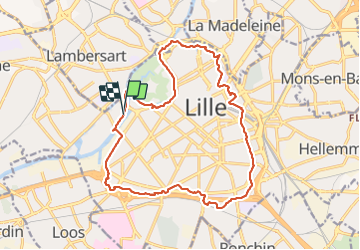
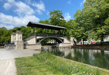
Randonnée A pied de 17,3 km à découvrir à Hauts-de-France, Nord, Lille. Cette randonnée est proposée par dehemjacques.
Description
Départ de la Piscine Marx Dormoy, sens aiguille d'une montre
petite modif entre porte de Gand et Porte de Roubaix
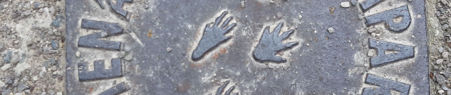
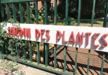
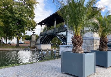
Localisation
Pays :
France
Région :
Hauts-de-France
Département/Province :
Nord
Commune :
Lille
Localité :
Lille
Départ:(Dec)
Départ:(UTM)
502495 ; 5609291 (31U) N.
Commentaires
Randonnées à proximité
![Randonnée Marche Lille - Autour de la citadelle - Photo](https://media.geolcdn.com/t/375/260/ext.jpg?maxdim=2&url=https%3A%2F%2Fservices.sitytrail.com%2FGeolivesWS%2FDownloadMedia.ashx%3FTrailID%3D202857%26Media%3Dcd62111c-4a73-449f-8a35-c1f82fa269d1.jpg)
![Marche Marche](https://static1.geolcdn.com/sitytour/trail-icons/101.png)
Autour de la citadelle
Marche
Très facile
(2)
Lille,
Hauts-de-France,
Nord,
France
![](/images/other/stat-length.png)
5,5 km | 6,1 km-effort
Inconnu
![](https://static1.geolcdn.com/siteimages/upload/files/16400158638029165_repeat_loop_refresh_sync_direction_icon.png)
Oui
![Randonnée Marche Lille - Autour de la citadelle de Lille - Photo](https://media.geolcdn.com/t/375/260/ext.jpg?maxdim=2&url=https%3A%2F%2Fservices.sitytrail.com%2FGeolivesWS%2FDownloadMedia.ashx%3FTrailID%3D109754%26Media%3D4580_6.jpg)
![Marche Marche](https://static1.geolcdn.com/sitytour/trail-icons/101.png)
Autour de la citadelle de Lille
Marche
Facile
(2)
Lille,
Hauts-de-France,
Nord,
France
![](/images/other/stat-length.png)
5,6 km | 6,3 km-effort
1h 30min
![](https://static1.geolcdn.com/siteimages/upload/files/16400158638029165_repeat_loop_refresh_sync_direction_icon.png)
Oui
![Marche Marche](https://static1.geolcdn.com/sitytour/trail-icons/101.png)
20230918 - TOTEMUS Lille - 5.4 Km
Marche
Facile
Lille,
Hauts-de-France,
Nord,
France
![](/images/other/stat-length.png)
5,4 km | 5,8 km-effort
1h 28min
![](https://static1.geolcdn.com/siteimages/upload/files/16400158638029165_repeat_loop_refresh_sync_direction_icon.png)
Oui
![Randonnée Marche Lille - LILLE (court) - de la gare L. Flandres au Minimes - Photo](https://media.geolcdn.com/t/375/260/ext.jpg?maxdim=2&url=https%3A%2F%2Fstatic1.geolcdn.com%2Fsiteimages%2Fupload%2Ffiles%2F1553511878bg_sport_marche.png)
![Marche Marche](https://static1.geolcdn.com/sitytour/trail-icons/101.png)
LILLE (court) - de la gare L. Flandres au Minimes
Marche
Facile
(1)
Lille,
Hauts-de-France,
Nord,
France
![](/images/other/stat-length.png)
4,1 km | 4,6 km-effort
1h 2min
![](https://static1.geolcdn.com/siteimages/upload/files/16400158638029165_repeat_loop_refresh_sync_direction_icon.png)
Oui
![Randonnée Marche Lille - Lille rando des remparts 18 km - Photo](https://media.geolcdn.com/t/375/260/47f3105d-7eb3-4eed-9a9d-96927ffd6f80.jpg&format=jpg&maxdim=2)
![Marche Marche](https://static1.geolcdn.com/sitytour/trail-icons/101.png)
Lille rando des remparts 18 km
Marche
Moyen
Lille,
Hauts-de-France,
Nord,
France
![](/images/other/stat-length.png)
20 km | 0 m-effort
5h 37min
![](https://static1.geolcdn.com/siteimages/upload/files/16400158638029165_repeat_loop_refresh_sync_direction_icon.png)
Oui
![Randonnée V.T.T. Lambersart - Deûle et ses campagnes - Photo](https://media.geolcdn.com/t/375/260/ext.jpg?maxdim=2&url=https%3A%2F%2Fstatic1.geolcdn.com%2Fsiteimages%2Fupload%2Ffiles%2F1524743154velo.jpg)
![V.T.T. V.T.T.](https://static1.geolcdn.com/sitytour/trail-icons/202.png)
Deûle et ses campagnes
V.T.T.
Facile
(2)
Lambersart,
Hauts-de-France,
Nord,
France
![](/images/other/stat-length.png)
24 km | 25 km-effort
1h 25min
![](https://static1.geolcdn.com/siteimages/upload/files/16400158638029165_repeat_loop_refresh_sync_direction_icon.png)
Oui
![Randonnée Marche Lille - Lille Citadelle - Lion bossu 5,4 km - Photo](https://media.geolcdn.com/t/375/260/cac3c5ee-efcd-4c5f-8540-f45174e54dca.jpg&format=jpg&maxdim=2)
![Marche Marche](https://static1.geolcdn.com/sitytour/trail-icons/101.png)
Lille Citadelle - Lion bossu 5,4 km
Marche
Facile
Lille,
Hauts-de-France,
Nord,
France
![](/images/other/stat-length.png)
5,4 km | 6 km-effort
1h 53min
![](https://static1.geolcdn.com/siteimages/upload/files/16400158638029165_repeat_loop_refresh_sync_direction_icon.png)
Non
![Randonnée Marche Lille - Lille 9,5 km - Photo](https://media.geolcdn.com/t/375/260/4613ef8f-7f8a-43c2-950f-fd137ced6f10.jpg&format=jpg&maxdim=2)
![Marche Marche](https://static1.geolcdn.com/sitytour/trail-icons/101.png)
Lille 9,5 km
Marche
Facile
Lille,
Hauts-de-France,
Nord,
France
![](/images/other/stat-length.png)
10,3 km | 11,3 km-effort
4h 24min
![](https://static1.geolcdn.com/siteimages/upload/files/16400158638029165_repeat_loop_refresh_sync_direction_icon.png)
Oui
![Randonnée Marche Lille - Lille Citadelle parcs remparts centre 12,5 km - Photo](https://media.geolcdn.com/t/375/260/79c56a3c-0714-422d-8318-22ce7061d762.jpg&format=jpg&maxdim=2)
![Marche Marche](https://static1.geolcdn.com/sitytour/trail-icons/101.png)
Lille Citadelle parcs remparts centre 12,5 km
Marche
Facile
Lille,
Hauts-de-France,
Nord,
France
![](/images/other/stat-length.png)
13,2 km | 14,5 km-effort
4h 53min
![](https://static1.geolcdn.com/siteimages/upload/files/16400158638029165_repeat_loop_refresh_sync_direction_icon.png)
Oui