![](/images/other/stat-length.png)
![Randonnée Marche Montigny-Lencoup - Boucle Montigny Lencoup - Donnemarie - Dontilly - Preuilly - Photo](https://media.geolcdn.com/t/1900/400/ffeb9e28-9fb6-4c09-9cf5-ed58c94e548f.jpg&format=pjpeg&maxdim=2)
Boucle Montigny Lencoup - Donnemarie - Dontilly - Preuilly
chessyca
Utilisateur GUIDE
![Longueur](/images/other/stat-length.png)
![Altitude max](https://static1.geolcdn.com/siteimages/upload/files/1508320355ic_sort_altitude_max_24dp.png)
![Dénivelé positif](https://static1.geolcdn.com/siteimages/upload/files/1508320355ic_sort_den_pos_24dp.png)
![Km-Effort](/images/other/stat-length.png)
![Altitude min](https://static1.geolcdn.com/siteimages/upload/files/1508320355ic_sort_altitude_min_24dp.png)
![Dénivelé négatif](https://static1.geolcdn.com/siteimages/upload/files/1508320355ic_sort_den_neg_24dp.png)
![Boucle](https://static1.geolcdn.com/siteimages/upload/files/16400158638029165_repeat_loop_refresh_sync_direction_icon.png)
![Marche](https://static1.geolcdn.com/sitytour/trail-icons/101.png)
6h34
Difficulté : Facile
![Scannez ce code QR pour ouvrir la randonnée dans l'application SityTrail](https://capi.geolives.com/qq0zvz2zws4bq2lad0pu/sitytour/trails/2861818/qr.png?size=200)
Application GPS de randonnée GRATUITE
À propos
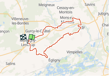
Randonnée Marche de 33 km à découvrir à Île-de-France, Seine-et-Marne, Montigny-Lencoup. Cette randonnée est proposée par chessyca.
Description
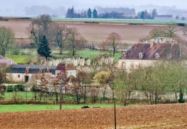
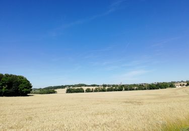
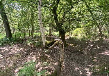
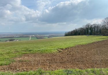
Découverte d'une partie vraiment pittoresque de Seine et Marne
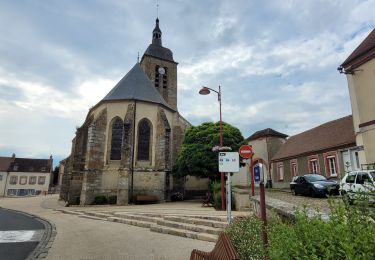
L'église et le cloitre de Donnemarie valent vraiment le déplacement
Attention : le château du Sigy est un domaine privé. (une erreur pour nous mais nous n'étions que 3 . Si on prévoit d'y faire passer un groupe il est préférable de prendre les devants. on trouve le numéro de téléphone du propriétaire sur le net )
Localisation
Commentaires
Randonnées à proximité
![Randonnée Marche Montigny-Lencoup - Boucle Montigny Lencoup - Donnemarie 30 km - Photo](https://media.geolcdn.com/t/375/260/b981e295-e152-41fe-b93f-ed478876f2d5.jpg&format=jpg&maxdim=2)
![Marche Marche](https://static1.geolcdn.com/sitytour/trail-icons/101.png)
Marche
![](/images/other/stat-length.png)
![](https://static1.geolcdn.com/siteimages/upload/files/16400158638029165_repeat_loop_refresh_sync_direction_icon.png)
![Randonnée Vélo de route Salins - Sortie vélo la tombe - Photo](https://media.geolcdn.com/t/375/260/ext.jpg?maxdim=2&url=https%3A%2F%2Fstatic1.geolcdn.com%2Fsiteimages%2Fupload%2Ffiles%2F1524743154velo.jpg)
![Vélo de route Vélo de route](https://static1.geolcdn.com/sitytour/trail-icons/201.png)
Vélo de route
![](/images/other/stat-length.png)
![](https://static1.geolcdn.com/siteimages/upload/files/16400158638029165_repeat_loop_refresh_sync_direction_icon.png)
![Randonnée Marche Montigny-Lencoup - Boucle Montigny Lencoup - Donnemarie - Sigy - Photo](https://media.geolcdn.com/t/375/260/178755b8-d008-4058-b06d-82df06cd2cd5.jpg&format=jpg&maxdim=2)
![Marche Marche](https://static1.geolcdn.com/sitytour/trail-icons/101.png)
Marche
![](/images/other/stat-length.png)
![](https://static1.geolcdn.com/siteimages/upload/files/16400158638029165_repeat_loop_refresh_sync_direction_icon.png)
![Randonnée Marche Donnemarie-Dontilly - Boucle autour de Donnemarie Dontilly - Photo](https://media.geolcdn.com/t/375/260/5126377a-9e73-4979-8b56-f2ae40de8e4d.jpg&format=jpg&maxdim=2)
![Marche Marche](https://static1.geolcdn.com/sitytour/trail-icons/101.png)
Marche
![](/images/other/stat-length.png)
![](https://static1.geolcdn.com/siteimages/upload/files/16400158638029165_repeat_loop_refresh_sync_direction_icon.png)
![Randonnée Marche nordique Salins - Salin jc à l'ombre R - Photo](https://media.geolcdn.com/t/375/260/1d6e0bfb-2946-401b-acf2-cbfe61065054.jpg&format=jpg&maxdim=2)
![Marche nordique Marche nordique](https://static1.geolcdn.com/sitytour/trail-icons/102.png)
Marche nordique
![](/images/other/stat-length.png)
![](https://static1.geolcdn.com/siteimages/upload/files/16400158638029165_repeat_loop_refresh_sync_direction_icon.png)
![Randonnée Marche Salins - Le bois du Maulny - Photo](https://media.geolcdn.com/t/375/260/3951737e-4fd5-4f06-9c31-f23f3c7d35af.jpg&format=jpg&maxdim=2)
![Marche Marche](https://static1.geolcdn.com/sitytour/trail-icons/101.png)
Marche
![](/images/other/stat-length.png)
![](https://static1.geolcdn.com/siteimages/upload/files/16400158638029165_repeat_loop_refresh_sync_direction_icon.png)
![Randonnée Marche nordique Salins - Le dimanche 21 Mars - Photo](https://media.geolcdn.com/t/375/260/e335de20-700d-4d98-83a8-071b77d81b3e.jpg&format=jpg&maxdim=2)
![Marche nordique Marche nordique](https://static1.geolcdn.com/sitytour/trail-icons/102.png)
Marche nordique
![](/images/other/stat-length.png)
![](https://static1.geolcdn.com/siteimages/upload/files/16400158638029165_repeat_loop_refresh_sync_direction_icon.png)
![Randonnée Marche Salins - Essai 316 avec bcp de photos - Photo](https://media.geolcdn.com/t/375/260/0d393317-2752-4286-9c1e-e5f7fb57183f.jpg&format=jpg&maxdim=2)
![Marche Marche](https://static1.geolcdn.com/sitytour/trail-icons/101.png)
Marche
![](/images/other/stat-length.png)
![](https://static1.geolcdn.com/siteimages/upload/files/16400158638029165_repeat_loop_refresh_sync_direction_icon.png)
![Randonnée Vélo de route Salins - Mormant échou - Photo](https://media.geolcdn.com/t/375/260/877fce3b-bc6d-42c8-984f-be1b791687c4.jpeg&format=jpg&maxdim=2)
![Vélo de route Vélo de route](https://static1.geolcdn.com/sitytour/trail-icons/201.png)
Vélo de route
![](/images/other/stat-length.png)
![](https://static1.geolcdn.com/siteimages/upload/files/16400158638029165_repeat_loop_refresh_sync_direction_icon.png)