![](/images/other/stat-length.png)
![Randonnée V.T.T. Marsanne - TARTAIGUILLE - Marsanne (26 Drome) - Photo](https://media.geolcdn.com/t/1900/400/ext.pjpeg?maxdim=2&url=https%3A%2F%2Fstatic1.geolcdn.com%2Fsiteimages%2Fupload%2Ffiles%2F1524743154velo.jpg)
TARTAIGUILLE - Marsanne (26 Drome)
charlytan
Utilisateur
![Longueur](/images/other/stat-length.png)
![Altitude max](https://static1.geolcdn.com/siteimages/upload/files/1508320355ic_sort_altitude_max_24dp.png)
![Dénivelé positif](https://static1.geolcdn.com/siteimages/upload/files/1508320355ic_sort_den_pos_24dp.png)
![Km-Effort](/images/other/stat-length.png)
![Altitude min](https://static1.geolcdn.com/siteimages/upload/files/1508320355ic_sort_altitude_min_24dp.png)
![Dénivelé négatif](https://static1.geolcdn.com/siteimages/upload/files/1508320355ic_sort_den_neg_24dp.png)
![Boucle](https://static1.geolcdn.com/siteimages/upload/files/16400158638029165_repeat_loop_refresh_sync_direction_icon.png)
![V.T.T.](https://static1.geolcdn.com/sitytour/trail-icons/202.png)
--
Difficulté : Inconnu
![Scannez ce code QR pour ouvrir la randonnée dans l'application SityTrail](https://capi.geolives.com/qq0zvz2zws4bq2lad0pu/sitytour/trails/2853923/qr.png?size=200)
Application GPS de randonnée GRATUITE
À propos
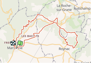
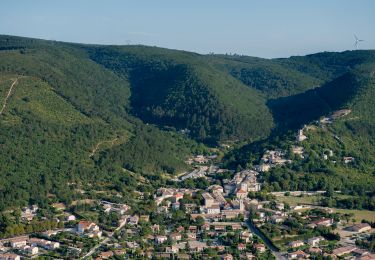
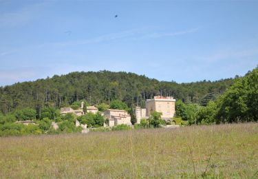
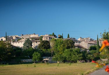
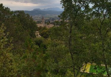
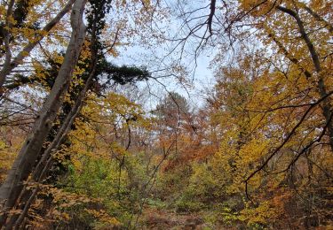
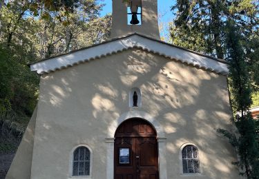
Randonnée V.T.T. de 26 km à découvrir à Auvergne-Rhône-Alpes, Drôme, Marsanne. Cette randonnée est proposée par charlytan.
Description
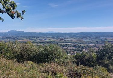
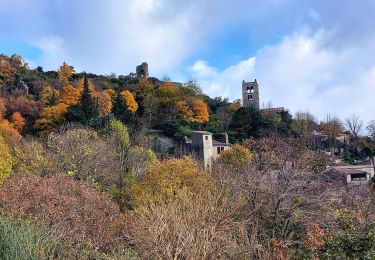
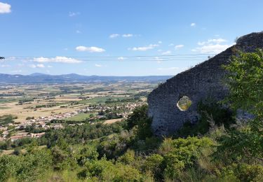
Au bord de la plaine de Marsanne, ce circuit court mais avec certains passages techniques, permet d'arriver au Col de Tartaiguille. Plusieurs options s'offrent alors devant vous : poursuivre le circuit vers Roynac ou revenir vers Marsanne. Autant d'options de chemins que de points de vue !
Localisation
Commentaires
Randonnées à proximité
![Randonnée Marche Sauzet - Sauzet Les Grands Abris 7km5 - Photo](https://media.geolcdn.com/t/375/260/dc904df7-2d15-4473-9afc-0180c6e306df.jpg&format=jpg&maxdim=2)
![Marche Marche](https://static1.geolcdn.com/sitytour/trail-icons/101.png)
Marche
![](/images/other/stat-length.png)
![](https://static1.geolcdn.com/siteimages/upload/files/16400158638029165_repeat_loop_refresh_sync_direction_icon.png)
![Randonnée Marche Marsanne - Marsanne Les Fileuses 11km - Photo](https://media.geolcdn.com/t/375/260/1bc76543-3f04-4843-8b57-1b794a10099f.jpg&format=jpg&maxdim=2)
![Marche Marche](https://static1.geolcdn.com/sitytour/trail-icons/101.png)
Marche
![](/images/other/stat-length.png)
![](https://static1.geolcdn.com/siteimages/upload/files/16400158638029165_repeat_loop_refresh_sync_direction_icon.png)
![Randonnée Marche Marsanne - Marsanne . Les extrêmes 23km - Photo](https://media.geolcdn.com/t/375/260/7e7a370b-6dd4-40a2-9fe9-e7b41d047702.jpg&format=jpg&maxdim=2)
![Marche Marche](https://static1.geolcdn.com/sitytour/trail-icons/101.png)
Marche
![](/images/other/stat-length.png)
![](https://static1.geolcdn.com/siteimages/upload/files/16400158638029165_repeat_loop_refresh_sync_direction_icon.png)
![Randonnée Marche Marsanne - Le Serre de Paturel 4km5 - Photo](https://media.geolcdn.com/t/375/260/6920fa6a-09c5-442d-bdb3-dc0abd5d0470.jpg&format=jpg&maxdim=2)
![Marche Marche](https://static1.geolcdn.com/sitytour/trail-icons/101.png)
Marche
![](/images/other/stat-length.png)
![](https://static1.geolcdn.com/siteimages/upload/files/16400158638029165_repeat_loop_refresh_sync_direction_icon.png)
![Randonnée Marche Condillac - Condillac Borne Rousse et le Grand Travers 11km - Photo](https://media.geolcdn.com/t/375/260/682fa6c2-f9ec-4b30-ade4-a125a2ae7aa0.jpg&format=jpg&maxdim=2)
![Marche Marche](https://static1.geolcdn.com/sitytour/trail-icons/101.png)
Marche
![](/images/other/stat-length.png)
![](https://static1.geolcdn.com/siteimages/upload/files/16400158638029165_repeat_loop_refresh_sync_direction_icon.png)
![Randonnée Marche Sauzet - Les Grands Abris 7km - Photo](https://media.geolcdn.com/t/375/260/7a0f940a-b445-4320-8788-dc8b4c52f3c2.jpg&format=jpg&maxdim=2)
![Marche Marche](https://static1.geolcdn.com/sitytour/trail-icons/101.png)
Marche
![](/images/other/stat-length.png)
![](https://static1.geolcdn.com/siteimages/upload/files/16400158638029165_repeat_loop_refresh_sync_direction_icon.png)
![Randonnée Marche Marsanne - 26 marsanne - Photo](https://media.geolcdn.com/t/375/260/eb9e8457-8b6e-43e2-b07d-70d6ea2ee458.jpg&format=jpg&maxdim=2)
![Marche Marche](https://static1.geolcdn.com/sitytour/trail-icons/101.png)
Marche
![](/images/other/stat-length.png)
![](https://static1.geolcdn.com/siteimages/upload/files/16400158638029165_repeat_loop_refresh_sync_direction_icon.png)
![Randonnée Marche Marsanne - Marsanne la Teissonnière 10km. - Photo](https://media.geolcdn.com/t/375/260/3bf0be89-93ab-4fe5-ab65-545a02c9fe31.jpg&format=jpg&maxdim=2)
![Marche Marche](https://static1.geolcdn.com/sitytour/trail-icons/101.png)
Marche
![](/images/other/stat-length.png)
![](https://static1.geolcdn.com/siteimages/upload/files/16400158638029165_repeat_loop_refresh_sync_direction_icon.png)
![Randonnée sport Marsanne - Marsanne grande limite ND Fresneau - Photo](https://media.geolcdn.com/t/375/260/0900e885-54f4-4782-b307-7bbe8bc15844.jpg&format=jpg&maxdim=2)
sport
![](/images/other/stat-length.png)
![](https://static1.geolcdn.com/siteimages/upload/files/16400158638029165_repeat_loop_refresh_sync_direction_icon.png)