![](/images/other/stat-length.png)
![Randonnée Marche Limerzel - Limerzel Sentier du Sillon - Photo](https://media.geolcdn.com/t/1900/400/e5c40b33-a7bf-4c14-985e-7b1dc60ed7f4.jpg&format=pjpeg&maxdim=2)
Limerzel Sentier du Sillon
guydu41
Utilisateur
![Longueur](/images/other/stat-length.png)
![Altitude max](https://static1.geolcdn.com/siteimages/upload/files/1508320355ic_sort_altitude_max_24dp.png)
![Dénivelé positif](https://static1.geolcdn.com/siteimages/upload/files/1508320355ic_sort_den_pos_24dp.png)
![Km-Effort](/images/other/stat-length.png)
![Altitude min](https://static1.geolcdn.com/siteimages/upload/files/1508320355ic_sort_altitude_min_24dp.png)
![Dénivelé négatif](https://static1.geolcdn.com/siteimages/upload/files/1508320355ic_sort_den_neg_24dp.png)
![Boucle](https://static1.geolcdn.com/siteimages/upload/files/16400158638029165_repeat_loop_refresh_sync_direction_icon.png)
![Marche](https://static1.geolcdn.com/sitytour/trail-icons/101.png)
2h58
Difficulté : Moyen
![Scannez ce code QR pour ouvrir la randonnée dans l'application SityTrail](https://capi.geolives.com/qq0zvz2zws4bq2lad0pu/sitytour/trails/2852696/qr.png?size=200)
Application GPS de randonnée GRATUITE
À propos
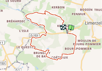
Randonnée Marche de 10,1 km à découvrir à Bretagne, Morbihan, Limerzel. Cette randonnée est proposée par guydu41.
Description
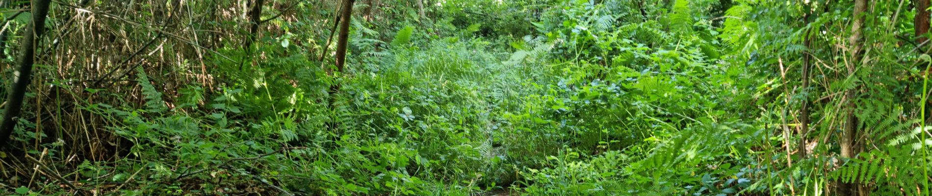
Très beau parcours sur de nombreux sentiers tortueux à travers bois avec plusieurs petits franchissements abrupts.
Le circuit PR est bien balisé (peinture jaune). Certains passages sont complètement cachés par les fougères.
Point de départ/arrivée du circuit : juste après le pont qui franchit le Ruisseau du Moulin de Pinieux sur la route vicinale qui part de la D153 en direction de Coëtfaux à côté de Limerzel 56220.
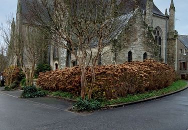
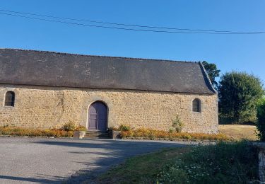
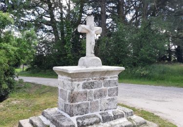
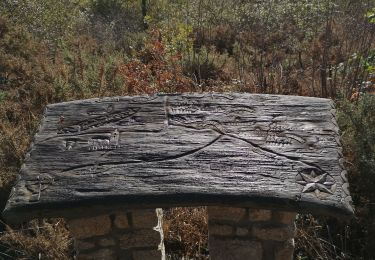
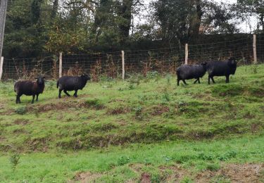
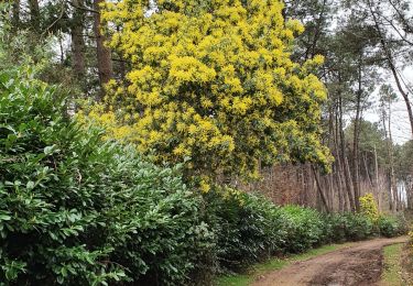
Localisation
Commentaires
Randonnées à proximité
![Randonnée Marche Limerzel - PR_56_Limerzel_AA_01_Circuit1b_Vallee-Du-Trevelo_20231215 - Photo](https://media.geolcdn.com/t/375/260/b434d388-f2cf-4273-a9c9-f910c9f7a88a.jpg&format=jpg&maxdim=2)
![Marche Marche](https://static1.geolcdn.com/sitytour/trail-icons/101.png)
Marche
![](/images/other/stat-length.png)
![](https://static1.geolcdn.com/siteimages/upload/files/16400158638029165_repeat_loop_refresh_sync_direction_icon.png)
![Randonnée Marche Péaule - PR_56_Peaule_BA_02_Circuit3b_De-L-Etier_20230914 - Photo](https://media.geolcdn.com/t/375/260/f17b2106-29c9-443c-b455-5d085c7b6379.jpg&format=jpg&maxdim=2)
![Marche Marche](https://static1.geolcdn.com/sitytour/trail-icons/101.png)
Marche
![](/images/other/stat-length.png)
![](https://static1.geolcdn.com/siteimages/upload/files/16400158638029165_repeat_loop_refresh_sync_direction_icon.png)
![Randonnée Marche Limerzel - GRP_Lanvaux_AI_09_Limerzel_Berric_20210528 - Photo](https://media.geolcdn.com/t/375/260/c931dd36-7661-451d-be62-fb02e50c34f3.jpg&format=jpg&maxdim=2)
![Marche Marche](https://static1.geolcdn.com/sitytour/trail-icons/101.png)
Marche
![](/images/other/stat-length.png)
![](https://static1.geolcdn.com/siteimages/upload/files/16400158638029165_repeat_loop_refresh_sync_direction_icon.png)
![Randonnée Marche Limerzel - 192- la vallée du Trévelo - Photo](https://media.geolcdn.com/t/375/260/118c7e85-b6b5-4111-bf8d-236391bf9068.jpg&format=jpg&maxdim=2)
![Marche Marche](https://static1.geolcdn.com/sitytour/trail-icons/101.png)
Marche
![](/images/other/stat-length.png)
![](https://static1.geolcdn.com/siteimages/upload/files/16400158638029165_repeat_loop_refresh_sync_direction_icon.png)
![Randonnée Marche Limerzel - 196 - rando du sillon Limerzel - Photo](https://media.geolcdn.com/t/375/260/ff8b2d16-fa07-4205-863f-1f2750659492.jpg&format=jpg&maxdim=2)
![Marche Marche](https://static1.geolcdn.com/sitytour/trail-icons/101.png)
Marche
![](/images/other/stat-length.png)
![](https://static1.geolcdn.com/siteimages/upload/files/16400158638029165_repeat_loop_refresh_sync_direction_icon.png)
![Randonnée V.T.T. Limerzel - Limerzel 2022 - Photo](https://media.geolcdn.com/t/375/260/ext.jpg?maxdim=2&url=https%3A%2F%2Fstatic1.geolcdn.com%2Fsiteimages%2Fupload%2Ffiles%2F1524743154velo.jpg)
![V.T.T. V.T.T.](https://static1.geolcdn.com/sitytour/trail-icons/202.png)
V.T.T.
![](/images/other/stat-length.png)
![](https://static1.geolcdn.com/siteimages/upload/files/16400158638029165_repeat_loop_refresh_sync_direction_icon.png)
![Randonnée Marche Péaule - Rando chapelle St André Peaule - Photo](https://media.geolcdn.com/t/375/260/ext.jpg?maxdim=2&url=https%3A%2F%2Fstatic1.geolcdn.com%2Fsiteimages%2Fupload%2Ffiles%2F1553511878bg_sport_marche.png)
![Marche Marche](https://static1.geolcdn.com/sitytour/trail-icons/101.png)
Marche
![](/images/other/stat-length.png)
![](https://static1.geolcdn.com/siteimages/upload/files/16400158638029165_repeat_loop_refresh_sync_direction_icon.png)
![Randonnée Marche Péaule - Autour de Saint-André - Photo](https://media.geolcdn.com/t/375/260/b9bd09ed-ec82-4839-85af-177d642e046b.jpg&format=jpg&maxdim=2)
![Marche Marche](https://static1.geolcdn.com/sitytour/trail-icons/101.png)
Marche
![](/images/other/stat-length.png)
![](https://static1.geolcdn.com/siteimages/upload/files/16400158638029165_repeat_loop_refresh_sync_direction_icon.png)
![Randonnée Marche Péaule - Peaule - Photo](https://media.geolcdn.com/t/375/260/ext.jpg?maxdim=2&url=https%3A%2F%2Fstatic1.geolcdn.com%2Fsiteimages%2Fupload%2Ffiles%2F1553511878bg_sport_marche.png)
![Marche Marche](https://static1.geolcdn.com/sitytour/trail-icons/101.png)