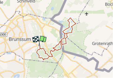
![](/images/other/stat-length.png)
![Randonnée Marche Brunssum - Brunssum_1288 - Photo](https://media.geolcdn.com/t/1900/400/be5d1686-e005-4060-95f9-6d7688290c56.jpg&format=pjpeg&maxdim=2)
Brunssum_1288
mumu.larandonneuse
Utilisateur GUIDE
![Longueur](/images/other/stat-length.png)
![Altitude max](https://static1.geolcdn.com/siteimages/upload/files/1508320355ic_sort_altitude_max_24dp.png)
![Dénivelé positif](https://static1.geolcdn.com/siteimages/upload/files/1508320355ic_sort_den_pos_24dp.png)
![Km-Effort](/images/other/stat-length.png)
![Altitude min](https://static1.geolcdn.com/siteimages/upload/files/1508320355ic_sort_altitude_min_24dp.png)
![Dénivelé négatif](https://static1.geolcdn.com/siteimages/upload/files/1508320355ic_sort_den_neg_24dp.png)
![Boucle](https://static1.geolcdn.com/siteimages/upload/files/16400158638029165_repeat_loop_refresh_sync_direction_icon.png)
![Marche](https://static1.geolcdn.com/sitytour/trail-icons/101.png)
3h56
Difficulté : Facile
![Scannez ce code QR pour ouvrir la randonnée dans l'application SityTrail](https://capi.geolives.com/qq0zvz2zws4bq2lad0pu/sitytour/trails/2845729/qr.png?size=200)
Application GPS de randonnée GRATUITE
À propos
Randonnée Marche de 15,1 km à découvrir à Limbourg, Inconnu, Brunssum. Cette randonnée est proposée par mumu.larandonneuse.
Description
ℹ Gpx pris sur www.wandelgidszuidlimburg.com n° 1288.
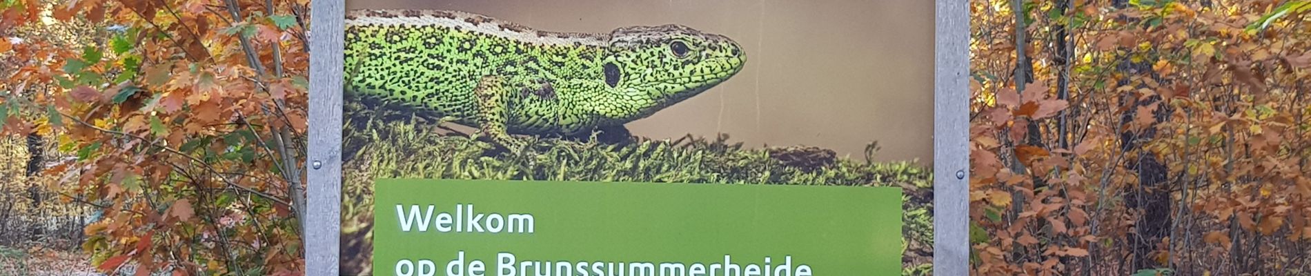
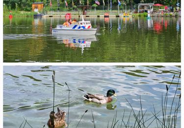
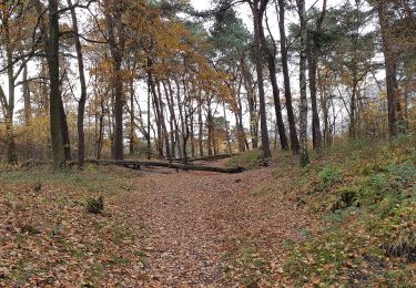
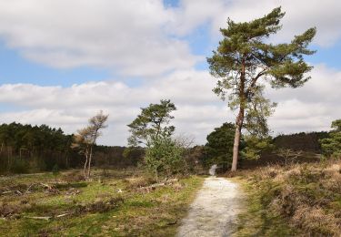
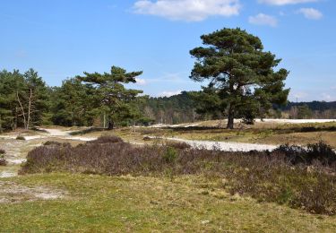
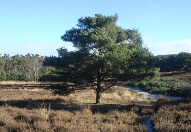
➡️ Cette promenade variée, transfrontalière et vallonnée mène à la Teverenerheide avec de beaux marais. Par de jolis chemins forestiers, vous marchez jusqu'à un tunnel qui passe sous le Ring Parkstad, puis vous longez le parcours de golf de Brunssum. Vous traversez la frontière allemande puis vous vous promenez un bon moment sur la Teverenerheide avec de beaux marais qui portent tous un nom. Cette boucle est en forme de 8. Vous revenez le long du parcours de golf puis vous vous dirigez vers un point de vue sur la Brunssummerheide avec une belle vue sur la vallée de la Roode Beek. Par des chemins forestiers, vous marchez jusqu'au magnifique étang Koffiepoel.
Localisation
Commentaires
Randonnées à proximité
![Randonnée Marche Brunssum - Brunsumm - 1055 - Photo](https://media.geolcdn.com/t/375/260/a9d4ae47-6d3e-4d55-a221-1cbefb6a45e5.jpg&format=jpg&maxdim=2)
![Marche Marche](https://static1.geolcdn.com/sitytour/trail-icons/101.png)
Marche
![](/images/other/stat-length.png)
![](https://static1.geolcdn.com/siteimages/upload/files/16400158638029165_repeat_loop_refresh_sync_direction_icon.png)
![Randonnée A pied Landgraaf - Brunssummer Heide Paarse route - Photo](https://media.geolcdn.com/t/375/260/fc5733ac-21b1-4256-9efd-d70ddf8f828f.jpeg&format=jpg&maxdim=2)
![A pied A pied](https://static1.geolcdn.com/sitytour/trail-icons/100.png)
A pied
![](/images/other/stat-length.png)
![](https://static1.geolcdn.com/siteimages/upload/files/16400158638029165_repeat_loop_refresh_sync_direction_icon.png)
![Randonnée A pied Heerlen - Brunssummer Heide Lichtgroene route - Photo](https://media.geolcdn.com/t/375/260/508b716c-8807-4753-8004-f75de6f128b2.jpeg&format=jpg&maxdim=2)
![A pied A pied](https://static1.geolcdn.com/sitytour/trail-icons/100.png)
A pied
![](/images/other/stat-length.png)
![](https://static1.geolcdn.com/siteimages/upload/files/16400158638029165_repeat_loop_refresh_sync_direction_icon.png)
![Randonnée A pied Heerlen - Brunssummer Heide Lichtblauwe route - Photo](https://media.geolcdn.com/t/375/260/39c8b9d7-66fe-45a6-8073-0f378ccb205b.jpeg&format=jpg&maxdim=2)
![A pied A pied](https://static1.geolcdn.com/sitytour/trail-icons/100.png)
A pied
![](/images/other/stat-length.png)
![](https://static1.geolcdn.com/siteimages/upload/files/16400158638029165_repeat_loop_refresh_sync_direction_icon.png)
![Randonnée A pied Heerlen - Brunssummer Heide Donkergroene route - Photo](https://media.geolcdn.com/t/375/260/ad778f8c-75f7-4599-b089-d9f2e7b1eaf0.jpeg&format=jpg&maxdim=2)
![A pied A pied](https://static1.geolcdn.com/sitytour/trail-icons/100.png)
A pied
![](/images/other/stat-length.png)
![](https://static1.geolcdn.com/siteimages/upload/files/16400158638029165_repeat_loop_refresh_sync_direction_icon.png)
![Randonnée A pied Beekdaelen - Rode Route - Photo](https://media.geolcdn.com/t/375/260/ee24fe33-e676-4d4e-8211-77f2cd86e479.jpeg&format=jpg&maxdim=2)
![A pied A pied](https://static1.geolcdn.com/sitytour/trail-icons/100.png)
A pied
![](/images/other/stat-length.png)
![](https://static1.geolcdn.com/siteimages/upload/files/16400158638029165_repeat_loop_refresh_sync_direction_icon.png)
![Randonnée A pied Beekdaelen - Groene Route - Photo](https://media.geolcdn.com/t/375/260/ee24fe33-e676-4d4e-8211-77f2cd86e479.jpeg&format=jpg&maxdim=2)
![A pied A pied](https://static1.geolcdn.com/sitytour/trail-icons/100.png)
A pied
![](/images/other/stat-length.png)
![](https://static1.geolcdn.com/siteimages/upload/files/16400158638029165_repeat_loop_refresh_sync_direction_icon.png)
![Randonnée A pied Beekdaelen - Niederbusch Wanderweg - Photo](https://media.geolcdn.com/t/375/260/ee24fe33-e676-4d4e-8211-77f2cd86e479.jpeg&format=jpg&maxdim=2)
![A pied A pied](https://static1.geolcdn.com/sitytour/trail-icons/100.png)
A pied
![](/images/other/stat-length.png)
![](https://static1.geolcdn.com/siteimages/upload/files/16400158638029165_repeat_loop_refresh_sync_direction_icon.png)
![Randonnée A pied Beekdaelen - Blauwe Route - Photo](https://media.geolcdn.com/t/375/260/f0254392-3f34-4697-921c-482aa71516af.jpeg&format=jpg&maxdim=2)
![A pied A pied](https://static1.geolcdn.com/sitytour/trail-icons/100.png)
A pied
![](/images/other/stat-length.png)
![](https://static1.geolcdn.com/siteimages/upload/files/16400158638029165_repeat_loop_refresh_sync_direction_icon.png)
Magnifique région, très dépaysante.