


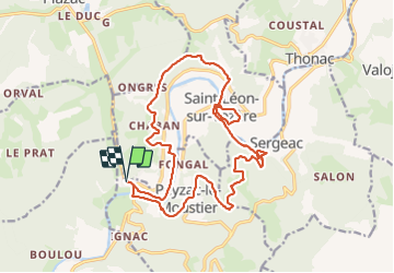

18,7 km | 26 km-effort

Utilisateur


Application GPS de randonnée GRATUITE
 SityTrail
IGN / Instituts géographiques
SityTrail World
Le monde est à vous
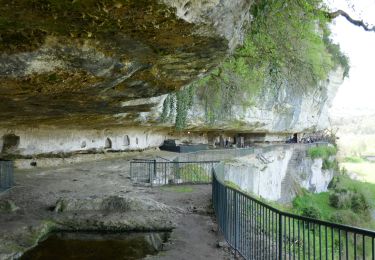
Randonnée Marche de 21 km à découvrir à Nouvelle-Aquitaine, Dordogne, Peyzac-le-Moustier. Cette randonnée est proposée par jcc24.
Belle boucle le long de la Vézère et sur la cote de Jor. Paysages et falaises troglodytes en passant par le village typique de St Léon sur Vézère.


Vélo électrique
Marche
Vélo électrique
A pied
A pied

Marche

Marche

Marche

Marche