


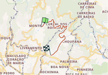

6,4 km | 10,7 km-effort

Tracés randos


Application GPS de randonnée GRATUITE
 SityTrail
IGN / Instituts géographiques
SityTrail World
Le monde est à vous
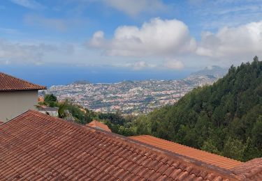
Randonnée Marche de 5,4 km à découvrir à Madère, Inconnu, Monte. Cette randonnée est proposée par Vacances.
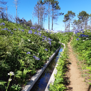
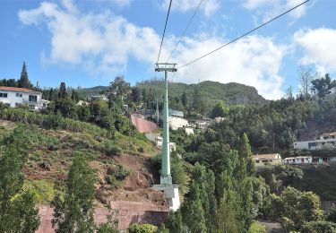
B mais descente très raide sur la fin (pas très agréable) / Visite du jardin tropical à éviter / Visite du jardin botanique bcp plus intéressante/ Possibilité de restauration au jardin botanique (€)
Marche
Marche
A pied
A pied

Marche
Marche

