14,4 km | 22 km-effort
o
anniston
Utilisateur
Longueur
29 km
Altitude max
1302 m
Dénivelé positif
658 m
Km-Effort
40 km
Altitude min
752 m
Dénivelé négatif
1148 m
Boucle
Non
Date de création :
2021-06-16 08:47:39.388
Dernière modification :
2021-06-16 20:37:30.987
5h49
Difficulté : Difficile
Application GPS de randonnée GRATUITE
À propos
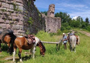
Randonnée Randonnée équestre de 29 km à découvrir à Grand Est, Haut-Rhin, Orbey. Cette randonnée est proposée par anniston.
Description
Orbey aubure
Localisation
Pays :
France
Région :
Grand Est
Département/Province :
Haut-Rhin
Commune :
Orbey
Localité :
Unknown
Départ:(Dec)
Départ:(UTM)
357545 ; 5330052 (32U) N.
Commentaires
Randonnées à proximité
Les Rochers des Hirschsteine - Lac Vert
Marche
Difficile
(2)
Le Valtin,
Grand Est,
Vosges,
France
5h 2min
Oui
2020-06-28 WE Orbey Petit Hohnack Glasborn
Randonnée équestre
Difficile
(1)
Orbey,
Grand Est,
Haut-Rhin,
France
22 km | 31 km-effort
4h 5min
Oui
2020-06-27 WE Orbey Noir Gazon Vert Forlet
Randonnée équestre
Moyen
(1)
Orbey,
Grand Est,
Haut-Rhin,
France
21 km | 30 km-effort
3h 59min
Oui
Le Sentier des Roches
Marche
Difficile
(2)
Le Valtin,
Grand Est,
Vosges,
France
20 km | 34 km-effort
7h 43min
Oui
Tour du belvedere avec le passage sur les crêtes
Marche
Très facile
(3)
Stosswihr,
Grand Est,
Haut-Rhin,
France
8,5 km | 0 m-effort
2h 28min
Oui
Totom 4 lacs
Autre activité
Moyen
(1)
Soultzeren,
Grand Est,
Haut-Rhin,
France
15,6 km | 26 km-effort
4h 37min
Oui
Circuit historique 1914-18 Hohrodberg - Linge
Marche
Moyen
(1)
Hohrod,
Grand Est,
Haut-Rhin,
France
14 km | 19,8 km-effort
5h 50min
Oui
Les Hirschsteine
Marche
Difficile
(1)
Le Valtin,
Grand Est,
Vosges,
France
16,1 km | 25 km-effort
6h 28min
Oui
Le Tour du Lac Blanc par le Rocher Hans et le sentier de crête
Marche
Difficile
(3)
Orbey,
Grand Est,
Haut-Rhin,
France
4,4 km | 7,7 km-effort
2h 30min
Oui