


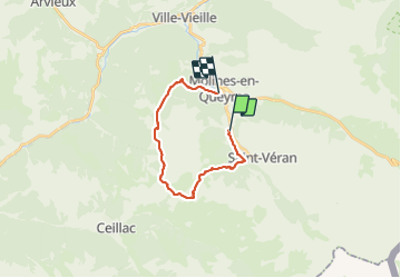

6,9 km | 16,1 km-effort


Utilisateur


Application GPS de randonnée GRATUITE
 SityTrail
IGN / Instituts géographiques
SityTrail World
Le monde est à vous
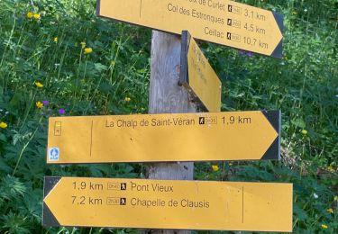
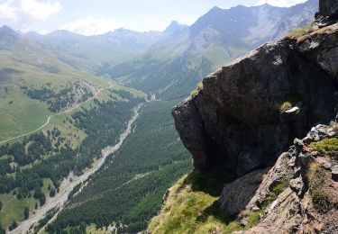
Randonnée Marche de 18,5 km à découvrir à Provence-Alpes-Côte d'Azur, Hautes-Alpes, Saint-Véran. Cette randonnée est proposée par franquen.
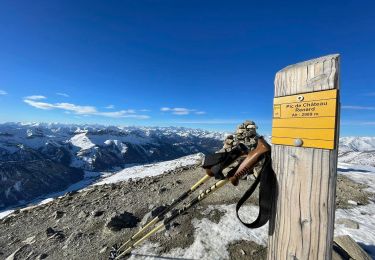
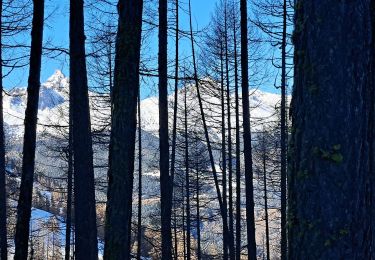
à partir de la Chalp, belle rando dont une grande partie dans les mélèzes. Jolies vues. Long

Marche

Marche

Raquettes à neige
Raquettes à neige

Autre activité
Marche
Marche
Marche
Marche