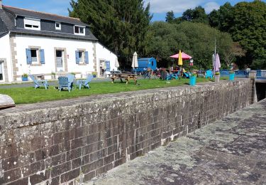
6,3 km | 7,5 km-effort
Carhaix Mur de Bretagne 3ème jour
Roulland
Utilisateur
Longueur
63 km
Altitude max
245 m
Dénivelé positif
664 m
Km-Effort
71 km
Altitude min
74 m
Dénivelé négatif
579 m
Boucle
Non
Date de création :
2021-06-13 06:47:21.319
Dernière modification :
2021-06-13 14:14:07.738
3h54
Difficulté : Moyen
Application GPS de randonnée GRATUITE
À propos
Randonnée V.T.C. de 63 km à découvrir à Bretagne, Finistère, Carhaix-Plouguer. Cette randonnée est proposée par Roulland.
Localisation
Pays :
France
Région :
Bretagne
Département/Province :
Finistère
Commune :
Carhaix-Plouguer
Localité :
Unknown
Départ:(Dec)
Départ:(UTM)
455270 ; 5343529 (30U) N.
Commentaires
Randonnées à proximité
GR_37_EB_08_Carhaix-Plouguer_Landeleau_20200715
Marche
Facile
Carhaix-Plouguer,
Bretagne,
Finistère,
France
19,6 km | 23 km-effort
4h 30min
Non
Carrhaix-Ecluse 150 Pont de Bonen
Vélo électrique
Très facile
Carhaix-Plouguer,
Bretagne,
Finistère,
France
33 km | 36 km-effort
3h 36min
Non
Cléden Poher et le canal de Nantes à Brest
Marche
Difficile
Cléden-Poher,
Bretagne,
Finistère,
France
21 km | 24 km-effort
4h 30min
Oui
Canal Nantes-Brest (6)
Autre activité
Très facile
Carhaix-Plouguer,
Bretagne,
Finistère,
France
55 km | 63 km-effort
5min
Non
Canal N/B complet 310 km
Cyclotourisme
Très difficile
Carhaix-Plouguer,
Bretagne,
Finistère,
France
310 km | 340 km-effort
Inconnu
Non
etape 6
V.T.C.
Très difficile
Carhaix-Plouguer,
Bretagne,
Finistère,
France
118 km | 134 km-effort
6h 28min
Non
Carhaix centre - Roscoff centre
Vélo
Facile
Carhaix-Plouguer,
Bretagne,
Finistère,
France
80 km | 93 km-effort
Inconnu
Non
Carhaix - Vallée des Saints - Poullaouen (Voie verte V7)
Vélo
Facile
Carhaix-Plouguer,
Bretagne,
Finistère,
France
23 km | 28 km-effort
Inconnu
Non