![](/images/other/stat-length.png)
![Randonnée Marche La Motte-Chalancon - LA MOTTE CHALANCON - LE PLATEAU DE LA CHAU - Photo](https://media.geolcdn.com/t/1900/400/4f26d25d-f819-4267-a4ac-87b7f19efa5f.jpg&format=pjpeg&maxdim=2)
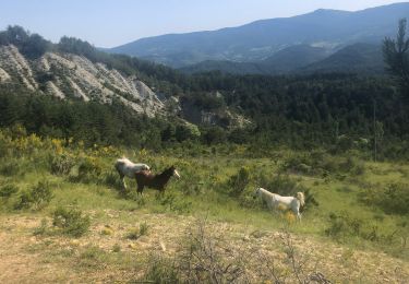
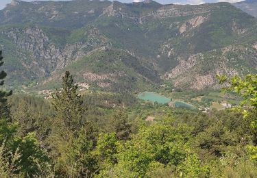
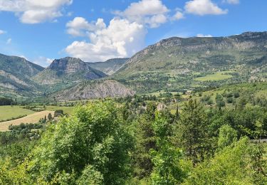
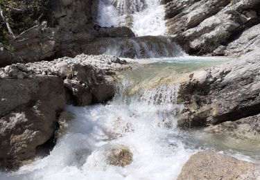
LA MOTTE CHALANCON - LE PLATEAU DE LA CHAU
jean-marie.parachini
Utilisateur
![Longueur](/images/other/stat-length.png)
Longueur
9,1 km
![Altitude max](https://static1.geolcdn.com/siteimages/upload/files/1508320355ic_sort_altitude_max_24dp.png)
Altitude max
945 m
![Dénivelé positif](https://static1.geolcdn.com/siteimages/upload/files/1508320355ic_sort_den_pos_24dp.png)
Dénivelé positif
434 m
![Km-Effort](/images/other/stat-length.png)
Km-Effort
14,9 km
![Altitude min](https://static1.geolcdn.com/siteimages/upload/files/1508320355ic_sort_altitude_min_24dp.png)
Altitude min
552 m
![Dénivelé négatif](https://static1.geolcdn.com/siteimages/upload/files/1508320355ic_sort_den_neg_24dp.png)
Dénivelé négatif
434 m
![Boucle](https://static1.geolcdn.com/siteimages/upload/files/16400158638029165_repeat_loop_refresh_sync_direction_icon.png)
Boucle
Oui
Date de création :
2021-06-09 07:22:32.536
Dernière modification :
2021-06-09 15:59:02.779
![Marche](https://static1.geolcdn.com/sitytour/trail-icons/101.png)
7h30
Difficulté : Moyen
![Scannez ce code QR pour ouvrir la randonnée dans l'application SityTrail](https://capi.geolives.com/qq0zvz2zws4bq2lad0pu/sitytour/trails/2820534/qr.png?size=200)
Application GPS de randonnée GRATUITE
À propos
Randonnée Marche de 9,1 km à découvrir à Auvergne-Rhône-Alpes, Drôme, La Motte-Chalancon. Cette randonnée est proposée par jean-marie.parachini.
Description
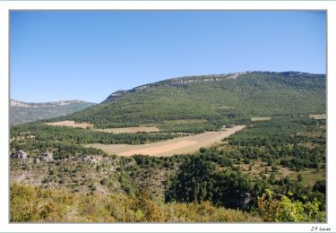
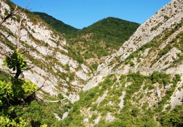
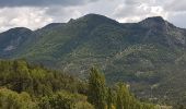
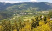
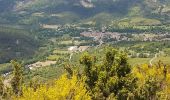
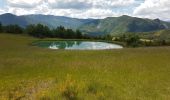
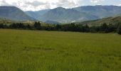
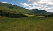
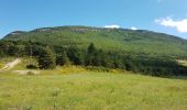
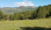
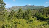
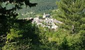
panorama sur la vallée de l'Oule au-dessus du village de la Motte Chalancon.
Localisation
Pays :
France
Région :
Auvergne-Rhône-Alpes
Département/Province :
Drôme
Commune :
La Motte-Chalancon
Localité :
Unknown
Départ:(Dec)
Départ:(UTM)
689360 ; 4928631 (31T) N.
Commentaires
Randonnées à proximité
![Randonnée Marche Chalancon - 26 eyriau - Photo](https://media.geolcdn.com/t/375/260/7f70cd36-a3d0-48cb-b54c-083b90637d61.jpg&format=jpg&maxdim=2)
![Marche Marche](https://static1.geolcdn.com/sitytour/trail-icons/101.png)
26 eyriau
Marche
Moyen
Chalancon,
Auvergne-Rhône-Alpes,
Drôme,
France
![](/images/other/stat-length.png)
14,7 km | 27 km-effort
6h 57min
![](https://static1.geolcdn.com/siteimages/upload/files/16400158638029165_repeat_loop_refresh_sync_direction_icon.png)
Oui
![Randonnée Marche Establet - Establet - Photo](https://media.geolcdn.com/t/375/260/215556b5-b44f-4e42-87f4-f7d873c060ef.jpg&format=jpg&maxdim=2)
![Marche Marche](https://static1.geolcdn.com/sitytour/trail-icons/101.png)
Establet
Marche
Facile
Establet,
Auvergne-Rhône-Alpes,
Drôme,
France
![](/images/other/stat-length.png)
15,3 km | 24 km-effort
4h 31min
![](https://static1.geolcdn.com/siteimages/upload/files/16400158638029165_repeat_loop_refresh_sync_direction_icon.png)
Oui
![Randonnée Marche La Motte-Chalancon - Boucle à Cornillon - Photo](https://media.geolcdn.com/t/375/260/68e11cbc-3244-4d5b-8d24-31101eb609ab.jpg&format=jpg&maxdim=2)
![Marche Marche](https://static1.geolcdn.com/sitytour/trail-icons/101.png)
Boucle à Cornillon
Marche
Moyen
(1)
La Motte-Chalancon,
Auvergne-Rhône-Alpes,
Drôme,
France
![](/images/other/stat-length.png)
10,7 km | 16,9 km-effort
3h 34min
![](https://static1.geolcdn.com/siteimages/upload/files/16400158638029165_repeat_loop_refresh_sync_direction_icon.png)
Oui
![Randonnée Marche La Motte-Chalancon - La Motte Chalancon - Plateau de la Chau - Photo](https://media.geolcdn.com/t/375/260/5f397974-316e-44d5-952e-803b0bd6736b.jpg&format=jpg&maxdim=2)
![Marche Marche](https://static1.geolcdn.com/sitytour/trail-icons/101.png)
La Motte Chalancon - Plateau de la Chau
Marche
Moyen
(1)
La Motte-Chalancon,
Auvergne-Rhône-Alpes,
Drôme,
France
![](/images/other/stat-length.png)
8,8 km | 14,6 km-effort
8h 5min
![](https://static1.geolcdn.com/siteimages/upload/files/16400158638029165_repeat_loop_refresh_sync_direction_icon.png)
Oui
![Randonnée Marche Chalancon - Chalancon (26)Montagne Eyriau - Photo](https://media.geolcdn.com/t/375/260/e1e7d64c-ae8c-44c1-bef1-46573e2ead16.jpg&format=jpg&maxdim=2)
![Marche Marche](https://static1.geolcdn.com/sitytour/trail-icons/101.png)
Chalancon (26)Montagne Eyriau
Marche
Moyen
Chalancon,
Auvergne-Rhône-Alpes,
Drôme,
France
![](/images/other/stat-length.png)
13,4 km | 24 km-effort
6h 16min
![](https://static1.geolcdn.com/siteimages/upload/files/16400158638029165_repeat_loop_refresh_sync_direction_icon.png)
Non
![Randonnée Cheval La Motte-Chalancon - DIOIS 3J J2 1605 - Photo](https://media.geolcdn.com/t/375/260/ext.jpg?maxdim=2&url=https%3A%2F%2Fstatic1.geolcdn.com%2Fsiteimages%2Fupload%2Ffiles%2F1524743154cheval.jpg)
![Cheval Cheval](https://static1.geolcdn.com/sitytour/trail-icons/300.png)
DIOIS 3J J2 1605
Cheval
Moyen
(1)
La Motte-Chalancon,
Auvergne-Rhône-Alpes,
Drôme,
France
![](/images/other/stat-length.png)
28 km | 45 km-effort
5h 24min
![](https://static1.geolcdn.com/siteimages/upload/files/16400158638029165_repeat_loop_refresh_sync_direction_icon.png)
Non
![Randonnée Marche La Motte-Chalancon - lac du pas des ondes-la motte chaloncon - Photo](https://media.geolcdn.com/t/375/260/ext.jpg?maxdim=2&url=https%3A%2F%2Fservices.sitytrail.com%2FGeolivesWS%2FDownloadMedia.ashx%3FTrailID%3D215403%26Media%3D20130820172336.jpg)
![Marche Marche](https://static1.geolcdn.com/sitytour/trail-icons/101.png)
lac du pas des ondes-la motte chaloncon
Marche
Facile
La Motte-Chalancon,
Auvergne-Rhône-Alpes,
Drôme,
France
![](/images/other/stat-length.png)
5,7 km | 7,1 km-effort
2h 25min
![](https://static1.geolcdn.com/siteimages/upload/files/16400158638029165_repeat_loop_refresh_sync_direction_icon.png)
Oui
![Randonnée Marche La Motte-Chalancon - Motte - Vieille - La Motte Chalancon - Photo](https://media.geolcdn.com/t/375/260/ext.jpg?maxdim=2&url=https%3A%2F%2Fservices.sitytrail.com%2FGeolivesWS%2FDownloadMedia.ashx%3FTrailID%3D106200%26Media%3D10491_4.jpg)
![Marche Marche](https://static1.geolcdn.com/sitytour/trail-icons/101.png)
Motte - Vieille - La Motte Chalancon
Marche
Moyen
La Motte-Chalancon,
Auvergne-Rhône-Alpes,
Drôme,
France
![](/images/other/stat-length.png)
6,7 km | 11 km-effort
2h 30min
![](https://static1.geolcdn.com/siteimages/upload/files/16400158638029165_repeat_loop_refresh_sync_direction_icon.png)
Non
![Randonnée Marche Arnayon - Chamousset - Photo](https://media.geolcdn.com/t/375/260/ext.jpg?maxdim=2&url=https%3A%2F%2Fservices.sitytrail.com%2FGeolivesWS%2FDownloadMedia.ashx%3FTrailID%3D104451%26Media%3D7704_6.jpg)
![Marche Marche](https://static1.geolcdn.com/sitytour/trail-icons/101.png)
Chamousset
Marche
Moyen
Arnayon,
Auvergne-Rhône-Alpes,
Drôme,
France
![](/images/other/stat-length.png)
5,9 km | 9 km-effort
2h 30min
![](https://static1.geolcdn.com/siteimages/upload/files/16400158638029165_repeat_loop_refresh_sync_direction_icon.png)
Oui