![](/images/other/stat-length.png)
![Randonnée Marche Urdos - Col d'Ayous depuis Urdos - Photo](https://media.geolcdn.com/t/1900/400/63e49128-6b86-439d-8c57-e86c7c10e323.jpg&format=pjpeg&maxdim=2)
Col d'Ayous depuis Urdos
bedous
Utilisateur
![Longueur](/images/other/stat-length.png)
Longueur
14,6 km
![Altitude max](https://static1.geolcdn.com/siteimages/upload/files/1508320355ic_sort_altitude_max_24dp.png)
Altitude max
2189 m
![Dénivelé positif](https://static1.geolcdn.com/siteimages/upload/files/1508320355ic_sort_den_pos_24dp.png)
Dénivelé positif
1082 m
![Km-Effort](/images/other/stat-length.png)
Km-Effort
29 km
![Altitude min](https://static1.geolcdn.com/siteimages/upload/files/1508320355ic_sort_altitude_min_24dp.png)
Altitude min
1128 m
![Dénivelé négatif](https://static1.geolcdn.com/siteimages/upload/files/1508320355ic_sort_den_neg_24dp.png)
Dénivelé négatif
1077 m
![Boucle](https://static1.geolcdn.com/siteimages/upload/files/16400158638029165_repeat_loop_refresh_sync_direction_icon.png)
Boucle
Oui
Date de création :
2021-06-08 06:44:12.758
Dernière modification :
2021-06-11 13:00:33.92
![Marche](https://static1.geolcdn.com/sitytour/trail-icons/101.png)
6h53
Difficulté : Difficile
![Scannez ce code QR pour ouvrir la randonnée dans l'application SityTrail](https://capi.geolives.com/qq0zvz2zws4bq2lad0pu/sitytour/trails/2819283/qr.png?size=200)
Application GPS de randonnée GRATUITE
À propos
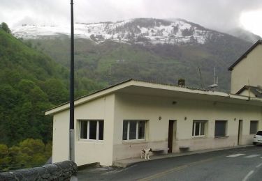
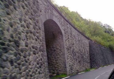
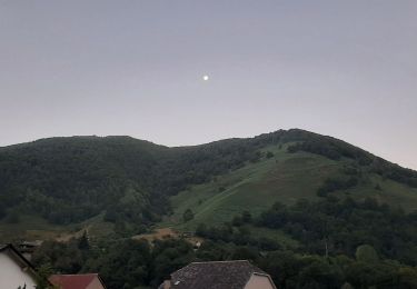
Randonnée Marche de 14,6 km à découvrir à Nouvelle-Aquitaine, Pyrénées-Atlantiques, Urdos. Cette randonnée est proposée par bedous.
Description
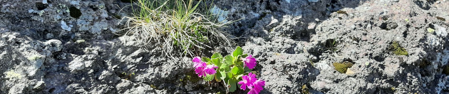
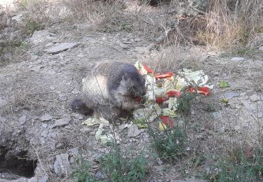
Rando depuis le Nord d'Urdos par un chemin avec des pentes assez raides mais des paysages magnifiques au refuge de Larry et au col avec vue sue le pic du midi d'Ossau J.P.) et sur le lac Gentau
Localisation
Pays :
France
Région :
Nouvelle-Aquitaine
Département/Province :
Pyrénées-Atlantiques
Commune :
Urdos
Localité :
Unknown
Départ:(Dec)
Départ:(UTM)
700770 ; 4748272 (30T) N.
Commentaires
Randonnées à proximité
![Randonnée Raquettes à neige Borce - Refuge et lac d’Arlet - Photo](https://media.geolcdn.com/t/375/260/a5cc868f-a627-4b9d-939f-bef0d8443aec.jpg&format=jpg&maxdim=2)
![Raquettes à neige Raquettes à neige](https://static1.geolcdn.com/sitytour/trail-icons/504.png)
Refuge et lac d’Arlet
Raquettes à neige
Moyen
(1)
Borce,
Nouvelle-Aquitaine,
Pyrénées-Atlantiques,
France
![](/images/other/stat-length.png)
16,9 km | 30 km-effort
6h 49min
![](https://static1.geolcdn.com/siteimages/upload/files/16400158638029165_repeat_loop_refresh_sync_direction_icon.png)
Oui
![Randonnée Marche Etsaut - CHEMIN DE LA MATURE - Photo](https://media.geolcdn.com/t/375/260/ext.jpg?maxdim=2&url=https%3A%2F%2Fservices.sitytrail.com%2FGeolivesWS%2FDownloadMedia.ashx%3FTrailID%3D330343%26Media%3Dfix__20140727111121.jpg)
![Marche Marche](https://static1.geolcdn.com/sitytour/trail-icons/101.png)
CHEMIN DE LA MATURE
Marche
Moyen
(2)
Etsaut,
Nouvelle-Aquitaine,
Pyrénées-Atlantiques,
France
![](/images/other/stat-length.png)
8,8 km | 18,6 km-effort
3h 25min
![](https://static1.geolcdn.com/siteimages/upload/files/16400158638029165_repeat_loop_refresh_sync_direction_icon.png)
Oui
![Randonnée Marche Etsaut - Chemin de la Mâture en vallée d'Aspe - Photo](https://media.geolcdn.com/t/375/260/ext.jpg?maxdim=2&url=https%3A%2F%2Fservices.sitytrail.com%2FGeolivesWS%2FDownloadMedia.ashx%3FTrailID%3D109346%26Media%3D3629_1.jpg)
![Marche Marche](https://static1.geolcdn.com/sitytour/trail-icons/101.png)
Chemin de la Mâture en vallée d'Aspe
Marche
Difficile
(1)
Etsaut,
Nouvelle-Aquitaine,
Pyrénées-Atlantiques,
France
![](/images/other/stat-length.png)
7,5 km | 16,8 km-effort
4h 0min
![](https://static1.geolcdn.com/siteimages/upload/files/16400158638029165_repeat_loop_refresh_sync_direction_icon.png)
Oui
![Randonnée A pied Urdos - Tour Urdos - Bérat asp66 - Photo](https://media.geolcdn.com/t/375/260/6386a7ee-b394-4eb6-89b9-f6e5520be03f.jpeg&format=jpg&maxdim=2)
![A pied A pied](https://static1.geolcdn.com/sitytour/trail-icons/100.png)
Tour Urdos - Bérat asp66
A pied
Facile
Urdos,
Nouvelle-Aquitaine,
Pyrénées-Atlantiques,
France
![](/images/other/stat-length.png)
4,4 km | 6,8 km-effort
1h 32min
![](https://static1.geolcdn.com/siteimages/upload/files/16400158638029165_repeat_loop_refresh_sync_direction_icon.png)
Oui
![Randonnée A pied Borce - Sentier de Borce à Belonce PNP - Photo](https://media.geolcdn.com/t/375/260/c9dd0836-6811-4332-bdc7-4bfac8c4af11.jpeg&format=jpg&maxdim=2)
![A pied A pied](https://static1.geolcdn.com/sitytour/trail-icons/100.png)
Sentier de Borce à Belonce PNP
A pied
Facile
Borce,
Nouvelle-Aquitaine,
Pyrénées-Atlantiques,
France
![](/images/other/stat-length.png)
6,4 km | 11,3 km-effort
2h 33min
![](https://static1.geolcdn.com/siteimages/upload/files/16400158638029165_repeat_loop_refresh_sync_direction_icon.png)
Non
![Randonnée A pied Urdos - Sentier d'Urdos au Refuge de Larry PNP - Photo](https://media.geolcdn.com/t/375/260/6386a7ee-b394-4eb6-89b9-f6e5520be03f.jpeg&format=jpg&maxdim=2)
![A pied A pied](https://static1.geolcdn.com/sitytour/trail-icons/100.png)
Sentier d'Urdos au Refuge de Larry PNP
A pied
Facile
Urdos,
Nouvelle-Aquitaine,
Pyrénées-Atlantiques,
France
![](/images/other/stat-length.png)
5,4 km | 14,9 km-effort
3h 23min
![](https://static1.geolcdn.com/siteimages/upload/files/16400158638029165_repeat_loop_refresh_sync_direction_icon.png)
Non
![Randonnée A pied Etsaut - Tour Mâture-Arras asp62 - Photo](https://media.geolcdn.com/t/375/260/f3760fa6-9e7d-47c2-8dc3-2c277e684cdb.jpeg&format=jpg&maxdim=2)
![A pied A pied](https://static1.geolcdn.com/sitytour/trail-icons/100.png)
Tour Mâture-Arras asp62
A pied
Facile
Etsaut,
Nouvelle-Aquitaine,
Pyrénées-Atlantiques,
France
![](/images/other/stat-length.png)
8,7 km | 17,9 km-effort
4h 4min
![](https://static1.geolcdn.com/siteimages/upload/files/16400158638029165_repeat_loop_refresh_sync_direction_icon.png)
Non
![Randonnée Marche Etsaut - Boucle Lescun 4J - E2 - Photo](https://media.geolcdn.com/t/375/260/ext.jpg?maxdim=2&url=https%3A%2F%2Fstatic1.geolcdn.com%2Fsiteimages%2Fupload%2Ffiles%2F1553511878bg_sport_marche.png)
![Marche Marche](https://static1.geolcdn.com/sitytour/trail-icons/101.png)
Boucle Lescun 4J - E2
Marche
Très facile
(1)
Etsaut,
Nouvelle-Aquitaine,
Pyrénées-Atlantiques,
France
![](/images/other/stat-length.png)
25 km | 49 km-effort
10h 10min
![](https://static1.geolcdn.com/siteimages/upload/files/16400158638029165_repeat_loop_refresh_sync_direction_icon.png)
Non
![Randonnée Marche Urdos - Borce - Sentier de la traverse - Photo](https://media.geolcdn.com/t/375/260/23d61935-9145-44ea-a032-65bf58f12017.jpg&format=jpg&maxdim=2)
![Marche Marche](https://static1.geolcdn.com/sitytour/trail-icons/101.png)
Borce - Sentier de la traverse
Marche
Difficile
Urdos,
Nouvelle-Aquitaine,
Pyrénées-Atlantiques,
France
![](/images/other/stat-length.png)
7,2 km | 15,1 km-effort
4h 0min
![](https://static1.geolcdn.com/siteimages/upload/files/16400158638029165_repeat_loop_refresh_sync_direction_icon.png)
Oui