![](/images/other/stat-length.png)
![Randonnée Marche Luc - Une partie du sentier de Stevenson - Photo](https://media.geolcdn.com/t/1900/400/bfb9d05e-ae3e-460a-ba5c-c5037b124f03.jpg&format=pjpeg&maxdim=2)
Une partie du sentier de Stevenson
ombrabella
Utilisateur
![Longueur](/images/other/stat-length.png)
Longueur
95 km
![Altitude max](https://static1.geolcdn.com/siteimages/upload/files/1508320355ic_sort_altitude_max_24dp.png)
Altitude max
1699 m
![Dénivelé positif](https://static1.geolcdn.com/siteimages/upload/files/1508320355ic_sort_den_pos_24dp.png)
Dénivelé positif
3050 m
![Km-Effort](/images/other/stat-length.png)
Km-Effort
137 km
![Altitude min](https://static1.geolcdn.com/siteimages/upload/files/1508320355ic_sort_altitude_min_24dp.png)
Altitude min
537 m
![Dénivelé négatif](https://static1.geolcdn.com/siteimages/upload/files/1508320355ic_sort_den_neg_24dp.png)
Dénivelé négatif
3478 m
![Boucle](https://static1.geolcdn.com/siteimages/upload/files/16400158638029165_repeat_loop_refresh_sync_direction_icon.png)
Boucle
Non
Date de création :
2021-06-02 07:45:04.0
Dernière modification :
2021-06-06 17:13:17.578
![Marche](https://static1.geolcdn.com/sitytour/trail-icons/101.png)
29h58
Difficulté : Moyen
![Scannez ce code QR pour ouvrir la randonnée dans l'application SityTrail](https://capi.geolives.com/qq0zvz2zws4bq2lad0pu/sitytour/trails/2816973/qr.png?size=200)
Application GPS de randonnée GRATUITE
À propos
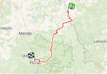
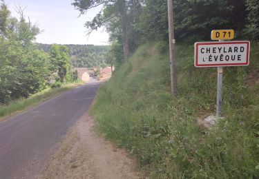
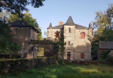
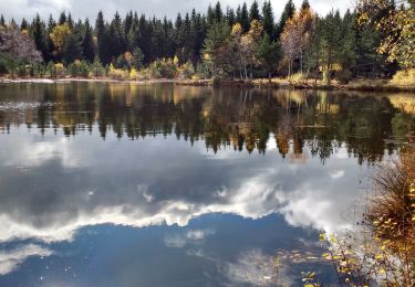
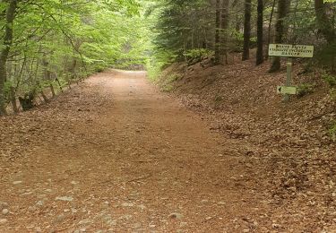
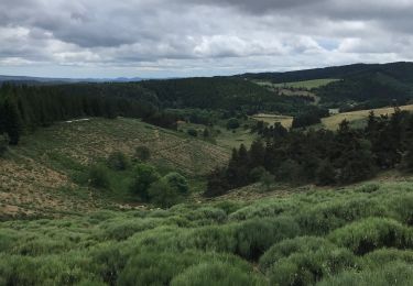
Randonnée Marche de 95 km à découvrir à Occitanie, Lozère, Luc. Cette randonnée est proposée par ombrabella.
Description
Départ de Luc, La Bastide St Laurent, Chasseradès,le Blemart, le Pont de Montvert, arrivée Florac
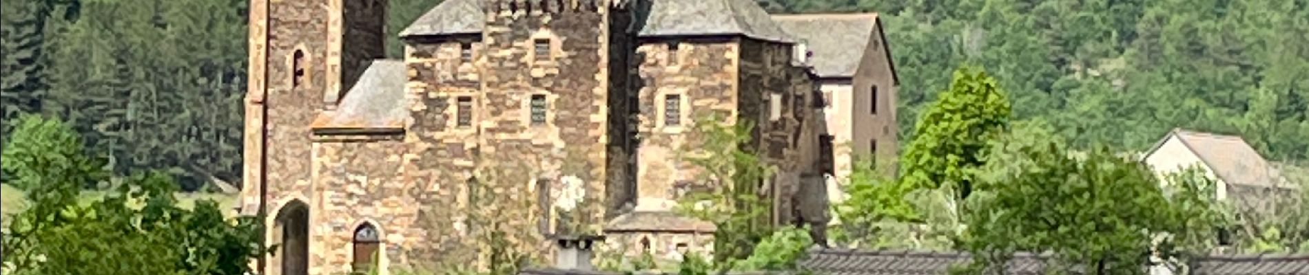
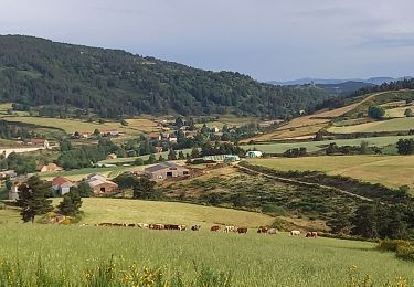
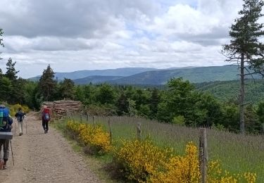
Localisation
Pays :
France
Région :
Occitanie
Département/Province :
Lozère
Commune :
Luc
Localité :
Unknown
Départ:(Dec)
Départ:(UTM)
570681 ; 4944896 (31T) N.
Commentaires
Randonnées à proximité
![Randonnée Marche Laveyrune - chemin de Stevenson étape 6 - Photo](https://media.geolcdn.com/t/375/260/03091446-e0a3-452d-a9a6-0e5da8b0e881.jpg&format=jpg&maxdim=2)
![Marche Marche](https://static1.geolcdn.com/sitytour/trail-icons/101.png)
chemin de Stevenson étape 6
Marche
Difficile
Laveyrune,
Auvergne-Rhône-Alpes,
Ardèche,
France
![](/images/other/stat-length.png)
25 km | 34 km-effort
6h 50min
![](https://static1.geolcdn.com/siteimages/upload/files/16400158638029165_repeat_loop_refresh_sync_direction_icon.png)
Non
![Randonnée Marche Luc - 5 étape Stevenson - Photo](https://media.geolcdn.com/t/375/260/bce1fbca-ee7b-470a-85b4-41c8101bc81d.jpg&format=jpg&maxdim=2)
![Marche Marche](https://static1.geolcdn.com/sitytour/trail-icons/101.png)
5 étape Stevenson
Marche
Très difficile
Luc,
Occitanie,
Lozère,
France
![](/images/other/stat-length.png)
29 km | 40 km-effort
8h 3min
![](https://static1.geolcdn.com/siteimages/upload/files/16400158638029165_repeat_loop_refresh_sync_direction_icon.png)
Non
![Randonnée Marche Saint-Flour-de-Mercoire - le chélard - Photo](https://media.geolcdn.com/t/375/260/95b8db69-3dce-47bc-9f31-4efaab872b01.jpg&format=jpg&maxdim=2)
![Marche Marche](https://static1.geolcdn.com/sitytour/trail-icons/101.png)
le chélard
Marche
Difficile
Saint-Flour-de-Mercoire,
Occitanie,
Lozère,
France
![](/images/other/stat-length.png)
11 km | 14,9 km-effort
3h 6min
![](https://static1.geolcdn.com/siteimages/upload/files/16400158638029165_repeat_loop_refresh_sync_direction_icon.png)
Non
![Randonnée Marche Laveyrune - Régordane 3 - Laveyrune-Albespeyre - Photo](https://media.geolcdn.com/t/375/260/759b5a3a-489f-4e3e-9330-e37bebde61d8.jpg&format=jpg&maxdim=2)
![Marche Marche](https://static1.geolcdn.com/sitytour/trail-icons/101.png)
Régordane 3 - Laveyrune-Albespeyre
Marche
Difficile
Laveyrune,
Auvergne-Rhône-Alpes,
Ardèche,
France
![](/images/other/stat-length.png)
23 km | 32 km-effort
7h 1min
![](https://static1.geolcdn.com/siteimages/upload/files/16400158638029165_repeat_loop_refresh_sync_direction_icon.png)
Non
![Randonnée Marche Luc - E5 Luc - La Bastide Puylaurent GR70 - Photo](https://media.geolcdn.com/t/375/260/4c2135f1-c322-41ad-ab46-9046fce45dc1.jpg&format=jpg&maxdim=2)
![Marche Marche](https://static1.geolcdn.com/sitytour/trail-icons/101.png)
E5 Luc - La Bastide Puylaurent GR70
Marche
Difficile
Luc,
Occitanie,
Lozère,
France
![](/images/other/stat-length.png)
21 km | 30 km-effort
6h 4min
![](https://static1.geolcdn.com/siteimages/upload/files/16400158638029165_repeat_loop_refresh_sync_direction_icon.png)
Non
![Randonnée Marche Saint-Étienne-de-Lugdarès - Labrot-Bertail-L'Auradou-Luc - Photo](https://media.geolcdn.com/t/375/260/67c66b77-ebb2-4d24-a21b-b39b56d5861f.jpg&format=jpg&maxdim=2)
![Marche Marche](https://static1.geolcdn.com/sitytour/trail-icons/101.png)
Labrot-Bertail-L'Auradou-Luc
Marche
Très difficile
Saint-Étienne-de-Lugdarès,
Auvergne-Rhône-Alpes,
Ardèche,
France
![](/images/other/stat-length.png)
15 km | 21 km-effort
4h 19min
![](https://static1.geolcdn.com/siteimages/upload/files/16400158638029165_repeat_loop_refresh_sync_direction_icon.png)
Oui
![Randonnée Marche Luc - 10-05-2023 E5 Luc - La Bastide Puylaurent - Photo](https://media.geolcdn.com/t/375/260/d54008fb-46e9-42ef-8c51-d54928e19ffd.jpg&format=jpg&maxdim=2)
![Marche Marche](https://static1.geolcdn.com/sitytour/trail-icons/101.png)
10-05-2023 E5 Luc - La Bastide Puylaurent
Marche
Difficile
Luc,
Occitanie,
Lozère,
France
![](/images/other/stat-length.png)
19,5 km | 27 km-effort
6h 8min
![](https://static1.geolcdn.com/siteimages/upload/files/16400158638029165_repeat_loop_refresh_sync_direction_icon.png)
Non
![Randonnée Marche Luc - Labeur une chasserades - Photo](https://media.geolcdn.com/t/375/260/90080d69-c0c0-4345-a160-00078b701bc0.jpg&format=jpg&maxdim=2)
![Marche Marche](https://static1.geolcdn.com/sitytour/trail-icons/101.png)
Labeur une chasserades
Marche
Difficile
Luc,
Occitanie,
Lozère,
France
![](/images/other/stat-length.png)
27 km | 37 km-effort
8h 16min
![](https://static1.geolcdn.com/siteimages/upload/files/16400158638029165_repeat_loop_refresh_sync_direction_icon.png)
Non
![Randonnée Marche Luc - étape 3 - Photo](https://media.geolcdn.com/t/375/260/49636e18-0a1f-4358-bd50-94a4f06690e4.jpg&format=jpg&maxdim=2)
![Marche Marche](https://static1.geolcdn.com/sitytour/trail-icons/101.png)