25 km | 31 km-effort
Saint Urcize à La Chaldette.
dominiq
Utilisateur
Longueur
19,2 km
Altitude max
1179 m
Dénivelé positif
330 m
Km-Effort
24 km
Altitude min
1006 m
Dénivelé négatif
440 m
Boucle
Non
Date de création :
2021-06-01 06:58:08.0
Dernière modification :
2021-06-01 13:22:42.246
5h16
Difficulté : Inconnu
Application GPS de randonnée GRATUITE
À propos
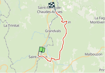
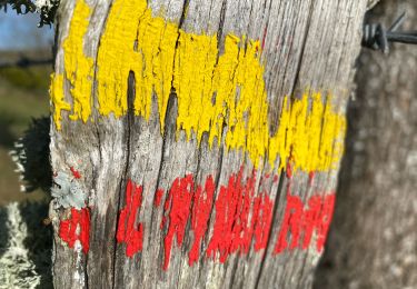
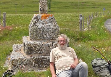
Randonnée Marche de 19,2 km à découvrir à Auvergne-Rhône-Alpes, Cantal, Saint-Urcize. Cette randonnée est proposée par dominiq.
Localisation
Pays :
France
Région :
Auvergne-Rhône-Alpes
Département/Province :
Cantal
Commune :
Saint-Urcize
Localité :
Unknown
Départ:(Dec)
Départ:(UTM)
500270 ; 4949342 (31T) N.
Commentaires
Randonnées à proximité
chemin de Saint-Jacques-de-Compostelle pour randonneurs avec animaux (chien, ...
A pied
Facile
Nasbinals,
Occitanie,
Lozère,
France
5,7 km | 7,3 km-effort
1h 38min
Non
St urcize
Marche
Facile
Saint-Urcize,
Auvergne-Rhône-Alpes,
Cantal,
France
16,4 km | 22 km-effort
5h 55min
Non
Au temps des fleurs et des genêts
Marche
Facile
Recoules-d'Aubrac,
Occitanie,
Lozère,
France
16,6 km | 21 km-effort
4h 24min
Oui
Nasbinals
Marche
Très facile
Nasbinals,
Occitanie,
Lozère,
France
5,8 km | 7,2 km-effort
2h 3min
Non
Nasbinal - Aubrac
sport
Très facile
(1)
Nasbinals,
Occitanie,
Lozère,
France
42 km | 50 km-effort
Inconnu
Non
Des estives et des croix
Marche
Facile
Saint-Urcize,
Auvergne-Rhône-Alpes,
Cantal,
France
19,8 km | 25 km-effort
5h 19min
Oui
Recoules Bouchabes
Marche
Très facile
Recoules-d'Aubrac,
Occitanie,
Lozère,
France
14,4 km | 18,6 km-effort
3h 38min
Oui
Nasbinals col d’Aubrac Montorzier
Marche
Moyen
Nasbinals,
Occitanie,
Lozère,
France
23 km | 28 km-effort
5h 51min
Oui