24 km | 34 km-effort
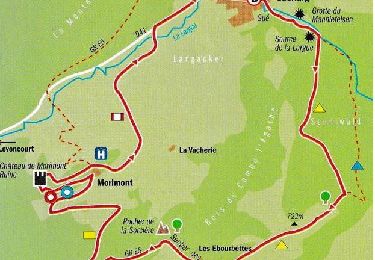
oberlag- château de morimont
jcguew
Utilisateur
Longueur
9,9 km
Altitude max
722 m
Dénivelé positif
284 m
Km-Effort
13,7 km
Altitude min
491 m
Dénivelé négatif
291 m
Boucle
Oui
Date de création :
2021-05-20 09:25:38.098
Dernière modification :
2021-05-20 14:42:34.093
3h49
Difficulté : Facile
Application GPS de randonnée GRATUITE
À propos
Randonnée Marche de 9,9 km à découvrir à Grand Est, Haut-Rhin, Oberlarg. Cette randonnée est proposée par jcguew.
Localisation
Pays :
France
Région :
Grand Est
Département/Province :
Haut-Rhin
Commune :
Oberlarg
Localité :
Unknown
Départ:(Dec)
Départ:(UTM)
366943 ; 5257548 (32T) N.
Commentaires
Randonnées à proximité
Sortie les Copains d'abord.. 24/03/2022
Marche
Moyen
Levoncourt,
Grand Est,
Haut-Rhin,
France
4h 57min
Oui
Lucelle Douane - Pleigne
A pied
Facile
Pleigne,
Jura,
District de Delémont,
Suisse
5,3 km | 8 km-effort
1h 48min
Non
Oberlarg - sa grotte - la ferme des Ebourbettes - le château de Morimont
Marche
Moyen
Oberlarg,
Grand Est,
Haut-Rhin,
France
9,5 km | 13,3 km-effort
3h 22min
Oui
Château de Morimont avec Patrice
Marche
Moyen
Oberlarg,
Grand Est,
Haut-Rhin,
France
6,2 km | 8,1 km-effort
2h 10min
Oui
68 Oberlarg - Château de Morimont
Marche
Difficile
Oberlarg,
Grand Est,
Haut-Rhin,
France
9 km | 12,8 km-effort
2h 46min
Oui
Rando CLAS du 20/06/2024 par PBo
A pied
Moyen
Bendorf,
Grand Est,
Haut-Rhin,
France
18,8 km | 26 km-effort
5h 56min
Oui
Rando Bendorf 30/05/2024
Marche
Très difficile
Bendorf,
Grand Est,
Haut-Rhin,
France
19,7 km | 27 km-effort
4h 15min
Oui
Winkel-Petit Kohlberg-Verreries variante
Marche
Très facile
Winkel,
Grand Est,
Haut-Rhin,
France
6,8 km | 8,7 km-effort
1h 58min
Oui
Winkel-Petit Kohlberg-Allée des Hêtres
Marche
Très facile
Winkel,
Grand Est,
Haut-Rhin,
France
6,2 km | 8,2 km-effort
1h 51min
Oui