![](/images/other/stat-length.png)
![Randonnée Marche Estérençuby - Col d'Orgambidé - Urkulu en boucle - Photo](https://media.geolcdn.com/t/1900/400/ext.pjpeg?maxdim=2&url=https%3A%2F%2Fstatic1.geolcdn.com%2Fsiteimages%2Fupload%2Ffiles%2F1553511878bg_sport_marche.png)
Col d'Orgambidé - Urkulu en boucle
pacha56
Utilisateur
![Longueur](/images/other/stat-length.png)
Longueur
9,7 km
![Altitude max](https://static1.geolcdn.com/siteimages/upload/files/1508320355ic_sort_altitude_max_24dp.png)
Altitude max
1413 m
![Dénivelé positif](https://static1.geolcdn.com/siteimages/upload/files/1508320355ic_sort_den_pos_24dp.png)
Dénivelé positif
507 m
![Km-Effort](/images/other/stat-length.png)
Km-Effort
16,4 km
![Altitude min](https://static1.geolcdn.com/siteimages/upload/files/1508320355ic_sort_altitude_min_24dp.png)
Altitude min
977 m
![Dénivelé négatif](https://static1.geolcdn.com/siteimages/upload/files/1508320355ic_sort_den_neg_24dp.png)
Dénivelé négatif
507 m
![Boucle](https://static1.geolcdn.com/siteimages/upload/files/16400158638029165_repeat_loop_refresh_sync_direction_icon.png)
Boucle
Oui
Date de création :
2021-05-18 08:43:53.72
Dernière modification :
2021-05-18 16:15:38.869
![Marche](https://static1.geolcdn.com/sitytour/trail-icons/101.png)
7h21
Difficulté : Moyen
![Scannez ce code QR pour ouvrir la randonnée dans l'application SityTrail](https://capi.geolives.com/qq0zvz2zws4bq2lad0pu/sitytour/trails/2792018/qr.png?size=200)
Application GPS de randonnée GRATUITE
À propos
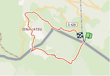
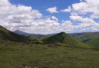
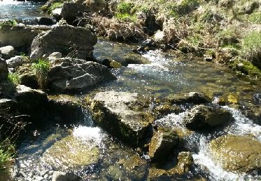
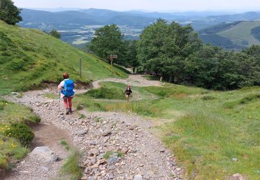
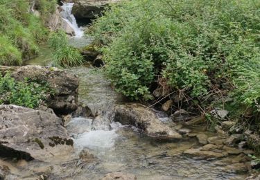
Randonnée Marche de 9,7 km à découvrir à Nouvelle-Aquitaine, Pyrénées-Atlantiques, Estérençuby. Cette randonnée est proposée par pacha56.
Description
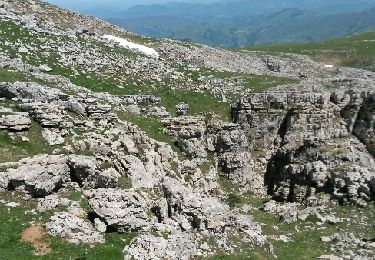
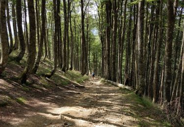
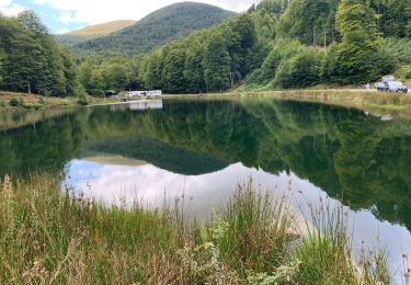
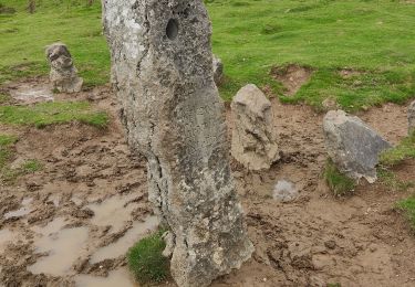
Belle balade sur un relief calcaire, avec des troupeaux de chevaux et moutons et rdv avec l'histoire romaine en haut
Localisation
Pays :
France
Région :
Nouvelle-Aquitaine
Département/Province :
Pyrénées-Atlantiques
Commune :
Estérençuby
Localité :
Unknown
Départ:(Dec)
Départ:(UTM)
645679 ; 4767869 (30T) N.
Commentaires
Randonnées à proximité
![Randonnée Marche Estérençuby - URCULU 2015 05 12 effectuée - Photo](https://media.geolcdn.com/t/375/260/ext.jpg?maxdim=2&url=https%3A%2F%2Fservices.sitytrail.com%2FGeolivesWS%2FDownloadMedia.ashx%3FTrailID%3D419942%26Media%3Dfix__20150512133806.jpg)
![Marche Marche](https://static1.geolcdn.com/sitytour/trail-icons/101.png)
URCULU 2015 05 12 effectuée
Marche
Moyen
(2)
Estérençuby,
Nouvelle-Aquitaine,
Pyrénées-Atlantiques,
France
![](/images/other/stat-length.png)
12,3 km | 19,6 km-effort
3h 46min
![](https://static1.geolcdn.com/siteimages/upload/files/16400158638029165_repeat_loop_refresh_sync_direction_icon.png)
Oui
![Randonnée Marche Estérençuby - GROTTE D'HARPEA - Photo](https://media.geolcdn.com/t/375/260/ext.jpg?maxdim=2&url=https%3A%2F%2Fstatic1.geolcdn.com%2Fsiteimages%2Fupload%2Ffiles%2F1553511878bg_sport_marche.png)
![Marche Marche](https://static1.geolcdn.com/sitytour/trail-icons/101.png)
GROTTE D'HARPEA
Marche
Moyen
(1)
Estérençuby,
Nouvelle-Aquitaine,
Pyrénées-Atlantiques,
France
![](/images/other/stat-length.png)
12,1 km | 23 km-effort
4h 49min
![](https://static1.geolcdn.com/siteimages/upload/files/16400158638029165_repeat_loop_refresh_sync_direction_icon.png)
Oui
![Randonnée Marche Saint-Michel - compostelle - camino Frances J2 : de Orisson à Espinal - Photo](https://media.geolcdn.com/t/375/260/20a6e720-4338-4926-9405-8088c87e561f.jpg&format=jpg&maxdim=2)
![Marche Marche](https://static1.geolcdn.com/sitytour/trail-icons/101.png)
compostelle - camino Frances J2 : de Orisson à Espinal
Marche
Moyen
Saint-Michel,
Nouvelle-Aquitaine,
Pyrénées-Atlantiques,
France
![](/images/other/stat-length.png)
20 km | 28 km-effort
7h 30min
![](https://static1.geolcdn.com/siteimages/upload/files/16400158638029165_repeat_loop_refresh_sync_direction_icon.png)
Non
![Randonnée Marche Estérençuby - GR 10 7ème étape : gîte de Kaskoleta - com d’Okabe - chalet Iraty - Photo](https://media.geolcdn.com/t/375/260/501d613f-cef8-4e6f-a900-e37dd44e3d86.jpg&format=jpg&maxdim=2)
![Marche Marche](https://static1.geolcdn.com/sitytour/trail-icons/101.png)
GR 10 7ème étape : gîte de Kaskoleta - com d’Okabe - chalet Iraty
Marche
Difficile
Estérençuby,
Nouvelle-Aquitaine,
Pyrénées-Atlantiques,
France
![](/images/other/stat-length.png)
23 km | 41 km-effort
6h 27min
![](https://static1.geolcdn.com/siteimages/upload/files/16400158638029165_repeat_loop_refresh_sync_direction_icon.png)
Non
![Randonnée Marche Estérençuby - Harpéa - Photo](https://media.geolcdn.com/t/375/260/ext.jpg?maxdim=2&url=https%3A%2F%2Fservices.sitytrail.com%2FGeolivesWS%2FDownloadMedia.ashx%3FTrailID%3D748133%26Media%3Dfix__20170507143514.jpg)
![Marche Marche](https://static1.geolcdn.com/sitytour/trail-icons/101.png)
Harpéa
Marche
Moyen
Estérençuby,
Nouvelle-Aquitaine,
Pyrénées-Atlantiques,
France
![](/images/other/stat-length.png)
15,9 km | 29 km-effort
5h 52min
![](https://static1.geolcdn.com/siteimages/upload/files/16400158638029165_repeat_loop_refresh_sync_direction_icon.png)
Oui
![Randonnée Marche Estérençuby - source de la Nive et grotte Harpéa. - Photo](https://media.geolcdn.com/t/375/260/ext.jpg?maxdim=2&url=https%3A%2F%2Fservices.sitytrail.com%2FGeolivesWS%2FDownloadMedia.ashx%3FTrailID%3D405148%26Media%3Dfix__20150407120019.jpg)
![Marche Marche](https://static1.geolcdn.com/sitytour/trail-icons/101.png)
source de la Nive et grotte Harpéa.
Marche
Très difficile
Estérençuby,
Nouvelle-Aquitaine,
Pyrénées-Atlantiques,
France
![](/images/other/stat-length.png)
12 km | 21 km-effort
4h 43min
![](https://static1.geolcdn.com/siteimages/upload/files/16400158638029165_repeat_loop_refresh_sync_direction_icon.png)
Oui
![Randonnée Marche Orbaizeta - Pyrénées 3 - Photo](https://media.geolcdn.com/t/375/260/f978f373-9e0b-4d56-a812-c331cfe0b464.jpg&format=jpg&maxdim=2)
![Marche Marche](https://static1.geolcdn.com/sitytour/trail-icons/101.png)
Pyrénées 3
Marche
Difficile
Orbaizeta,
Navarre,
Inconnu,
Espagne
![](/images/other/stat-length.png)
10,2 km | 16,8 km-effort
4h 58min
![](https://static1.geolcdn.com/siteimages/upload/files/16400158638029165_repeat_loop_refresh_sync_direction_icon.png)
Oui
![Randonnée Marche Arnéguy - 2023 01 ronceveaux - Photo](https://media.geolcdn.com/t/375/260/2d8bb93b-63a0-42e6-9a00-980942b8ccae.jpg&format=jpg&maxdim=2)
![Marche Marche](https://static1.geolcdn.com/sitytour/trail-icons/101.png)
2023 01 ronceveaux
Marche
Difficile
Arnéguy,
Nouvelle-Aquitaine,
Pyrénées-Atlantiques,
France
![](/images/other/stat-length.png)
12,6 km | 18,6 km-effort
4h 21min
![](https://static1.geolcdn.com/siteimages/upload/files/16400158638029165_repeat_loop_refresh_sync_direction_icon.png)
Non
![Randonnée Marche Estérençuby - Rando Nive Hapea - Photo](https://media.geolcdn.com/t/375/260/20f3b9f4-e198-43bc-81d9-dbe55a5f2edb.jpg&format=jpg&maxdim=2)
![Marche Marche](https://static1.geolcdn.com/sitytour/trail-icons/101.png)
Rando Nive Hapea
Marche
Moyen
Estérençuby,
Nouvelle-Aquitaine,
Pyrénées-Atlantiques,
France
![](/images/other/stat-length.png)
12,2 km | 21 km-effort
3h 38min
![](https://static1.geolcdn.com/siteimages/upload/files/16400158638029165_repeat_loop_refresh_sync_direction_icon.png)
Oui