![](/images/other/stat-length.png)
![Randonnée Marche Beaucroissant - Beaucroissant-Galaboutemps - Photo](https://media.geolcdn.com/t/1900/400/ext.pjpeg?maxdim=2&url=https%3A%2F%2Fstatic1.geolcdn.com%2Fsiteimages%2Fupload%2Ffiles%2F1553511878bg_sport_marche.png)
Beaucroissant-Galaboutemps
raymondfn
Utilisateur
![Longueur](/images/other/stat-length.png)
Longueur
7,2 km
![Altitude max](https://static1.geolcdn.com/siteimages/upload/files/1508320355ic_sort_altitude_max_24dp.png)
Altitude max
445 m
![Dénivelé positif](https://static1.geolcdn.com/siteimages/upload/files/1508320355ic_sort_den_pos_24dp.png)
Dénivelé positif
35 m
![Km-Effort](/images/other/stat-length.png)
Km-Effort
7,6 km
![Altitude min](https://static1.geolcdn.com/siteimages/upload/files/1508320355ic_sort_altitude_min_24dp.png)
Altitude min
428 m
![Dénivelé négatif](https://static1.geolcdn.com/siteimages/upload/files/1508320355ic_sort_den_neg_24dp.png)
Dénivelé négatif
35 m
![Boucle](https://static1.geolcdn.com/siteimages/upload/files/16400158638029165_repeat_loop_refresh_sync_direction_icon.png)
Boucle
Oui
Date de création :
2021-05-13 08:51:24.303
Dernière modification :
2021-05-16 16:02:07.838
![Marche](https://static1.geolcdn.com/sitytour/trail-icons/101.png)
1h33
Difficulté : Moyen
![Scannez ce code QR pour ouvrir la randonnée dans l'application SityTrail](https://capi.geolives.com/qq0zvz2zws4bq2lad0pu/sitytour/trails/2784250/qr.png?size=200)
Application GPS de randonnée GRATUITE
À propos
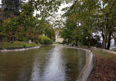
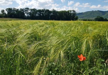
Randonnée Marche de 7,2 km à découvrir à Auvergne-Rhône-Alpes, Isère, Beaucroissant. Cette randonnée est proposée par raymondfn.
Description
Parking : venant d'Izeaux quitter la déviation de Beaucroissant pour aller vers le village, puis tourner sur la 3ième rue à droite, et se garer sur la gauche de cette rue.
Localisation
Pays :
France
Région :
Auvergne-Rhône-Alpes
Département/Province :
Isère
Commune :
Beaucroissant
Localité :
Unknown
Départ:(Dec)
Départ:(UTM)
693254 ; 5024008 (31T) N.
Commentaires
Randonnées à proximité
![Randonnée Marche Tullins - Clos des Chartreux Parmenie 2 - Photo](https://media.geolcdn.com/t/375/260/3e5993b5-a74b-4c7a-a6d9-a420eaf80d04.jpg&format=jpg&maxdim=2)
![Marche Marche](https://static1.geolcdn.com/sitytour/trail-icons/101.png)
Clos des Chartreux Parmenie 2
Marche
Moyen
Tullins,
Auvergne-Rhône-Alpes,
Isère,
France
![](/images/other/stat-length.png)
14,1 km | 23 km-effort
5h 29min
![](https://static1.geolcdn.com/siteimages/upload/files/16400158638029165_repeat_loop_refresh_sync_direction_icon.png)
Oui
![Randonnée Marche Saint-Blaise-du-Buis - Le tour des Voyes - Photo](https://media.geolcdn.com/t/375/260/52e090e6-02ac-4fdb-b326-05575f2c58a3.jpg&format=jpg&maxdim=2)
![Marche Marche](https://static1.geolcdn.com/sitytour/trail-icons/101.png)
Le tour des Voyes
Marche
Facile
Saint-Blaise-du-Buis,
Auvergne-Rhône-Alpes,
Isère,
France
![](/images/other/stat-length.png)
8,5 km | 10,6 km-effort
2h 24min
![](https://static1.geolcdn.com/siteimages/upload/files/16400158638029165_repeat_loop_refresh_sync_direction_icon.png)
Oui
![Randonnée Course à pied Beaucroissant - Sacré Trail des Collines - Col de Parménie - Photo](https://media.geolcdn.com/t/375/260/ext.jpg?maxdim=2&url=https%3A%2F%2Fservices.sitytrail.com%2FGeolivesWS%2FDownloadMedia.ashx%3FTrailID%3D118853%26Media%3D13068_2.jpg)
![Course à pied Course à pied](https://static1.geolcdn.com/sitytour/trail-icons/103.png)
Sacré Trail des Collines - Col de Parménie
Course à pied
Difficile
Beaucroissant,
Auvergne-Rhône-Alpes,
Isère,
France
![](/images/other/stat-length.png)
35 km | 57 km-effort
4h 0min
![](https://static1.geolcdn.com/siteimages/upload/files/16400158638029165_repeat_loop_refresh_sync_direction_icon.png)
Oui
![Randonnée Marche Beaucroissant - RR-Beaucroissant-LesEtangs - Photo](https://media.geolcdn.com/t/375/260/ext.jpg?maxdim=2&url=https%3A%2F%2Fstatic1.geolcdn.com%2Fsiteimages%2Fupload%2Ffiles%2F1553511878bg_sport_marche.png)
![Marche Marche](https://static1.geolcdn.com/sitytour/trail-icons/101.png)
RR-Beaucroissant-LesEtangs
Marche
Facile
Beaucroissant,
Auvergne-Rhône-Alpes,
Isère,
France
![](/images/other/stat-length.png)
4,2 km | 5,1 km-effort
1h 9min
![](https://static1.geolcdn.com/siteimages/upload/files/16400158638029165_repeat_loop_refresh_sync_direction_icon.png)
Oui
![Randonnée sport Tullins - Plaine de tullins - Photo](https://media.geolcdn.com/t/375/260/ext.jpg?maxdim=2&url=https%3A%2F%2Fsecurestorage.geolives.com%2Fsitytour%2Ftrail-bg%2Fdefault.jpg)
Plaine de tullins
sport
Très facile
Tullins,
Auvergne-Rhône-Alpes,
Isère,
France
![](/images/other/stat-length.png)
32 km | 34 km-effort
Inconnu
![](https://static1.geolcdn.com/siteimages/upload/files/16400158638029165_repeat_loop_refresh_sync_direction_icon.png)
Oui
![Randonnée Marche Beaucroissant - RD-Beaucroissant-Les étangs - Photo](https://media.geolcdn.com/t/375/260/ext.jpg?maxdim=2&url=https%3A%2F%2Fstatic1.geolcdn.com%2Fsiteimages%2Fupload%2Ffiles%2F1553511878bg_sport_marche.png)
![Marche Marche](https://static1.geolcdn.com/sitytour/trail-icons/101.png)
RD-Beaucroissant-Les étangs
Marche
Moyen
Beaucroissant,
Auvergne-Rhône-Alpes,
Isère,
France
![](/images/other/stat-length.png)
7,8 km | 9,1 km-effort
2h 3min
![](https://static1.geolcdn.com/siteimages/upload/files/16400158638029165_repeat_loop_refresh_sync_direction_icon.png)
Oui
![Randonnée Marche Rives - Anniv Do - Photo](https://media.geolcdn.com/t/375/260/ext.jpg?maxdim=2&url=https%3A%2F%2Fstatic1.geolcdn.com%2Fsiteimages%2Fupload%2Ffiles%2F1553511878bg_sport_marche.png)
![Marche Marche](https://static1.geolcdn.com/sitytour/trail-icons/101.png)
Anniv Do
Marche
Moyen
Rives,
Auvergne-Rhône-Alpes,
Isère,
France
![](/images/other/stat-length.png)
7,8 km | 9,8 km-effort
2h 12min
![](https://static1.geolcdn.com/siteimages/upload/files/16400158638029165_repeat_loop_refresh_sync_direction_icon.png)
Oui
![Randonnée Marche Beaucroissant - Beaucroissant - Photo](https://media.geolcdn.com/t/375/260/ext.jpg?maxdim=2&url=https%3A%2F%2Fstatic1.geolcdn.com%2Fsiteimages%2Fupload%2Ffiles%2F1553511878bg_sport_marche.png)
![Marche Marche](https://static1.geolcdn.com/sitytour/trail-icons/101.png)
Beaucroissant
Marche
Moyen
Beaucroissant,
Auvergne-Rhône-Alpes,
Isère,
France
![](/images/other/stat-length.png)
7,5 km | 8 km-effort
3h 4min
![](https://static1.geolcdn.com/siteimages/upload/files/16400158638029165_repeat_loop_refresh_sync_direction_icon.png)
Oui
![Randonnée Marche Izeaux - Izeaux-le tour des carrières - Photo](https://media.geolcdn.com/t/375/260/ext.jpg?maxdim=2&url=https%3A%2F%2Fstatic1.geolcdn.com%2Fsiteimages%2Fupload%2Ffiles%2F1553511878bg_sport_marche.png)
![Marche Marche](https://static1.geolcdn.com/sitytour/trail-icons/101.png)
Izeaux-le tour des carrières
Marche
Facile
Izeaux,
Auvergne-Rhône-Alpes,
Isère,
France
![](/images/other/stat-length.png)
5,4 km | 5,9 km-effort
1h 20min
![](https://static1.geolcdn.com/siteimages/upload/files/16400158638029165_repeat_loop_refresh_sync_direction_icon.png)
Oui