![](/images/other/stat-length.png)
![Randonnée Course à pied Colmar - Boucle Dachsbulh Colmar Course - Photo](https://media.geolcdn.com/t/1900/400/ext.pjpeg?maxdim=2&url=https%3A%2F%2Fmedia.geolcdn.com%2Ff%2F6aa33e0b-f76d-4fe7-bcd9-22d6766b2e29.jpg)
Boucle Dachsbulh Colmar Course
zazie
Utilisateur
![Longueur](/images/other/stat-length.png)
Longueur
11 km
![Altitude max](https://static1.geolcdn.com/siteimages/upload/files/1508320355ic_sort_altitude_max_24dp.png)
Altitude max
201 m
![Dénivelé positif](https://static1.geolcdn.com/siteimages/upload/files/1508320355ic_sort_den_pos_24dp.png)
Dénivelé positif
87 m
![Km-Effort](/images/other/stat-length.png)
Km-Effort
12,1 km
![Altitude min](https://static1.geolcdn.com/siteimages/upload/files/1508320355ic_sort_altitude_min_24dp.png)
Altitude min
183 m
![Dénivelé négatif](https://static1.geolcdn.com/siteimages/upload/files/1508320355ic_sort_den_neg_24dp.png)
Dénivelé négatif
90 m
![Boucle](https://static1.geolcdn.com/siteimages/upload/files/16400158638029165_repeat_loop_refresh_sync_direction_icon.png)
Boucle
Oui
Date de création :
2021-05-02 07:17:38.977
Dernière modification :
2021-05-02 08:29:01.235
![Course à pied](https://static1.geolcdn.com/sitytour/trail-icons/103.png)
1h01
Difficulté : Très facile
![Scannez ce code QR pour ouvrir la randonnée dans l'application SityTrail](https://capi.geolives.com/qq0zvz2zws4bq2lad0pu/sitytour/trails/2769705/qr.png?size=200)
Application GPS de randonnée GRATUITE
À propos
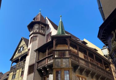
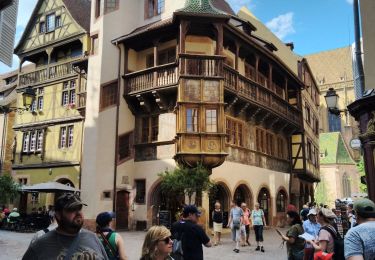
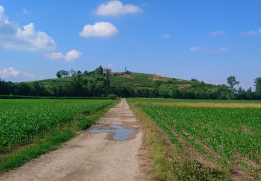
Randonnée Course à pied de 11 km à découvrir à Grand Est, Haut-Rhin, Colmar. Cette randonnée est proposée par zazie.
Description
Circuit pour course, traversée de routes et le long de l'autoroute, donc avec des 🎧, c'est supportable.
Parcours varié en sous nous lignes droites petites pentes.
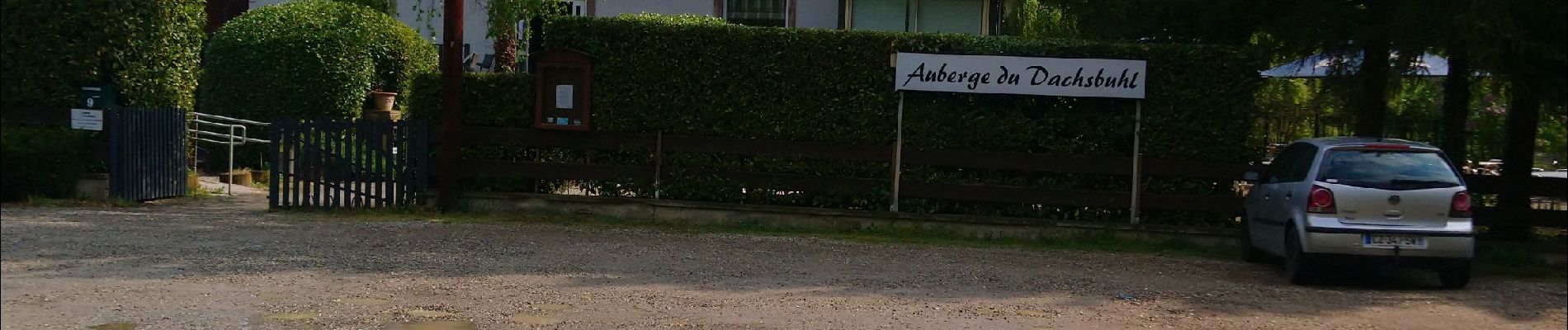
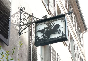
Ne pas hésiter à réserver à l'auberge, cuisine très bonne et terrasse agréable.
Localisation
Pays :
France
Région :
Grand Est
Département/Province :
Haut-Rhin
Commune :
Colmar
Localité :
Unknown
Départ:(Dec)
Départ:(UTM)
379299 ; 5324183 (32U) N.
Commentaires
Randonnées à proximité
![Randonnée Course à pied Colmar - Covid-19 - A la recherche du cercle parfait - Photo](https://media.geolcdn.com/t/375/260/ext.jpg?maxdim=2&url=https%3A%2F%2Fstatic1.geolcdn.com%2Fsiteimages%2Fupload%2Ffiles%2F1524743154running.jpg)
![Course à pied Course à pied](https://static1.geolcdn.com/sitytour/trail-icons/103.png)
Covid-19 - A la recherche du cercle parfait
Course à pied
Très facile
(1)
Colmar,
Grand Est,
Haut-Rhin,
France
![](/images/other/stat-length.png)
11,2 km | 11,9 km-effort
1h 0min
![](https://static1.geolcdn.com/siteimages/upload/files/16400158638029165_repeat_loop_refresh_sync_direction_icon.png)
Oui
![Randonnée Marche Colmar - grand tour de Colmar - Photo](https://media.geolcdn.com/t/375/260/ext.jpg?maxdim=2&url=https%3A%2F%2Fstatic1.geolcdn.com%2Fsiteimages%2Fupload%2Ffiles%2F1553511878bg_sport_marche.png)
![Marche Marche](https://static1.geolcdn.com/sitytour/trail-icons/101.png)
grand tour de Colmar
Marche
Très facile
(1)
Colmar,
Grand Est,
Haut-Rhin,
France
![](/images/other/stat-length.png)
4,7 km | 5,1 km-effort
1h 22min
![](https://static1.geolcdn.com/siteimages/upload/files/16400158638029165_repeat_loop_refresh_sync_direction_icon.png)
Oui
![Randonnée Marche Colmar - Colmar petite Venise - Photo](https://media.geolcdn.com/t/375/260/ext.jpg?maxdim=2&url=https%3A%2F%2Fmedia.geolcdn.com%2Ff%2Fcb1a55ed-d7ca-476a-8a88-d48c10da04cb.jpg)
![Marche Marche](https://static1.geolcdn.com/sitytour/trail-icons/101.png)
Colmar petite Venise
Marche
Colmar,
Grand Est,
Haut-Rhin,
France
![](/images/other/stat-length.png)
9,3 km | 10,1 km-effort
3h 16min
![](https://static1.geolcdn.com/siteimages/upload/files/16400158638029165_repeat_loop_refresh_sync_direction_icon.png)
Oui
![Randonnée Marche Colmar - balade découverte de Colmar - Photo](https://media.geolcdn.com/t/375/260/ext.jpg?maxdim=2&url=https%3A%2F%2Fmedia.geolcdn.com%2Ff%2Fa090b411-e5c3-4f8a-96a5-5454a29ca881.jpg)
![Marche Marche](https://static1.geolcdn.com/sitytour/trail-icons/101.png)
balade découverte de Colmar
Marche
Très facile
Colmar,
Grand Est,
Haut-Rhin,
France
![](/images/other/stat-length.png)
6,4 km | 7 km-effort
2h 50min
![](https://static1.geolcdn.com/siteimages/upload/files/16400158638029165_repeat_loop_refresh_sync_direction_icon.png)
Oui
![Randonnée V.T.T. Andolsheim - VTT 15/11/22 effectuée - Photo](https://media.geolcdn.com/t/375/260/ext.jpg?maxdim=2&url=https%3A%2F%2Fstatic1.geolcdn.com%2Fsiteimages%2Fupload%2Ffiles%2F1524743154velo.jpg)
![V.T.T. V.T.T.](https://static1.geolcdn.com/sitytour/trail-icons/202.png)
VTT 15/11/22 effectuée
V.T.T.
Facile
(1)
Andolsheim,
Grand Est,
Haut-Rhin,
France
![](/images/other/stat-length.png)
11,6 km | 12,5 km-effort
1h 26min
![](https://static1.geolcdn.com/siteimages/upload/files/16400158638029165_repeat_loop_refresh_sync_direction_icon.png)
Non
![Randonnée Marche Colmar - Sur un parcours d'une course d'orientation - Photo](https://media.geolcdn.com/t/375/260/ext.jpg?maxdim=2&url=https%3A%2F%2Fmedia.geolcdn.com%2Ff%2Fc8a73b1e-1924-4d74-bfc8-611dd53e5910.jpg)
![Marche Marche](https://static1.geolcdn.com/sitytour/trail-icons/101.png)
Sur un parcours d'une course d'orientation
Marche
Très facile
Colmar,
Grand Est,
Haut-Rhin,
France
![](/images/other/stat-length.png)
4,6 km | 5 km-effort
51min
![](https://static1.geolcdn.com/siteimages/upload/files/16400158638029165_repeat_loop_refresh_sync_direction_icon.png)
Non
![Randonnée V.T.C. Colmar - Vélo randonnée Colmar Guebwiller - Photo](https://media.geolcdn.com/t/375/260/ext.jpg?maxdim=2&url=https%3A%2F%2Fmedia.geolcdn.com%2Ff%2F6cf00bf4-257c-4f82-9b53-86096a3e95e9.jpg)
![V.T.C. V.T.C.](https://static1.geolcdn.com/sitytour/trail-icons/203.png)
Vélo randonnée Colmar Guebwiller
V.T.C.
Facile
Colmar,
Grand Est,
Haut-Rhin,
France
![](/images/other/stat-length.png)
59 km | 64 km-effort
3h 29min
![](https://static1.geolcdn.com/siteimages/upload/files/16400158638029165_repeat_loop_refresh_sync_direction_icon.png)
Oui
![Randonnée A pied Colmar - Colmar centre Enseignes - Photo](https://media.geolcdn.com/t/375/260/ext.jpg?maxdim=2&url=https%3A%2F%2Fmedia.geolcdn.com%2Ff%2F0d055925-366a-4988-8b7d-8363ed26e27b.JPG)
![A pied A pied](https://static1.geolcdn.com/sitytour/trail-icons/100.png)
Colmar centre Enseignes
A pied
Facile
Colmar,
Grand Est,
Haut-Rhin,
France
![](/images/other/stat-length.png)
4,8 km | 5,2 km-effort
Inconnu
![](https://static1.geolcdn.com/siteimages/upload/files/16400158638029165_repeat_loop_refresh_sync_direction_icon.png)
Oui
![Randonnée Marche Colmar - Willer sur Thur - Grand Ballon- Willer sur Thur - Photo](https://media.geolcdn.com/t/375/260/ext.jpg?maxdim=2&url=https%3A%2F%2Fmedia.geolcdn.com%2Ff%2Fc1b49f34-58de-40fa-a641-c3caa279b53a.jpg)
![Marche Marche](https://static1.geolcdn.com/sitytour/trail-icons/101.png)
Willer sur Thur - Grand Ballon- Willer sur Thur
Marche
Difficile
Colmar,
Grand Est,
Haut-Rhin,
France
![](/images/other/stat-length.png)
51 km | 0 m-effort
5h 34min
![](https://static1.geolcdn.com/siteimages/upload/files/16400158638029165_repeat_loop_refresh_sync_direction_icon.png)
Non