Randonnée Marche Plouha - Pointe de la Tour (SUD) - Photo

Pointe de la Tour (SUD)

 neitag61
neitag61

Utilisateur

© OpenStreetMap contributors
Longueur
Longueur
19,7 km
Altitude max
Altitude max
105 m
Dénivelé positif
Dénivelé positif
420 m
Km-Effort
Km-Effort  
25 km
Altitude min
Altitude min
4 m
Dénivelé négatif
Dénivelé négatif
422 m
Boucle
Boucle
Oui
Date de création :
2021-04-30 15:13:52.458
Dernière modification :
2021-05-17 15:15:15.091

(0 Avis)

Marche
Marche
5h00
Difficulté : Difficile

Scannez ce code QR pour ouvrir la randonnée dans l'application SityTrail

Application GPS de randonnée GRATUITE

Logo SityTrail SityTrail

IGN / Instituts géographiques

Télécharger SityTrail sur l'App Store Télécharger SityTrail sur Google Play

Logo SityTrail SityTrail World

Le monde est à vous

Télécharger SityTrail sur l'App Store Télécharger SityTrail sur Google Play Télécharger SityTrail sur Huawei AppGallery

À propos

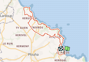
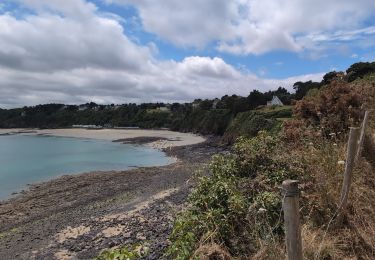
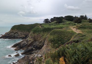
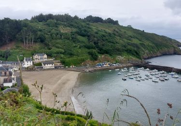
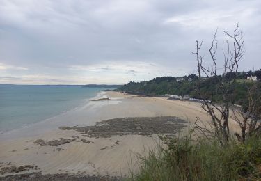
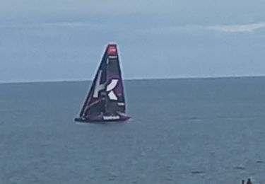
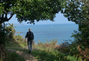
Randonnée Marche de 19,7 km à découvrir à Bretagne, Côtes-d'Armor, Plouha. Cette randonnée est proposée par neitag61.

Profil altimétrique

Points d'intérêt

Point d'intérêt Plouha - Chapelle St Samson - Photo
neitag61
Point d'intérêt Plouha - Lavoir de Kersalic - Photo
neitag61

Localisation

Pays :
France
Région :
Bretagne
Département/Province :
Côtes-d'Armor
Commune :
Plouha
Localité :
Unknown
Départ:(Dec)
Départ:(UTM)
508425 ; 5391438 (30U) N.

Randonnées à proximité

Randonnée Marche Tréveneuc - Tréveneuc Chapelle Saint-Marc - GR34 Plage de la Banche - 24.8km 420m 5h35 (40mn) - 2024 07 03 - Photo
Marche
GUIDE
Orcal37

Marche

Difficile
Tréveneuc, Bretagne, Côtes-d'Armor, France
25 km | 30 km-effort
5h 35min
Oui
Randonnée Marche Plouha - Plouha Plage Bonaparte - GR34 Chapelle Saint-Marc - 22.9km 465m 5h20 (35mn) - 2024 07 02 - Photo
Marche
GUIDE
Orcal37

Marche

Difficile
Plouha, Bretagne, Côtes-d'Armor, France
23 km | 29 km-effort
5h 20min
Oui
Randonnée Marche Plouha - GR_34_CG_20_Plouha_Plouezec_20240528 - Photo
Marche
patrickdanilo

Marche

Moyen
Plouha, Bretagne, Côtes-d'Armor, France
12,2 km | 16,5 km-effort
3h 26min
Non
Randonnée Marche Saint-Quay-Portrieux - St Quay Portrieux - Étables/mer 14.7.23 - Photo
Marche
GUIDE
fredetpascale

Marche

Facile
Saint-Quay-Portrieux, Bretagne, Côtes-d'Armor, France
8,5 km | 10,9 km-effort
2h 30min
Oui
Randonnée Marche Saint-Quay-Portrieux - Littoral St Quay - Portrieux 11.7.23 - Photo
Marche
GUIDE
fredetpascale

Marche

Facile
Saint-Quay-Portrieux, Bretagne, Côtes-d'Armor, France
11,7 km | 14,1 km-effort
3h 30min
Oui
Randonnée Marche Plouha - Falaises de Plouha 9.7.23 - Photo
Marche
GUIDE
fredetpascale

Marche

Facile
Plouha, Bretagne, Côtes-d'Armor, France
14,8 km | 20 km-effort
2h 50min
Non
Randonnée Marche Plouha - plouha plage Bonaparte 5km - Photo
Marche
Vasseur Jean Marc

Marche

Très difficile
Plouha, Bretagne, Côtes-d'Armor, France
24 km | 28 km-effort
3h 6min
Non
Randonnée Marche Plouha - Falaises de Plouha - Photo
Marche
TOULAUDIN

Marche

Moyen
(1)
Plouha, Bretagne, Côtes-d'Armor, France
16,2 km | 21 km-effort
5h 44min
Oui
Randonnée Marche Plouha - A 13 De la Plage Bonaparte - Photo
Marche
vindju

Marche

Très facile
Plouha, Bretagne, Côtes-d'Armor, France
15,4 km | 19,7 km-effort
4h 21min
Oui


Fermer
Mes abonnements