Randonnée V.T.T. Saint-Laurent-de-Condel - petite rando au sud de caen - Photo
 Brendan LE MEUR
Brendan LE MEUR

Utilisateur

© OpenStreetMap contributors
Longueur
Longueur
27 km
Altitude max
Altitude max
180 m
Dénivelé positif
Dénivelé positif
391 m
Km-Effort
Km-Effort  
32 km
Altitude min
Altitude min
42 m
Dénivelé négatif
Dénivelé négatif
392 m
Boucle
Boucle
Oui
Date de création :
2021-04-29 19:54:16.366
Dernière modification :
2021-04-29 19:55:29.971

(0 Avis)

V.T.T.
V.T.T.
2h14
Difficulté : Difficile

Scannez ce code QR pour ouvrir la randonnée dans l'application SityTrail

Application GPS de randonnée GRATUITE

Logo SityTrail SityTrail

IGN / Instituts géographiques

Télécharger SityTrail sur l'App Store Télécharger SityTrail sur Google Play

Logo SityTrail SityTrail World

Le monde est à vous

Télécharger SityTrail sur l'App Store Télécharger SityTrail sur Google Play Télécharger SityTrail sur Huawei AppGallery

À propos

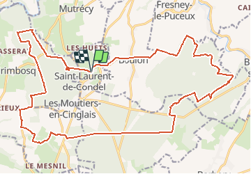
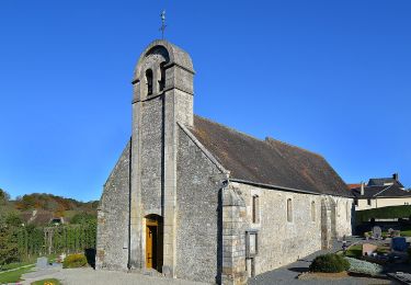
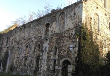
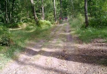
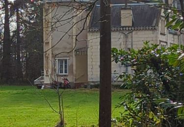
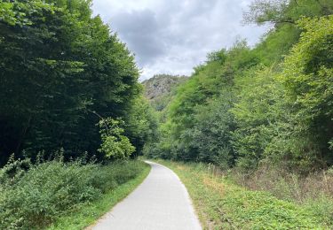
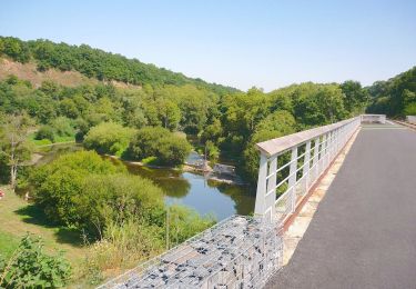
Randonnée V.T.T. de 27 km à découvrir à Normandie, Calvados, Saint-Laurent-de-Condel. Cette randonnée est proposée par Brendan LE MEUR.

Profil altimétrique

Localisation

Pays :
France
Région :
Normandie
Département/Province :
Calvados
Commune :
Saint-Laurent-de-Condel
Localité :
Unknown
Départ:(UTM)
689055 ; 5435500 (30U) N.

Randonnées à proximité

Randonnée V.T.T. Montillières-sur-Orne - curcy trois monts - Photo
V.T.T.
albers

V.T.T.

Moyen
(1)
Montillières-sur-Orne, Normandie, Calvados, France
28 km | 35 km-effort
1h 59min
Oui
Randonnée A pied Espins - D'Espins au Moulin du traspy - Photo
A pied
GUIDE+

A pied

Facile
Espins, Normandie, Calvados, France
6,9 km | 9 km-effort
2h 3min
Oui
Randonnée Geocaching Barbery - GC745R5 = https://coord.info/GC745R5 - Photo
Geocaching
yannick-p

Geocaching

Facile
Barbery, Normandie, Calvados, France
6,5 km | 7,5 km-effort
2h 40min
Oui
Randonnée Marche Maizet - COUDRAY 20 KM - Photo
Marche
UDGI54

Marche

Difficile
(2)
Maizet, Normandie, Calvados, France
19,8 km | 25 km-effort
5h 26min
Oui
Randonnée V.T.T. Amayé-sur-Orne - Xtrem Vtt Normandie 2013 - Amayé Sur Orne - Photo
V.T.T.
tracegps

V.T.T.

Difficile
Amayé-sur-Orne, Normandie, Calvados, France
45 km | 57 km-effort
2h 49min
Oui
Randonnée Course à pied Mutrécy - reco mouss 27 12 13 - Photo
Course à pied
mouss65

Course à pied

Très facile
(1)
Mutrécy, Normandie, Calvados, France
5,7 km | 7,6 km-effort
1h 59min
Non
Randonnée Marche Barbery - Babery Annick - Photo
Marche
gr1346

Marche

Moyen
Barbery, Normandie, Calvados, France
9 km | 10,1 km-effort
2h 34min
Oui
Randonnée Vélo de route Montillières-sur-Orne - Voie verte suisse normande - Photo
Vélo de route
yves62410

Vélo de route

Facile
Montillières-sur-Orne, Normandie, Calvados, France
47 km | 53 km-effort
4h 14min
Oui
Randonnée A pied Grimbosq - Moulin de Pray et Pont de Brie - Photo
A pied
GUIDE+

A pied

Facile
Grimbosq, Normandie, Calvados, France
4,3 km | 4,9 km-effort
1h 6min
Non


Fermer
Mes abonnements