Randonnée Marche Bad Homburg vor der Höhe - Limes, Herzbergturm et Marmorstein - Photo

Limes, Herzbergturm et Marmorstein

 shuck
shuck

Utilisateur

© OpenStreetMap contributors
Longueur
Longueur
16,2 km
Altitude max
Altitude max
645 m
Dénivelé positif
Dénivelé positif
475 m
Km-Effort
Km-Effort  
23 km
Altitude min
Altitude min
239 m
Dénivelé négatif
Dénivelé négatif
476 m
Boucle
Boucle
Oui
Date de création :
2021-04-25 09:41:33.407
Dernière modification :
2021-04-25 15:22:57.254

(0 Avis)

Marche
Marche
3h45
Difficulté : Moyen

Scannez ce code QR pour ouvrir la randonnée dans l'application SityTrail

Application GPS de randonnée GRATUITE

Logo SityTrail SityTrail

IGN / Instituts géographiques

Télécharger SityTrail sur l'App Store Télécharger SityTrail sur Google Play

Logo SityTrail SityTrail World

Le monde est à vous

Télécharger SityTrail sur l'App Store Télécharger SityTrail sur Google Play Télécharger SityTrail sur Huawei AppGallery

À propos

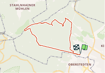
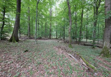
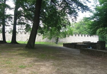
Randonnée Marche de 16,2 km à découvrir à Hesse, Hochtaunuskreis, Bad Homburg vor der Höhe. Cette randonnée est proposée par shuck.

Description

Hochtaunus près de Francfort-am-Main.
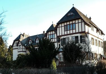
Départ Gotischenhaus - Bad-Hombourg

Profil altimétrique

Localisation

Pays :
Allemagne
Région :
Hesse
Département/Province :
Hochtaunuskreis
Commune :
Bad Homburg vor der Höhe
Localité :
Bad Homburg v. d. Höhe
Départ:(UTM)
469761 ; 5564788 (32U) N.

Randonnées à proximité

Randonnée A pied Bad Homburg vor der Höhe - Rehbockweg - Photo
A pied
PRO

A pied

Facile
Bad Homburg vor der Höhe, Hesse, Hochtaunuskreis, Allemagne
5,1 km | 6,6 km-effort
1h 29min
Oui
Randonnée A pied Bad Homburg vor der Höhe - Keilerweg - Photo
A pied
PRO

A pied

Facile
Bad Homburg vor der Höhe, Hesse, Hochtaunuskreis, Allemagne
6,5 km | 8,5 km-effort
1h 55min
Non
Randonnée A pied Bad Homburg vor der Höhe - Libellenweg - Photo
A pied
PRO

A pied

Facile
Bad Homburg vor der Höhe, Hesse, Hochtaunuskreis, Allemagne
3,4 km | 4,5 km-effort
1h 1min
Non
Randonnée A pied Oberursel - Urselbach Mühlenwanderweg - Photo
A pied
PRO

A pied

Facile
Oberursel, Hesse, Hochtaunuskreis, Allemagne
3,9 km | 4,8 km-effort
1h 6min
Non
Randonnée A pied Oberursel - Keltenrundwanderweg - Photo
A pied
PRO

A pied

Facile
Oberursel, Hesse, Hochtaunuskreis, Allemagne
4,1 km | 6,3 km-effort
1h 26min
Oui
Randonnée A pied Friedrichsdorf - Saalburg - Gickelsburg - Batzenbäumchen - Photo
A pied
PRO

A pied

Facile
Friedrichsdorf, Hesse, Hochtaunuskreis, Allemagne
4,7 km | 6,1 km-effort
1h 22min
Oui
Randonnée A pied Friedrichsdorf - Friedrichsdorf-Saalburg - Photo
A pied
PRO

A pied

Facile
Friedrichsdorf, Hesse, Hochtaunuskreis, Allemagne
5,2 km | 7,8 km-effort
1h 45min
Non


Fermer
Mes abonnements