![](/images/other/stat-length.png)
![Randonnée Marche Charbonnières-les-Varennes - Le Puy de Paugnat - Photo](https://media.geolcdn.com/t/1900/400/b631891c-a86d-4ad8-811c-e5b56ec82195.jpg&format=pjpeg&maxdim=2)
Le Puy de Paugnat
Gegetop
Utilisateur
![Longueur](/images/other/stat-length.png)
Longueur
10,7 km
![Altitude max](https://static1.geolcdn.com/siteimages/upload/files/1508320355ic_sort_altitude_max_24dp.png)
Altitude max
900 m
![Dénivelé positif](https://static1.geolcdn.com/siteimages/upload/files/1508320355ic_sort_den_pos_24dp.png)
Dénivelé positif
241 m
![Km-Effort](/images/other/stat-length.png)
Km-Effort
13,9 km
![Altitude min](https://static1.geolcdn.com/siteimages/upload/files/1508320355ic_sort_altitude_min_24dp.png)
Altitude min
773 m
![Dénivelé négatif](https://static1.geolcdn.com/siteimages/upload/files/1508320355ic_sort_den_neg_24dp.png)
Dénivelé négatif
238 m
![Boucle](https://static1.geolcdn.com/siteimages/upload/files/16400158638029165_repeat_loop_refresh_sync_direction_icon.png)
Boucle
Oui
Date de création :
2021-04-23 11:53:33.097
Dernière modification :
2021-04-24 15:37:10.042
![Marche](https://static1.geolcdn.com/sitytour/trail-icons/101.png)
2h40
Difficulté : Moyen
![Marche nordique](https://static1.geolcdn.com/sitytour/trail-icons/102.png)
2h20
Difficulté : Moyen
![Scannez ce code QR pour ouvrir la randonnée dans l'application SityTrail](https://capi.geolives.com/qq0zvz2zws4bq2lad0pu/sitytour/trails/2760112/qr.png?size=200)
Application GPS de randonnée GRATUITE
À propos
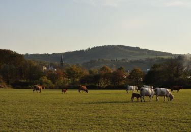
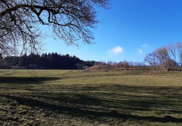
Randonnée Marche de 10,7 km à découvrir à Auvergne-Rhône-Alpes, Puy-de-Dôme, Charbonnières-les-Varennes. Cette randonnée est proposée par Gegetop.
Description
Le point de départ est différent mais la boucle est identique.
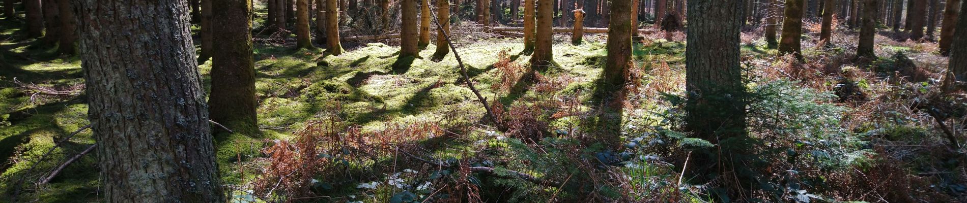
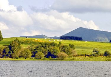
La montée au sommet du Puy vous offrira un magnifique panorama.
Localisation
Pays :
France
Région :
Auvergne-Rhône-Alpes
Département/Province :
Puy-de-Dôme
Commune :
Charbonnières-les-Varennes
Localité :
Unknown
Départ:(Dec)
Départ:(UTM)
497378 ; 5081729 (31T) N.
Commentaires
Randonnées à proximité
![Randonnée V.T.T. Volvic - Tour du Puy de Dôme en VTT - Photo](https://media.geolcdn.com/t/375/260/ext.jpg?maxdim=2&url=https%3A%2F%2Fservices.sitytrail.com%2FGeolivesWS%2FDownloadMedia.ashx%3FTrailID%3D191407%26Media%3D14983_4.jpg)
![V.T.T. V.T.T.](https://static1.geolcdn.com/sitytour/trail-icons/202.png)
Tour du Puy de Dôme en VTT
V.T.T.
Très difficile
(1)
Volvic,
Auvergne-Rhône-Alpes,
Puy-de-Dôme,
France
![](/images/other/stat-length.png)
62 km | 85 km-effort
5h 30min
![](https://static1.geolcdn.com/siteimages/upload/files/16400158638029165_repeat_loop_refresh_sync_direction_icon.png)
Oui
![Randonnée Marche Pulvérières - Pulverieres_Etang_Grand - Photo](https://media.geolcdn.com/t/375/260/422b13e9-38d7-4e06-b1aa-c671b113145c.jpg&format=jpg&maxdim=2)
![Marche Marche](https://static1.geolcdn.com/sitytour/trail-icons/101.png)
Pulverieres_Etang_Grand
Marche
Facile
(1)
Pulvérières,
Auvergne-Rhône-Alpes,
Puy-de-Dôme,
France
![](/images/other/stat-length.png)
8 km | 9,9 km-effort
2h 30min
![](https://static1.geolcdn.com/siteimages/upload/files/16400158638029165_repeat_loop_refresh_sync_direction_icon.png)
Oui
![Randonnée Marche Volvic - Les sources de Volvic - Photo](https://media.geolcdn.com/t/375/260/ext.jpg?maxdim=2&url=https%3A%2F%2Fservices.sitytrail.com%2FGeolivesWS%2FDownloadMedia.ashx%3FTrailID%3D102879%26Media%3D4090_1.jpg)
![Marche Marche](https://static1.geolcdn.com/sitytour/trail-icons/101.png)
Les sources de Volvic
Marche
Moyen
(2)
Volvic,
Auvergne-Rhône-Alpes,
Puy-de-Dôme,
France
![](/images/other/stat-length.png)
10,9 km | 14,3 km-effort
3h 0min
![](https://static1.geolcdn.com/siteimages/upload/files/16400158638029165_repeat_loop_refresh_sync_direction_icon.png)
Oui
![Randonnée Marche Volvic - Egaules (près de Luzet) - Photo](https://media.geolcdn.com/t/375/260/ext.jpg?maxdim=2&url=https%3A%2F%2Fservices.sitytrail.com%2FGeolivesWS%2FDownloadMedia.ashx%3FTrailID%3D101845%26Media%3D2131_1.jpg)
![Marche Marche](https://static1.geolcdn.com/sitytour/trail-icons/101.png)
Egaules (près de Luzet)
Marche
Difficile
(1)
Volvic,
Auvergne-Rhône-Alpes,
Puy-de-Dôme,
France
![](/images/other/stat-length.png)
8,8 km | 10,8 km-effort
2h 45min
![](https://static1.geolcdn.com/siteimages/upload/files/16400158638029165_repeat_loop_refresh_sync_direction_icon.png)
Oui
![Randonnée A pied Manzat - Aux Sources de la Morge - Photo](https://media.geolcdn.com/t/375/260/5410179d-bc75-4fce-aa40-6165831bf324.jpeg&format=jpg&maxdim=2)
![A pied A pied](https://static1.geolcdn.com/sitytour/trail-icons/100.png)
Aux Sources de la Morge
A pied
Moyen
Manzat,
Auvergne-Rhône-Alpes,
Puy-de-Dôme,
France
![](/images/other/stat-length.png)
16,3 km | 23 km-effort
5h 8min
![](https://static1.geolcdn.com/siteimages/upload/files/16400158638029165_repeat_loop_refresh_sync_direction_icon.png)
Oui
![Randonnée A pied Volvic - Les Sources de Volvic - Photo](https://media.geolcdn.com/t/375/260/8a359664-0a75-4b1d-ab80-e2b09ce7035c.jpeg&format=jpg&maxdim=2)
![A pied A pied](https://static1.geolcdn.com/sitytour/trail-icons/100.png)
Les Sources de Volvic
A pied
Facile
Volvic,
Auvergne-Rhône-Alpes,
Puy-de-Dôme,
France
![](/images/other/stat-length.png)
10,5 km | 13,9 km-effort
3h 10min
![](https://static1.geolcdn.com/siteimages/upload/files/16400158638029165_repeat_loop_refresh_sync_direction_icon.png)
Oui
![Randonnée A pied Volvic - Egaules - Photo](https://media.geolcdn.com/t/375/260/66520ebf-6b8a-4aa3-baf8-9236a5fbc503.jpeg&format=jpg&maxdim=2)
![A pied A pied](https://static1.geolcdn.com/sitytour/trail-icons/100.png)
Egaules
A pied
Facile
Volvic,
Auvergne-Rhône-Alpes,
Puy-de-Dôme,
France
![](/images/other/stat-length.png)
8 km | 10 km-effort
2h 16min
![](https://static1.geolcdn.com/siteimages/upload/files/16400158638029165_repeat_loop_refresh_sync_direction_icon.png)
Oui
![Randonnée Marche Volvic - Volvic_Impluvium - Photo](https://media.geolcdn.com/t/375/260/50c090f3-b1b7-4427-b041-71f291a36d3e.jpg&format=jpg&maxdim=2)
![Marche Marche](https://static1.geolcdn.com/sitytour/trail-icons/101.png)
Volvic_Impluvium
Marche
Moyen
Volvic,
Auvergne-Rhône-Alpes,
Puy-de-Dôme,
France
![](/images/other/stat-length.png)
8,9 km | 12,1 km-effort
2h 30min
![](https://static1.geolcdn.com/siteimages/upload/files/16400158638029165_repeat_loop_refresh_sync_direction_icon.png)
Oui
![Randonnée A pied Manzat - La Roche de Sauterre - Photo](https://media.geolcdn.com/t/375/260/8dba4542-9ef0-4bdf-8b1f-a5675463ca16.jpeg&format=jpg&maxdim=2)
![A pied A pied](https://static1.geolcdn.com/sitytour/trail-icons/100.png)
La Roche de Sauterre
A pied
Facile
Manzat,
Auvergne-Rhône-Alpes,
Puy-de-Dôme,
France
![](/images/other/stat-length.png)
4,2 km | 5,8 km-effort
1h 18min
![](https://static1.geolcdn.com/siteimages/upload/files/16400158638029165_repeat_loop_refresh_sync_direction_icon.png)
Oui