![](/images/other/stat-length.png)
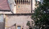
![Randonnée Marche Saint-André-d'Apchon - St-André-d'Apchon-Rocher de Bellevue - Photo](https://media.geolcdn.com/t/1900/400/8e975bfa-15cb-4d0f-9f11-d5beb6ba5a25.jpg&format=pjpeg&maxdim=2)
St-André-d'Apchon-Rocher de Bellevue
Jgar
Utilisateur
![Longueur](/images/other/stat-length.png)
![Altitude max](https://static1.geolcdn.com/siteimages/upload/files/1508320355ic_sort_altitude_max_24dp.png)
![Dénivelé positif](https://static1.geolcdn.com/siteimages/upload/files/1508320355ic_sort_den_pos_24dp.png)
![Km-Effort](/images/other/stat-length.png)
![Altitude min](https://static1.geolcdn.com/siteimages/upload/files/1508320355ic_sort_altitude_min_24dp.png)
![Dénivelé négatif](https://static1.geolcdn.com/siteimages/upload/files/1508320355ic_sort_den_neg_24dp.png)
![Boucle](https://static1.geolcdn.com/siteimages/upload/files/16400158638029165_repeat_loop_refresh_sync_direction_icon.png)
![Marche](https://static1.geolcdn.com/sitytour/trail-icons/101.png)
4h16
Difficulté : Moyen
![Scannez ce code QR pour ouvrir la randonnée dans l'application SityTrail](https://capi.geolives.com/qq0zvz2zws4bq2lad0pu/sitytour/trails/2759058/qr.png?size=200)
Application GPS de randonnée GRATUITE
À propos
Randonnée Marche de 11 km à découvrir à Auvergne-Rhône-Alpes, Loire, Saint-André-d'Apchon. Cette randonnée est proposée par Jgar.
Description
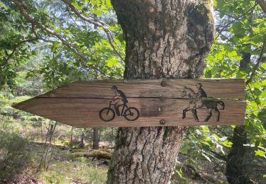
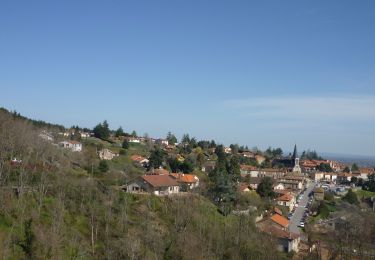
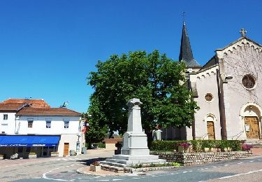
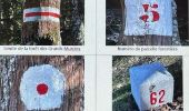
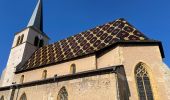
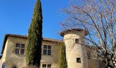
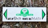
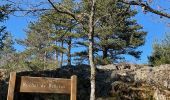
En partant de la place de la Mairie, prendre la rue J.B. Chambonnière, descendre à droite vers le château d'Apchon puis remonter à la maison Patin et rejoindre l'église St-André. Continuer à l'ouest et prendre à gauche du cimetière la route de Curtille qui conduit en ce lieu-dit. Par la droite, vous arriverez aux Gonnards puis à une intersection où passe la PR 22 (balise sur fond blanc-jaune). Monter à gauche et suivre ce sentier balisé jusqu'à une parcelle agricole au milieu des bois (domaine des Grands Murcins). Continuez à monter jusqu'à un chemin carrossable que vous suivrez à droite. A l'intersection, prendre le rocher de Bellevue par un petit sentier.
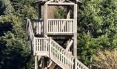
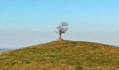
Le descendre à l'est, tourner à gauche et rejoindre la cote 747. Prendre à droite et descendre jusqu'à la cote 557 (reposoir de Picard). Ne pas prendre la direction des Gonnards mais continuer tout droit (on retrouve la PR 22) jusqu'à un mamelon dominé par un arbre-repère. Descendre à droite aux Goyards puis suivre la route de la Goutte et celle du Bouthéran pour arriver au village.
Localisation
Commentaires
Randonnées à proximité
![Randonnée Marche Cherier - rocher de rochefort depuis la croix Trévingt - Photo](https://media.geolcdn.com/t/375/260/dcc1659c-efdc-4c94-9e85-a848a823e0bd.jpg&format=jpg&maxdim=2)
![Marche Marche](https://static1.geolcdn.com/sitytour/trail-icons/101.png)
Marche
![](/images/other/stat-length.png)
![](https://static1.geolcdn.com/siteimages/upload/files/16400158638029165_repeat_loop_refresh_sync_direction_icon.png)
![Randonnée Marche Renaison - Renaison : d’un barrage à l’autre - Photo](https://media.geolcdn.com/t/375/260/0c55d59a-831c-4f21-8687-c1695b3393b5.jpg&format=jpg&maxdim=2)
![Marche Marche](https://static1.geolcdn.com/sitytour/trail-icons/101.png)
Marche
![](/images/other/stat-length.png)
![](https://static1.geolcdn.com/siteimages/upload/files/16400158638029165_repeat_loop_refresh_sync_direction_icon.png)
![Randonnée Marche Renaison - Saint-Haon-le-Châtel : Pardières - Photo](https://media.geolcdn.com/t/375/260/20289c32-20c2-4e09-8385-a8087ad95771.jpg&format=jpg&maxdim=2)
![Marche Marche](https://static1.geolcdn.com/sitytour/trail-icons/101.png)
Marche
![](/images/other/stat-length.png)
![](https://static1.geolcdn.com/siteimages/upload/files/16400158638029165_repeat_loop_refresh_sync_direction_icon.png)
![Randonnée Marche Arcon - Arcon: Roche Corbière-Quatre Murs - Photo](https://media.geolcdn.com/t/375/260/f084a593-c8ab-4485-bad9-4355d9e9f1a8.jpg&format=jpg&maxdim=2)
![Marche Marche](https://static1.geolcdn.com/sitytour/trail-icons/101.png)
Marche
![](/images/other/stat-length.png)
![](https://static1.geolcdn.com/siteimages/upload/files/16400158638029165_repeat_loop_refresh_sync_direction_icon.png)
![Randonnée Marche Ouches - Ouches : de la plaine à la côte roannaise - Photo](https://media.geolcdn.com/t/375/260/6b9e8121-0a01-4791-9e45-beccd7d62b78.jpg&format=jpg&maxdim=2)
![Marche Marche](https://static1.geolcdn.com/sitytour/trail-icons/101.png)
Marche
![](/images/other/stat-length.png)
![](https://static1.geolcdn.com/siteimages/upload/files/16400158638029165_repeat_loop_refresh_sync_direction_icon.png)
![Marche Marche](https://static1.geolcdn.com/sitytour/trail-icons/101.png)
Marche
![](/images/other/stat-length.png)
![](https://static1.geolcdn.com/siteimages/upload/files/16400158638029165_repeat_loop_refresh_sync_direction_icon.png)
![Marche Marche](https://static1.geolcdn.com/sitytour/trail-icons/101.png)
Marche
![](/images/other/stat-length.png)
![](https://static1.geolcdn.com/siteimages/upload/files/16400158638029165_repeat_loop_refresh_sync_direction_icon.png)
![Randonnée V.T.T. Lentigny - Escapade dans les Gouttes de la Loire - Lentigny - Photo](https://media.geolcdn.com/t/375/260/ext.jpg?maxdim=2&url=https%3A%2F%2Fservices.sitytrail.com%2FGeolivesWS%2FDownloadMedia.ashx%3FTrailID%3D318105%26Media%3D17564_6.jpg)
![V.T.T. V.T.T.](https://static1.geolcdn.com/sitytour/trail-icons/202.png)
V.T.T.
![](/images/other/stat-length.png)
![](https://static1.geolcdn.com/siteimages/upload/files/16400158638029165_repeat_loop_refresh_sync_direction_icon.png)
![Randonnée V.T.T. Renaison - Boucle autour de la Faille du Rouchain - Renaison (les barrages) - Photo](https://media.geolcdn.com/t/375/260/ext.jpg?maxdim=2&url=https%3A%2F%2Fservices.sitytrail.com%2FGeolivesWS%2FDownloadMedia.ashx%3FTrailID%3D318016%26Media%3D17472_6.jpg)
![V.T.T. V.T.T.](https://static1.geolcdn.com/sitytour/trail-icons/202.png)
V.T.T.
![](/images/other/stat-length.png)
![](https://static1.geolcdn.com/siteimages/upload/files/16400158638029165_repeat_loop_refresh_sync_direction_icon.png)