![](/images/other/stat-length.png)
![Randonnée Marche Charnay - charnay - Photo](https://media.geolcdn.com/t/1900/400/3a0b88c5-1d96-4f44-a545-03b03b7ef47c.jpg&format=pjpeg&maxdim=2)
charnay
eltonnermou
Utilisateur
![Longueur](/images/other/stat-length.png)
![Altitude max](https://static1.geolcdn.com/siteimages/upload/files/1508320355ic_sort_altitude_max_24dp.png)
![Dénivelé positif](https://static1.geolcdn.com/siteimages/upload/files/1508320355ic_sort_den_pos_24dp.png)
![Km-Effort](/images/other/stat-length.png)
![Altitude min](https://static1.geolcdn.com/siteimages/upload/files/1508320355ic_sort_altitude_min_24dp.png)
![Dénivelé négatif](https://static1.geolcdn.com/siteimages/upload/files/1508320355ic_sort_den_neg_24dp.png)
![Boucle](https://static1.geolcdn.com/siteimages/upload/files/16400158638029165_repeat_loop_refresh_sync_direction_icon.png)
![Marche](https://static1.geolcdn.com/sitytour/trail-icons/101.png)
2h29
Difficulté : Très facile
![Scannez ce code QR pour ouvrir la randonnée dans l'application SityTrail](https://capi.geolives.com/qq0zvz2zws4bq2lad0pu/sitytour/trails/2753967/qr.png?size=200)
Application GPS de randonnée GRATUITE
À propos
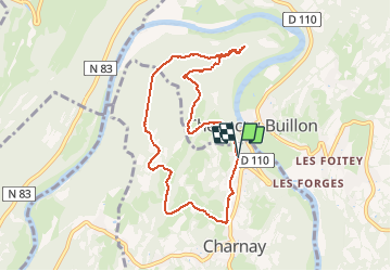
Randonnée Marche de 8,1 km à découvrir à Bourgogne-Franche-Comté, Doubs, Charnay. Cette randonnée est proposée par eltonnermou.
Description
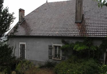
parking sur le bas côté de la rue ; randonnée en groupe
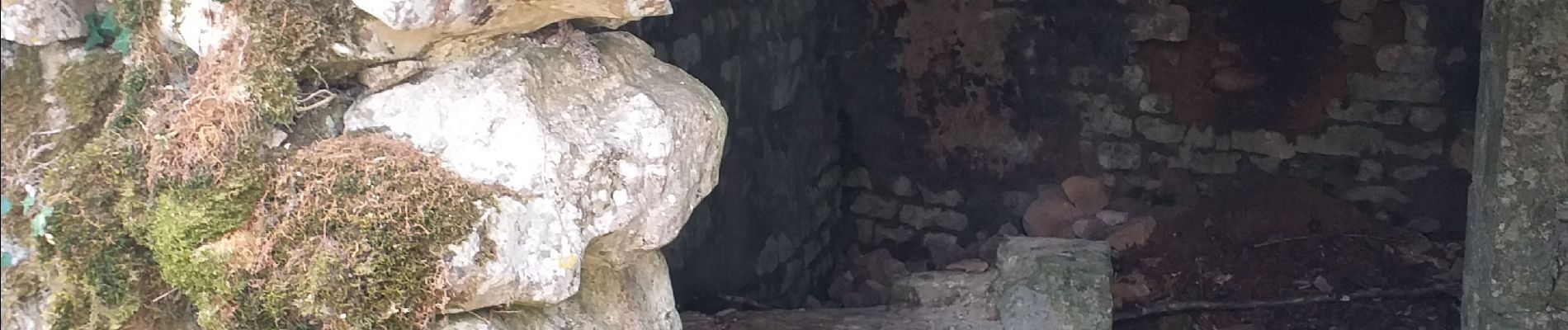
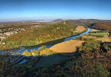
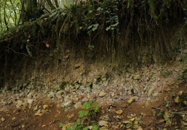
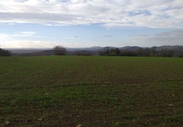
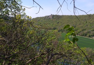
randonnée agréable à travers prairies et forêts qui à cette saison nous fait profiter de ses éclats de couleur. 2 petits raidillons à gravir mais rien de bien extraordinaire, pour une arrivée aux ruine du château de Charencey (au dessus de Chenecey Buillon).
Laissez vous surprendre par le passage d’un ou plusieurs chevreuils et dans les parties escarpées de voir des chamois.
Localisation
Commentaires
Randonnées à proximité
![Randonnée A pied Busy - Sentier de la Pierre de Vorges - Photo](https://media.geolcdn.com/t/375/260/6f249824-322a-4d94-8931-19d5b1d90e88.jpeg&format=jpg&maxdim=2)
![A pied A pied](https://static1.geolcdn.com/sitytour/trail-icons/100.png)
A pied
![](/images/other/stat-length.png)
![](https://static1.geolcdn.com/siteimages/upload/files/16400158638029165_repeat_loop_refresh_sync_direction_icon.png)
![Randonnée A pied Vorges-les-Pins - Sentier des Crêtes - Photo](https://media.geolcdn.com/t/375/260/11000138-aa02-48df-818f-23d3321a98ed.jpeg&format=jpg&maxdim=2)
![A pied A pied](https://static1.geolcdn.com/sitytour/trail-icons/100.png)
A pied
![](/images/other/stat-length.png)
![](https://static1.geolcdn.com/siteimages/upload/files/16400158638029165_repeat_loop_refresh_sync_direction_icon.png)
![Randonnée A pied Boussières - Sentier du Ruisseau - Photo](https://media.geolcdn.com/t/375/260/4b9f6489-2cea-48c8-a931-7d2d0fad9445.jpeg&format=jpg&maxdim=2)
![A pied A pied](https://static1.geolcdn.com/sitytour/trail-icons/100.png)
A pied
![](/images/other/stat-length.png)
![](https://static1.geolcdn.com/siteimages/upload/files/16400158638029165_repeat_loop_refresh_sync_direction_icon.png)
![Randonnée A pied Montferrand-le-Château - Sentier de Crête et Bois Rapin - Photo](https://media.geolcdn.com/t/375/260/c8b25516-529e-4f5c-85cb-5313429ddb47.jpeg&format=jpg&maxdim=2)
![A pied A pied](https://static1.geolcdn.com/sitytour/trail-icons/100.png)
A pied
![](/images/other/stat-length.png)
![](https://static1.geolcdn.com/siteimages/upload/files/16400158638029165_repeat_loop_refresh_sync_direction_icon.png)
![Randonnée A pied Thoraise - Sentier de Notre Dame du Mont - Photo](https://media.geolcdn.com/t/375/260/e4c78328-7a72-4c70-b054-e885f49e43ee.jpeg&format=jpg&maxdim=2)
![A pied A pied](https://static1.geolcdn.com/sitytour/trail-icons/100.png)
A pied
![](/images/other/stat-length.png)
![](https://static1.geolcdn.com/siteimages/upload/files/16400158638029165_repeat_loop_refresh_sync_direction_icon.png)
![Randonnée Marche Pugey - pugey vierge comice arguel - Photo](https://media.geolcdn.com/t/375/260/210ae8a7-1f70-4f24-86c2-2d030290ac2e.jpg&format=jpg&maxdim=2)
![Marche Marche](https://static1.geolcdn.com/sitytour/trail-icons/101.png)
Marche
![](/images/other/stat-length.png)
![](https://static1.geolcdn.com/siteimages/upload/files/16400158638029165_repeat_loop_refresh_sync_direction_icon.png)
![Randonnée Marche Boussières - Boussières crête - Photo](https://media.geolcdn.com/t/375/260/59815f49-0266-454c-acab-aa8c73607952.jpg&format=jpg&maxdim=2)
![Marche Marche](https://static1.geolcdn.com/sitytour/trail-icons/101.png)
Marche
![](/images/other/stat-length.png)
![](https://static1.geolcdn.com/siteimages/upload/files/16400158638029165_repeat_loop_refresh_sync_direction_icon.png)
![Randonnée Marche Busy - Busy Vierge du mont - Photo](https://media.geolcdn.com/t/375/260/a4594e72-5506-4551-90b2-490d3330d43d.jpg&format=jpg&maxdim=2)
![Marche Marche](https://static1.geolcdn.com/sitytour/trail-icons/101.png)
Marche
![](/images/other/stat-length.png)
![](https://static1.geolcdn.com/siteimages/upload/files/16400158638029165_repeat_loop_refresh_sync_direction_icon.png)
![Randonnée Marche Cessey - Cessey 2021-01-26 rando CAF - Photo](https://media.geolcdn.com/t/375/260/672450e4-6204-40da-8680-b68dabe30a24.jpg&format=jpg&maxdim=2)
![Marche Marche](https://static1.geolcdn.com/sitytour/trail-icons/101.png)
Marche
![](/images/other/stat-length.png)
![](https://static1.geolcdn.com/siteimages/upload/files/16400158638029165_repeat_loop_refresh_sync_direction_icon.png)