![](/images/other/stat-length.png)
![Randonnée Marche Détain-et-Bruant - blockhaus de Saint-Jean de Boeuf - Photo](https://media.geolcdn.com/t/1900/400/7b6e17cc-c96f-42ca-91f7-e764a111d3f2.jpg&format=pjpeg&maxdim=2)
blockhaus de Saint-Jean de Boeuf
mpstoop
Utilisateur
![Longueur](/images/other/stat-length.png)
![Altitude max](https://static1.geolcdn.com/siteimages/upload/files/1508320355ic_sort_altitude_max_24dp.png)
![Dénivelé positif](https://static1.geolcdn.com/siteimages/upload/files/1508320355ic_sort_den_pos_24dp.png)
![Km-Effort](/images/other/stat-length.png)
![Altitude min](https://static1.geolcdn.com/siteimages/upload/files/1508320355ic_sort_altitude_min_24dp.png)
![Dénivelé négatif](https://static1.geolcdn.com/siteimages/upload/files/1508320355ic_sort_den_neg_24dp.png)
![Boucle](https://static1.geolcdn.com/siteimages/upload/files/16400158638029165_repeat_loop_refresh_sync_direction_icon.png)
![Marche](https://static1.geolcdn.com/sitytour/trail-icons/101.png)
1h41
Difficulté : Moyen
![V.T.T.](https://static1.geolcdn.com/sitytour/trail-icons/202.png)
56m
Difficulté : Facile
![Scannez ce code QR pour ouvrir la randonnée dans l'application SityTrail](https://capi.geolives.com/qq0zvz2zws4bq2lad0pu/sitytour/trails/2746213/qr.png?size=200)
Application GPS de randonnée GRATUITE
À propos
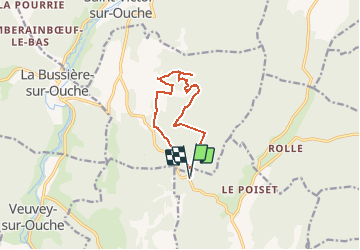
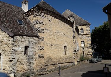
Randonnée Marche de 11 km à découvrir à Bourgogne-Franche-Comté, Côte-d'Or, Détain-et-Bruant. Cette randonnée est proposée par mpstoop.
Description
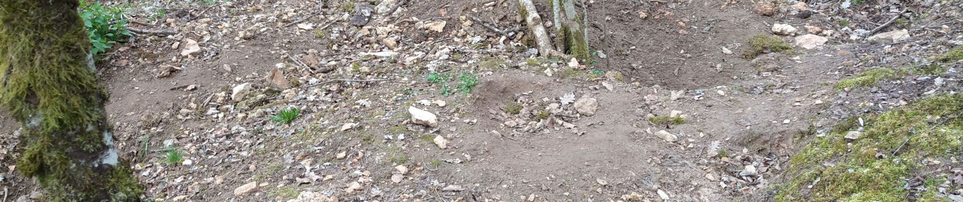
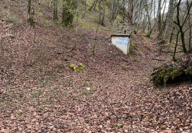
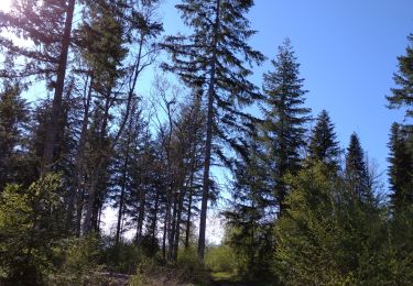
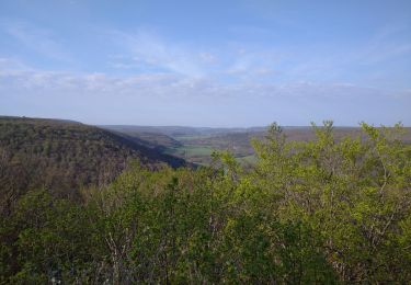
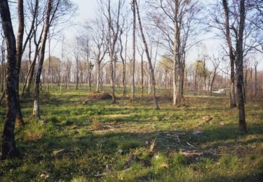
forêt mixte de feuillus autochtones et conifères plantés depuis plusieurs années ; de beaux chemins accessibles aussi en VTT vous conduirons vers les vestiges énigmatiques d'une fortification militaire abandonnée, dont fondations et souterrains demeurent .
Localisation
Commentaires
Randonnées à proximité
![Randonnée Marche La Bussière-sur-Ouche - La Bête de l'Auxois - La Bussière sur Ouche - Photo](https://media.geolcdn.com/t/375/260/ext.jpg?maxdim=2&url=https%3A%2F%2Fservices.sitytrail.com%2FGeolivesWS%2FDownloadMedia.ashx%3FTrailID%3D104674%26Media%3D8077_1.jpg)
![Marche Marche](https://static1.geolcdn.com/sitytour/trail-icons/101.png)
Marche
![](/images/other/stat-length.png)
![](https://static1.geolcdn.com/siteimages/upload/files/16400158638029165_repeat_loop_refresh_sync_direction_icon.png)
![Randonnée Marche La Bussière-sur-Ouche - Pierre du druide , grotte de tebsima - Photo](https://media.geolcdn.com/t/375/260/f5fb0392-9ba6-4c1e-8853-76c9bb7fb3dc.jpg&format=jpg&maxdim=2)
![Marche Marche](https://static1.geolcdn.com/sitytour/trail-icons/101.png)
Marche
![](/images/other/stat-length.png)
![](https://static1.geolcdn.com/siteimages/upload/files/16400158638029165_repeat_loop_refresh_sync_direction_icon.png)
![Randonnée Marche Antheuil - Saint JeandeBoeuf- Antheuil-Crugey-Labussièresur Ouche - Photo](https://media.geolcdn.com/t/375/260/cfbbfa30-225e-4285-b48a-0a8696c4b14b.jpg&format=jpg&maxdim=2)
![Marche Marche](https://static1.geolcdn.com/sitytour/trail-icons/101.png)
Marche
![](/images/other/stat-length.png)
![](https://static1.geolcdn.com/siteimages/upload/files/16400158638029165_repeat_loop_refresh_sync_direction_icon.png)
![Randonnée Marche Saint-Jean-de-Bœuf - Saint JeandeBoeuf-Gissey sur Ouche - Photo](https://media.geolcdn.com/t/375/260/8855f220-19b7-4cb5-9740-2586f5619cf3.jpg&format=jpg&maxdim=2)
![Marche Marche](https://static1.geolcdn.com/sitytour/trail-icons/101.png)
Marche
![](/images/other/stat-length.png)
![](https://static1.geolcdn.com/siteimages/upload/files/16400158638029165_repeat_loop_refresh_sync_direction_icon.png)
![Randonnée Marche Gergueil - balcon de l'Ouche - Photo](https://media.geolcdn.com/t/375/260/946ea50b-5544-4ca8-84ea-d0bce9713232.jpg&format=jpg&maxdim=2)
![Marche Marche](https://static1.geolcdn.com/sitytour/trail-icons/101.png)
Marche
![](/images/other/stat-length.png)
![](https://static1.geolcdn.com/siteimages/upload/files/16400158638029165_repeat_loop_refresh_sync_direction_icon.png)
![Randonnée Marche La Bussière-sur-Ouche - St Victor canal - Photo](https://media.geolcdn.com/t/375/260/922cca4b-d8a7-4ae9-a8f6-94d903732d88.jpg&format=jpg&maxdim=2)
![Marche Marche](https://static1.geolcdn.com/sitytour/trail-icons/101.png)
Marche
![](/images/other/stat-length.png)
![](https://static1.geolcdn.com/siteimages/upload/files/16400158638029165_repeat_loop_refresh_sync_direction_icon.png)
![Randonnée Cyclotourisme Veuvey-sur-Ouche - 71 Bourgogne J8/8 - Photo](https://media.geolcdn.com/t/375/260/7cf0b0f6-718d-42c9-b651-e0854c7bc5fe.jpg&format=jpg&maxdim=2)
![Cyclotourisme Cyclotourisme](https://static1.geolcdn.com/sitytour/trail-icons/204.png)
Cyclotourisme
![](/images/other/stat-length.png)
![](https://static1.geolcdn.com/siteimages/upload/files/16400158638029165_repeat_loop_refresh_sync_direction_icon.png)
![Randonnée Marche La Bussière-sur-Ouche - D'une Rive à l'Autre - La Bussière sur Ouche - Photo](https://media.geolcdn.com/t/375/260/ext.jpg?maxdim=2&url=https%3A%2F%2Fservices.sitytrail.com%2FGeolivesWS%2FDownloadMedia.ashx%3FTrailID%3D104676%26Media%3D8079_1.jpg)
![Marche Marche](https://static1.geolcdn.com/sitytour/trail-icons/101.png)
Marche
![](/images/other/stat-length.png)
![](https://static1.geolcdn.com/siteimages/upload/files/16400158638029165_repeat_loop_refresh_sync_direction_icon.png)
![Randonnée sport Saint-Victor-sur-Ouche - Table druide et château de marigny - Photo](https://media.geolcdn.com/t/375/260/ext.jpg?maxdim=2&url=https%3A%2F%2Fsecurestorage.geolives.com%2Fsitytour%2Ftrail-bg%2Fdefault.jpg)
sport
![](/images/other/stat-length.png)
![](https://static1.geolcdn.com/siteimages/upload/files/16400158638029165_repeat_loop_refresh_sync_direction_icon.png)