![](/images/other/stat-length.png)
![Randonnée Marche Bidart - Bidart St Jean De Luz par le sentier de la côte - Photo](https://media.geolcdn.com/t/1900/400/ext.pjpeg?maxdim=2&url=https%3A%2F%2Fservices.sitytrail.com%2FGeolivesWS%2FDownloadMedia.ashx%3FTrailID%3D274278%26Media%3D20120730154546.jpeg)
Bidart St Jean De Luz par le sentier de la côte
Axelloceane
Utilisateur
![Longueur](/images/other/stat-length.png)
Longueur
15 km
![Altitude max](https://static1.geolcdn.com/siteimages/upload/files/1508320355ic_sort_altitude_max_24dp.png)
Altitude max
78 m
![Dénivelé positif](https://static1.geolcdn.com/siteimages/upload/files/1508320355ic_sort_den_pos_24dp.png)
Dénivelé positif
249 m
![Km-Effort](/images/other/stat-length.png)
Km-Effort
18,6 km
![Altitude min](https://static1.geolcdn.com/siteimages/upload/files/1508320355ic_sort_altitude_min_24dp.png)
Altitude min
-1 m
![Dénivelé négatif](https://static1.geolcdn.com/siteimages/upload/files/1508320355ic_sort_den_neg_24dp.png)
Dénivelé négatif
318 m
![Boucle](https://static1.geolcdn.com/siteimages/upload/files/16400158638029165_repeat_loop_refresh_sync_direction_icon.png)
Boucle
Non
Date de création :
2016-04-04 00:00:00.0
Dernière modification :
2016-04-04 00:00:00.0
![Marche](https://static1.geolcdn.com/sitytour/trail-icons/101.png)
3h57
Difficulté : Facile
![Scannez ce code QR pour ouvrir la randonnée dans l'application SityTrail](https://capi.geolives.com/qq0zvz2zws4bq2lad0pu/sitytour/trails/274278/qr.png?size=200)
Application GPS de randonnée GRATUITE
À propos
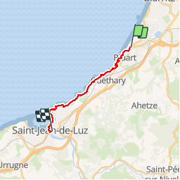
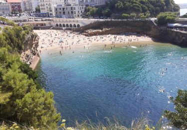
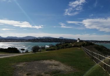
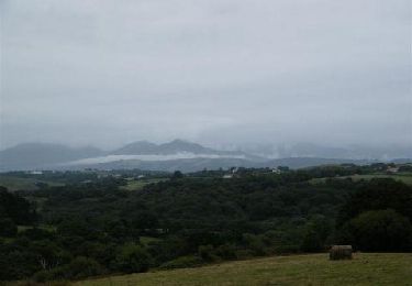
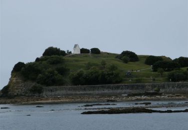
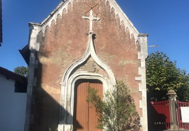
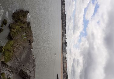
Randonnée Marche de 15 km à découvrir à Nouvelle-Aquitaine, Pyrénées-Atlantiques, Bidart. Cette randonnée est proposée par Axelloceane.
Description
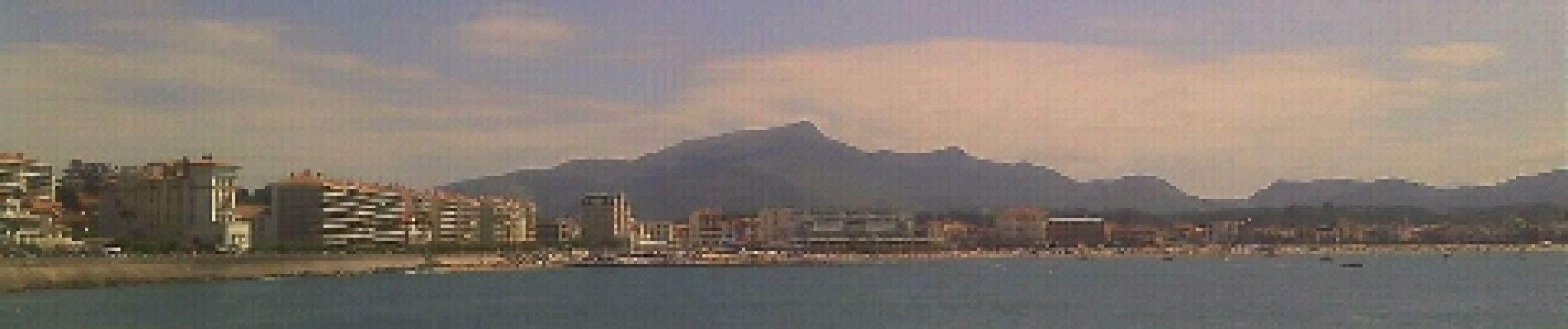
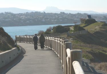
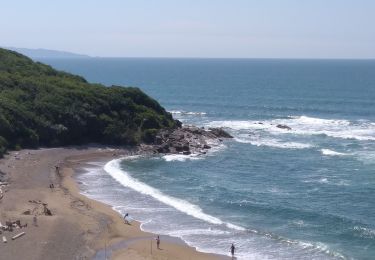
Départ de Bidart en rejoignant le sentier du littoral en direction de St Jean De luz en passant par guéthary avec de superbe vue du littoral et de chapelles.A St Jean De Luz retour en bus au point de départ.
Localisation
Pays :
France
Région :
Nouvelle-Aquitaine
Département/Province :
Pyrénées-Atlantiques
Commune :
Bidart
Localité :
Unknown
Départ:(Dec)
Départ:(UTM)
614618 ; 4811275 (30T) N.
Commentaires
Randonnées à proximité
![Randonnée Marche Biarritz - Sentier du Littoral - De Bidart à St Jean de Luz - Photo](https://media.geolcdn.com/t/375/260/ext.jpg?maxdim=2&url=https%3A%2F%2Fservices.sitytrail.com%2FGeolivesWS%2FDownloadMedia.ashx%3FTrailID%3D109248%26Media%3D3350_3.jpg)
![Marche Marche](https://static1.geolcdn.com/sitytour/trail-icons/101.png)
Sentier du Littoral - De Bidart à St Jean de Luz
Marche
Moyen
(4)
Biarritz,
Nouvelle-Aquitaine,
Pyrénées-Atlantiques,
France
![](/images/other/stat-length.png)
19 km | 24 km-effort
3h 30min
![](https://static1.geolcdn.com/siteimages/upload/files/16400158638029165_repeat_loop_refresh_sync_direction_icon.png)
Non
![Randonnée Marche Bidart - Bidart -saint jean de Luz - Photo](https://media.geolcdn.com/t/375/260/59034fde-2620-4403-8359-52383f4a85b5.jpg&format=jpg&maxdim=2)
![Marche Marche](https://static1.geolcdn.com/sitytour/trail-icons/101.png)
Bidart -saint jean de Luz
Marche
Très facile
Bidart,
Nouvelle-Aquitaine,
Pyrénées-Atlantiques,
France
![](/images/other/stat-length.png)
9,1 km | 11,6 km-effort
2h 56min
![](https://static1.geolcdn.com/siteimages/upload/files/16400158638029165_repeat_loop_refresh_sync_direction_icon.png)
Oui
![Randonnée A pied Bidart - Voie Verte de l'Uhabia - Photo](https://media.geolcdn.com/t/375/260/789f3e81-aa4b-47c3-8d2c-4ffad9febd7a.jpeg&format=jpg&maxdim=2)
![A pied A pied](https://static1.geolcdn.com/sitytour/trail-icons/100.png)
Voie Verte de l'Uhabia
A pied
Facile
Bidart,
Nouvelle-Aquitaine,
Pyrénées-Atlantiques,
France
![](/images/other/stat-length.png)
5,8 km | 6,9 km-effort
1h 34min
![](https://static1.geolcdn.com/siteimages/upload/files/16400158638029165_repeat_loop_refresh_sync_direction_icon.png)
Non
![Randonnée Marche Biarritz - Biarritz la côte , le rocher de la vierge, le port - Photo](https://media.geolcdn.com/t/375/260/5dffcc0a-b3bd-48c3-aee4-20a60099537e.jpg&format=jpg&maxdim=2)
![Marche Marche](https://static1.geolcdn.com/sitytour/trail-icons/101.png)
Biarritz la côte , le rocher de la vierge, le port
Marche
Facile
Biarritz,
Nouvelle-Aquitaine,
Pyrénées-Atlantiques,
France
![](/images/other/stat-length.png)
4,7 km | 6,4 km-effort
2h 16min
![](https://static1.geolcdn.com/siteimages/upload/files/16400158638029165_repeat_loop_refresh_sync_direction_icon.png)
Oui
![Randonnée Marche Bidart - Bidard St Jean de Luz par sentier côtier - Photo](https://media.geolcdn.com/t/375/260/14973de2-f099-4fda-8150-cd9c44165a9d.jpg&format=jpg&maxdim=2)
![Marche Marche](https://static1.geolcdn.com/sitytour/trail-icons/101.png)
Bidard St Jean de Luz par sentier côtier
Marche
Facile
Bidart,
Nouvelle-Aquitaine,
Pyrénées-Atlantiques,
France
![](/images/other/stat-length.png)
18,7 km | 24 km-effort
5h 54min
![](https://static1.geolcdn.com/siteimages/upload/files/16400158638029165_repeat_loop_refresh_sync_direction_icon.png)
Oui
![Randonnée V.T.T. Bidart - 05 - Bidart Ascain - Photo](https://media.geolcdn.com/t/375/260/ext.jpg?maxdim=2&url=https%3A%2F%2Fservices.sitytrail.com%2FGeolivesWS%2FDownloadMedia.ashx%3FTrailID%3D213296%26Media%3D6bb1549a-e52f-40f6-8671-3a0a4f192bce.jpg)
![V.T.T. V.T.T.](https://static1.geolcdn.com/sitytour/trail-icons/202.png)
05 - Bidart Ascain
V.T.T.
Difficile
Bidart,
Nouvelle-Aquitaine,
Pyrénées-Atlantiques,
France
![](/images/other/stat-length.png)
38 km | 47 km-effort
3h 30min
![](https://static1.geolcdn.com/siteimages/upload/files/16400158638029165_repeat_loop_refresh_sync_direction_icon.png)
Oui
![Randonnée V.T.T. Bidart - Bidart Ascain - Photo](https://media.geolcdn.com/t/375/260/ext.jpg?maxdim=2&url=https%3A%2F%2Fservices.sitytrail.com%2FGeolivesWS%2FDownloadMedia.ashx%3FTrailID%3D103645%26Media%3D6075_3.jpg)
![V.T.T. V.T.T.](https://static1.geolcdn.com/sitytour/trail-icons/202.png)
Bidart Ascain
V.T.T.
Difficile
(1)
Bidart,
Nouvelle-Aquitaine,
Pyrénées-Atlantiques,
France
![](/images/other/stat-length.png)
38 km | 47 km-effort
3h 30min
![](https://static1.geolcdn.com/siteimages/upload/files/16400158638029165_repeat_loop_refresh_sync_direction_icon.png)
Oui
![Randonnée Marche Saint-Jean-de-Luz - Chibau Berria a Bidart - Photo](https://media.geolcdn.com/t/375/260/3d7c1e67-41cf-41fe-9123-72edf3c939f7.jpg&format=jpg&maxdim=2)
![Marche Marche](https://static1.geolcdn.com/sitytour/trail-icons/101.png)
Chibau Berria a Bidart
Marche
Facile
Saint-Jean-de-Luz,
Nouvelle-Aquitaine,
Pyrénées-Atlantiques,
France
![](/images/other/stat-length.png)
10,3 km | 13,4 km-effort
2h 58min
![](https://static1.geolcdn.com/siteimages/upload/files/16400158638029165_repeat_loop_refresh_sync_direction_icon.png)
Non
![Randonnée Marche Saint-Jean-de-Luz - Erromardie - St jean de Luz - Cibourre - Soccoa - Photo](https://media.geolcdn.com/t/375/260/484d19d2-173f-46a7-8536-fb844b2f04ad.jpg&format=jpg&maxdim=2)
![Marche Marche](https://static1.geolcdn.com/sitytour/trail-icons/101.png)
Erromardie - St jean de Luz - Cibourre - Soccoa
Marche
Moyen
Saint-Jean-de-Luz,
Nouvelle-Aquitaine,
Pyrénées-Atlantiques,
France
![](/images/other/stat-length.png)
16,6 km | 19,4 km-effort
5h 16min
![](https://static1.geolcdn.com/siteimages/upload/files/16400158638029165_repeat_loop_refresh_sync_direction_icon.png)
Oui