23 km | 34 km-effort
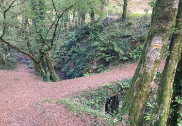
gorges de mémoire et cascade gourlastine
Baptiste.giscard
Utilisateur
Longueur
10,6 km
Altitude max
521 m
Dénivelé positif
335 m
Km-Effort
15 km
Altitude min
321 m
Dénivelé négatif
316 m
Boucle
Non
Date de création :
2021-04-04 10:11:08.183
Dernière modification :
2021-04-04 15:15:44.759
4h00
Difficulté : Difficile
Application GPS de randonnée GRATUITE
À propos
Randonnée Marche de 10,6 km à découvrir à Nouvelle-Aquitaine, Corrèze, Chenailler-Mascheix. Cette randonnée est proposée par Baptiste.giscard.
Localisation
Pays :
France
Région :
Nouvelle-Aquitaine
Département/Province :
Corrèze
Commune :
Chenailler-Mascheix
Localité :
Unknown
Départ:(Dec)
Départ:(UTM)
405732 ; 4991617 (31T) N.
Commentaires
Randonnées à proximité
monts-et-vallées-de-Lostanges-variante
V.T.T.
Difficile
(1)
Lostanges,
Nouvelle-Aquitaine,
Corrèze,
France
2h 22min
Oui
Roche de Vic depuis Mascheix
V.T.T.
Facile
(1)
Chenailler-Mascheix,
Nouvelle-Aquitaine,
Corrèze,
France
13,2 km | 17,5 km-effort
1h 8min
Oui
Marcillac
V.T.T.
Difficile
(1)
Marcillac-la-Croze,
Nouvelle-Aquitaine,
Corrèze,
France
27 km | 36 km-effort
2h 36min
Oui
Lostanges
Marche
Moyen
Lostanges,
Nouvelle-Aquitaine,
Corrèze,
France
13,9 km | 21 km-effort
4h 8min
Oui
puy d'arnac
Marche
Difficile
Puy-d'Arnac,
Nouvelle-Aquitaine,
Corrèze,
France
10,3 km | 14,1 km-effort
3h 12min
Non
menoir 2
Marche
Difficile
Ménoire,
Nouvelle-Aquitaine,
Corrèze,
France
11,3 km | 14,8 km-effort
3h 18min
Oui
Circuit Des Serpentines à Chenailler-Mascheix
Marche
Moyen
Chenailler-Mascheix,
Nouvelle-Aquitaine,
Corrèze,
France
10,2 km | 14,6 km-effort
2h 6min
Oui
Monts et vallées de Lostanges2
V.T.T.
Difficile
Lostanges,
Nouvelle-Aquitaine,
Corrèze,
France
14,1 km | 21 km-effort
4h 0min
Oui
Gorges de la Ménoire
Marche
Moyen
Chenailler-Mascheix,
Nouvelle-Aquitaine,
Corrèze,
France
9,3 km | 13,1 km-effort
2h 45min
Oui