![](/images/other/stat-length.png)
En suivant le ruisseau Metzange de Volkrange au Parc Napoléon.
Kynous
Utilisateur
![Longueur](/images/other/stat-length.png)
![Altitude max](https://static1.geolcdn.com/siteimages/upload/files/1508320355ic_sort_altitude_max_24dp.png)
![Dénivelé positif](https://static1.geolcdn.com/siteimages/upload/files/1508320355ic_sort_den_pos_24dp.png)
![Km-Effort](/images/other/stat-length.png)
![Altitude min](https://static1.geolcdn.com/siteimages/upload/files/1508320355ic_sort_altitude_min_24dp.png)
![Dénivelé négatif](https://static1.geolcdn.com/siteimages/upload/files/1508320355ic_sort_den_neg_24dp.png)
![Boucle](https://static1.geolcdn.com/siteimages/upload/files/16400158638029165_repeat_loop_refresh_sync_direction_icon.png)
![A pied](https://static1.geolcdn.com/sitytour/trail-icons/100.png)
5h50
Difficulté : Moyen
![Vélo](https://static1.geolcdn.com/sitytour/trail-icons/200.png)
2h30
Difficulté : Facile
![Scannez ce code QR pour ouvrir la randonnée dans l'application SityTrail](https://capi.geolives.com/qq0zvz2zws4bq2lad0pu/sitytour/trails/2734022/qr.png?size=200)
Application GPS de randonnée GRATUITE
À propos
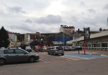
Randonnée A pied de 23 km à découvrir à Grand Est, Moselle, Thionville. Cette randonnée est proposée par Kynous.
Description
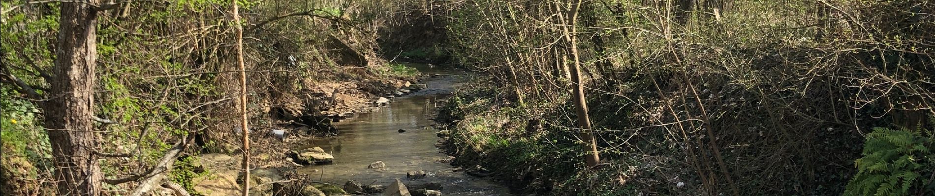
Ce tracé permet de rejoindre le parc Napoléon à Thionville centre depuis le Parc de Volkrange, à vélo ou à pied, par des pistes cyclables ou des sentiers sécurisés. Il suit le cours d'eau du Metzange jusqu'à sa confluence dans la Moselle.
Niveau facile, très peu de dénivelé. Parcours très sécurisé. Peut être fait avec des enfants.
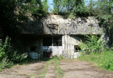
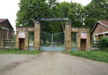
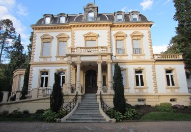
Points d'intérêts : Parc et château de Volkrange, parcours de santé de Veymerange, Parc du plan d'eau de Terville, bords de Moselle, Parc Wilson et Parc Napoléon.
Localisation
Commentaires
Randonnées à proximité
![Randonnée Vélo Thionville - promenade du dimanche - Photo](https://media.geolcdn.com/t/375/260/ext.jpg?maxdim=2&url=https%3A%2F%2Fstatic1.geolcdn.com%2Fsiteimages%2Fupload%2Ffiles%2F1524743154velo.jpg)
![Vélo Vélo](https://static1.geolcdn.com/sitytour/trail-icons/200.png)
Vélo
![](/images/other/stat-length.png)
![](https://static1.geolcdn.com/siteimages/upload/files/16400158638029165_repeat_loop_refresh_sync_direction_icon.png)
![Randonnée Marche Thionville - Thionville oeutrange - Photo](https://media.geolcdn.com/t/375/260/ext.jpg?maxdim=2&url=https%3A%2F%2Fservices.sitytrail.com%2FGeolivesWS%2FDownloadMedia.ashx%3FTrailID%3D396822%26Media%3Dfix__20150316133200.jpg)
![Marche Marche](https://static1.geolcdn.com/sitytour/trail-icons/101.png)
Marche
![](/images/other/stat-length.png)
![](https://static1.geolcdn.com/siteimages/upload/files/16400158638029165_repeat_loop_refresh_sync_direction_icon.png)
![Randonnée Marche Thionville - saint Michel 1 - Photo](https://media.geolcdn.com/t/375/260/ext.jpg?maxdim=2&url=https%3A%2F%2Fstatic1.geolcdn.com%2Fsiteimages%2Fupload%2Ffiles%2F1553511878bg_sport_marche.png)
![Marche Marche](https://static1.geolcdn.com/sitytour/trail-icons/101.png)
Marche
![](/images/other/stat-length.png)
![](https://static1.geolcdn.com/siteimages/upload/files/16400158638029165_repeat_loop_refresh_sync_direction_icon.png)
![Randonnée A pied Angevillers - Boucle d'Escherange - Photo](https://media.geolcdn.com/t/375/260/176fb65c-bd6d-455c-ad90-8e306bb68f54.jpeg&format=jpg&maxdim=2)
![A pied A pied](https://static1.geolcdn.com/sitytour/trail-icons/100.png)
A pied
![](/images/other/stat-length.png)
![](https://static1.geolcdn.com/siteimages/upload/files/16400158638029165_repeat_loop_refresh_sync_direction_icon.png)
![Randonnée A pied Thionville - Circuit de Chalet - Bois de la Côte - Photo](https://media.geolcdn.com/t/375/260/295e80af-b79e-4012-9385-ec4a1e3e8620.jpeg&format=jpg&maxdim=2)
![A pied A pied](https://static1.geolcdn.com/sitytour/trail-icons/100.png)
A pied
![](/images/other/stat-length.png)
![](https://static1.geolcdn.com/siteimages/upload/files/16400158638029165_repeat_loop_refresh_sync_direction_icon.png)
![Randonnée A pied Thionville - CV Oeutrange - Photo](https://media.geolcdn.com/t/375/260/176fb65c-bd6d-455c-ad90-8e306bb68f54.jpeg&format=jpg&maxdim=2)
![A pied A pied](https://static1.geolcdn.com/sitytour/trail-icons/100.png)
A pied
![](/images/other/stat-length.png)
![](https://static1.geolcdn.com/siteimages/upload/files/16400158638029165_repeat_loop_refresh_sync_direction_icon.png)
![Randonnée A pied Hayange - Circuit de Morlange - Photo](https://media.geolcdn.com/t/375/260/494eb21b-c4e3-4427-8699-0d13758f8333.jpeg&format=jpg&maxdim=2)
![A pied A pied](https://static1.geolcdn.com/sitytour/trail-icons/100.png)
A pied
![](/images/other/stat-length.png)
![](https://static1.geolcdn.com/siteimages/upload/files/16400158638029165_repeat_loop_refresh_sync_direction_icon.png)
![Randonnée A pied Nilvange - Circuit du Plateau d'Algrange - Photo](https://media.geolcdn.com/t/375/260/0bf296f4-662a-4226-ae61-aba60cf26949.jpeg&format=jpg&maxdim=2)
![A pied A pied](https://static1.geolcdn.com/sitytour/trail-icons/100.png)
A pied
![](/images/other/stat-length.png)
![](https://static1.geolcdn.com/siteimages/upload/files/16400158638029165_repeat_loop_refresh_sync_direction_icon.png)
![Randonnée Marche Algrange - orchis - Photo](https://media.geolcdn.com/t/375/260/c5cf822b-a3b6-40b3-a957-38f671172efe.jpg&format=jpg&maxdim=2)
![Marche Marche](https://static1.geolcdn.com/sitytour/trail-icons/101.png)