Randonnée A pied Saint-Martin-Vésubie - Col de Cerise - Lac du mercantour - Photo
 toutankhcarton
toutankhcarton

Utilisateur GUIDE

© OpenStreetMap contributors
Longueur
Longueur
4,4 km
Altitude max
Altitude max
2536 m
Dénivelé positif
Dénivelé positif
946 m
Km-Effort
Km-Effort  
13,8 km
Altitude min
Altitude min
1583 m
Dénivelé négatif
Dénivelé négatif
1 m
Boucle
Boucle
Non
Date de création :
2021-04-02 21:45:43.627
Dernière modification :
2021-04-02 21:46:31.72

(0 Avis)

A pied
A pied
3h08
Difficulté : Facile

Scannez ce code QR pour ouvrir la randonnée dans l'application SityTrail

Application GPS de randonnée GRATUITE

Logo SityTrail SityTrail

IGN / Instituts géographiques

Télécharger SityTrail sur l'App Store Télécharger SityTrail sur Google Play

Logo SityTrail SityTrail World

Le monde est à vous

Télécharger SityTrail sur l'App Store Télécharger SityTrail sur Google Play Télécharger SityTrail sur Huawei AppGallery

À propos

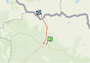
Randonnée A pied de 4,4 km à découvrir à Provence-Alpes-Côte d'Azur, Alpes-Maritimes, Saint-Martin-Vésubie. Cette randonnée est proposée par toutankhcarton.

Description

Vallée du Boréon
Lac de Cerise(2223m)
Col de Cerise(2678m)
Lac du Mercantour

Profil altimétrique

Points d'intérêt

Point d'intérêt Saint-Martin-Vésubie - Lac du Mercantour - Photo
toutankhcarton
SAINT-MARTIN-VÉSUBIE 
Point d'intérêt Valdieri - Col de Cerise - Photo
toutankhcarton
VALDIERI 
Point d'intérêt Saint-Martin-Vésubie - Lac de Cerise - Photo
toutankhcarton
SAINT-MARTIN-VÉSUBIE 

Localisation

Pays :
France
Région :
Provence-Alpes-Côte d'Azur
Département/Province :
Alpes-Maritimes
Commune :
Saint-Martin-Vésubie
Localité :
Unknown
Départ:(Dec)
Départ:(UTM)
363185 ; 4886146 (32T) N.

Randonnées à proximité

Randonnée Marche Saint-Martin-Vésubie - Lac de Trécolpas - Photo
Marche
patsure

Marche

Moyen
(2)
Saint-Martin-Vésubie, Provence-Alpes-Côte d'Azur, Alpes-Maritimes, France
13,3 km | 20 km-effort
4h 17min
Oui
Randonnée Marche Saint-Martin-Vésubie - lacs bessons - Photo
Marche
REYPatrick

Marche

Très facile
(1)
Saint-Martin-Vésubie, Provence-Alpes-Côte d'Azur, Alpes-Maritimes, France
13,1 km | 0 m-effort
7h 36min
Oui
Randonnée Marche Saint-Martin-Vésubie - Lac Ne`gre bis - Photo
Marche
kenhava

Marche

Moyen
(1)
Saint-Martin-Vésubie, Provence-Alpes-Côte d'Azur, Alpes-Maritimes, France
13,1 km | 23 km-effort
3h 42min
Oui
Randonnée A pied Saint-Martin-Vésubie - Col de Cerise - Photo
A pied
GUIDE+

A pied

Moyen
Saint-Martin-Vésubie, Provence-Alpes-Côte d'Azur, Alpes-Maritimes, France
9,7 km | 23 km-effort
5h 18min
Oui
Randonnée A pied Saint-Martin-Vésubie - Circuit des Adus - Photo
A pied
GUIDE+

A pied

Facile
Saint-Martin-Vésubie, Provence-Alpes-Côte d'Azur, Alpes-Maritimes, France
9,9 km | 18,8 km-effort
4h 16min
Oui
Randonnée A pied Saint-Martin-Vésubie - Circuit de Trécolpas - Photo
A pied
GUIDE+

A pied

Facile
Saint-Martin-Vésubie, Provence-Alpes-Côte d'Azur, Alpes-Maritimes, France
8,9 km | 15,8 km-effort
3h 35min
Oui
Randonnée A pied Valdeblore - Lac Nègre - Photo
A pied
GUIDE+

A pied

Facile
Valdeblore, Provence-Alpes-Côte d'Azur, Alpes-Maritimes, France
11,1 km | 19,6 km-effort
4h 27min
Oui
Randonnée Ski de randonnée Saint-Martin-Vésubie - Col de cerise et lac du Mercantour - Photo
Ski de randonnée
GUIDE
nadd73

Ski de randonnée

Moyen
Saint-Martin-Vésubie, Provence-Alpes-Côte d'Azur, Alpes-Maritimes, France
11,9 km | 29 km-effort
7h 39min
Oui
Randonnée Ski de randonnée Saint-Martin-Vésubie - Baisse de Pagari de Salèse - Photo
Ski de randonnée
GUIDE
nadd73

Ski de randonnée

Difficile
Saint-Martin-Vésubie, Provence-Alpes-Côte d'Azur, Alpes-Maritimes, France
10,5 km | 23 km-effort
6h 53min
Oui


Fermer
Mes abonnements