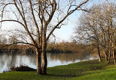
10,7 km | 11,7 km-effort
Potangis 13 km
Alain Picard
Utilisateur
Longueur
13,6 km
Altitude max
213 m
Dénivelé positif
222 m
Km-Effort
16,6 km
Altitude min
83 m
Dénivelé négatif
224 m
Boucle
Oui
Date de création :
2021-03-28 16:48:20.758
Dernière modification :
2021-03-28 16:48:59.405
3h45
Difficulté : Facile
Application GPS de randonnée GRATUITE
À propos
Randonnée A pied de 13,6 km à découvrir à Grand Est, Marne, Potangis. Cette randonnée est proposée par Alain Picard.
Localisation
Pays :
France
Région :
Grand Est
Département/Province :
Marne
Commune :
Potangis
Localité :
Unknown
Départ:(Dec)
Départ:(UTM)
547400 ; 5381858 (31U) N.
Commentaires
Randonnées à proximité
ENTRE CONFLANS SUR SEINE ET MARCILLY SUR SEINE
Marche
Moyen
Conflans-sur-Seine,
Grand Est,
Marne,
France
2h 39min
Oui
au départ de CONFLANS sur SEINE
Marche
Facile
Conflans-sur-Seine,
Grand Est,
Marne,
France
15,7 km | 17,5 km-effort
3h 17min
Non
tournée esclavolles-lurey
Marche
Facile
Esclavolles-Lurey,
Grand Est,
Marne,
France
3,8 km | 3,9 km-effort
50min
Oui
esclavolles-lurey, Périgny
Marche
Facile
Esclavolles-Lurey,
Grand Est,
Marne,
France
9,8 km | 11 km-effort
1h 58min
Oui
la celle bois de fontaine denis nuisy
Marche
Difficile
La Celle-sous-Chantemerle,
Grand Est,
Marne,
France
12,5 km | 15,5 km-effort
3h 31min
Oui
Esclavolles Esclavolles via éoliennes et Potangis
Marche
Moyen
Esclavolles-Lurey,
Grand Est,
Marne,
France
10,1 km | 11,9 km-effort
2h 36min
Oui
La Villeneuve au Châtelot, Courtavant
A pied
Facile
La Villeneuve-au-Châtelot,
Grand Est,
Aube,
France
7,4 km | 8,1 km-effort
2h 10min
Oui
esclavolles-lurey.perigny
Marche
Moyen
Esclavolles-Lurey,
Grand Est,
Marne,
France
8,7 km | 9,3 km-effort
1h 41min
Oui