![](/images/other/stat-length.png)
![Randonnée Saint-Fiacre-sur-Maine - SityTrail - 2689013 - entre-saint-fiacre-et-chaxteau-thebaud- - Photo](https://media.geolcdn.com/t/1900/400/ext.pjpeg?maxdim=2&url=https%3A%2F%2Fsecurestorage.geolives.com%2Fsitytour%2Ftrail-bg%2Fdefault.jpg)
SityTrail - 2689013 - entre-saint-fiacre-et-chaxteau-thebaud-
Bernard_FOURNIER
Utilisateur
![Longueur](/images/other/stat-length.png)
Longueur
12,6 km
![Altitude max](https://static1.geolcdn.com/siteimages/upload/files/1508320355ic_sort_altitude_max_24dp.png)
Altitude max
59 m
![Dénivelé positif](https://static1.geolcdn.com/siteimages/upload/files/1508320355ic_sort_den_pos_24dp.png)
Dénivelé positif
185 m
![Km-Effort](/images/other/stat-length.png)
Km-Effort
15 km
![Altitude min](https://static1.geolcdn.com/siteimages/upload/files/1508320355ic_sort_altitude_min_24dp.png)
Altitude min
3 m
![Dénivelé négatif](https://static1.geolcdn.com/siteimages/upload/files/1508320355ic_sort_den_neg_24dp.png)
Dénivelé négatif
185 m
![Boucle](https://static1.geolcdn.com/siteimages/upload/files/16400158638029165_repeat_loop_refresh_sync_direction_icon.png)
Boucle
Oui
Date de création :
2021-03-27 11:11:35.053
Dernière modification :
2022-04-13 16:25:56.972
![Scannez ce code QR pour ouvrir la randonnée dans l'application SityTrail](https://capi.geolives.com/qq0zvz2zws4bq2lad0pu/sitytour/trails/2723072/qr.png?size=200)
Application GPS de randonnée GRATUITE
À propos
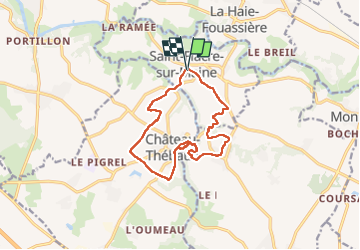
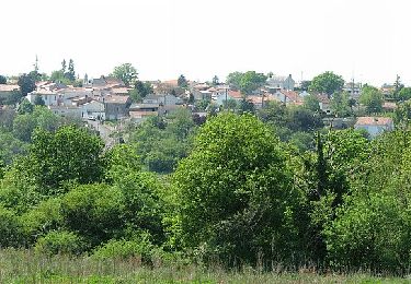
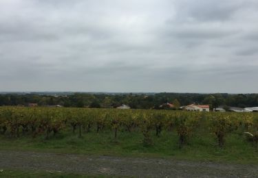
Randonnée de 12,6 km à découvrir à Pays de la Loire, Loire-Atlantique, Saint-Fiacre-sur-Maine. Cette randonnée est proposée par Bernard_FOURNIER.
Description
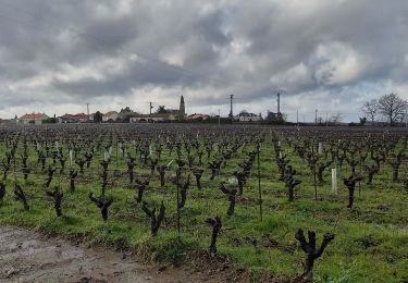
Belles randonnée essentiellement dans les vignes.
Pause déjeuner à Pont cafino en plein soleil.
Tables de picnic.
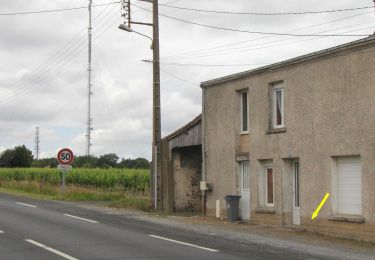
Attention, pas de marques après pont cafino, il faut avoir préparé.
Localisation
Pays :
France
Région :
Pays de la Loire
Département/Province :
Loire-Atlantique
Commune :
Saint-Fiacre-sur-Maine
Localité :
Unknown
Départ:(Dec)
Départ:(UTM)
620088 ; 5222243 (30T) N.
Commentaires
Randonnées à proximité
![Randonnée A pied Château-Thébaud - Le Bois Joly - Photo](https://media.geolcdn.com/t/375/260/506cee01-1922-4b2b-b122-5c1af244be27.jpeg&format=jpg&maxdim=2)
![A pied A pied](https://static1.geolcdn.com/sitytour/trail-icons/100.png)
Le Bois Joly
A pied
Facile
Château-Thébaud,
Pays de la Loire,
Loire-Atlantique,
France
![](/images/other/stat-length.png)
6,9 km | 8,2 km-effort
1h 51min
![](https://static1.geolcdn.com/siteimages/upload/files/16400158638029165_repeat_loop_refresh_sync_direction_icon.png)
Oui
![Randonnée A pied La Haie-Fouassière - Entre Sèvre et Côteaux - Photo](https://media.geolcdn.com/t/375/260/4e8b42dd-cce1-45ec-8683-cedd16950288.jpeg&format=jpg&maxdim=2)
![A pied A pied](https://static1.geolcdn.com/sitytour/trail-icons/100.png)
Entre Sèvre et Côteaux
A pied
Facile
La Haie-Fouassière,
Pays de la Loire,
Loire-Atlantique,
France
![](/images/other/stat-length.png)
9,3 km | 10,5 km-effort
2h 22min
![](https://static1.geolcdn.com/siteimages/upload/files/16400158638029165_repeat_loop_refresh_sync_direction_icon.png)
Oui
![Randonnée A pied Maisdon-sur-Sèvre - Soif de Nature - Photo](https://media.geolcdn.com/t/375/260/96221bb9-f267-458a-8e16-f477ffe0731a.jpeg&format=jpg&maxdim=2)
![A pied A pied](https://static1.geolcdn.com/sitytour/trail-icons/100.png)
Soif de Nature
A pied
Facile
Maisdon-sur-Sèvre,
Pays de la Loire,
Loire-Atlantique,
France
![](/images/other/stat-length.png)
14,7 km | 17,1 km-effort
3h 53min
![](https://static1.geolcdn.com/siteimages/upload/files/16400158638029165_repeat_loop_refresh_sync_direction_icon.png)
Oui
![Randonnée Marche Château-Thébaud - Château Thébaud_Le bois joli - Photo](https://media.geolcdn.com/t/375/260/ext.jpg?maxdim=2&url=https%3A%2F%2Fstatic1.geolcdn.com%2Fsiteimages%2Fupload%2Ffiles%2F1553511878bg_sport_marche.png)
![Marche Marche](https://static1.geolcdn.com/sitytour/trail-icons/101.png)
Château Thébaud_Le bois joli
Marche
Moyen
(2)
Château-Thébaud,
Pays de la Loire,
Loire-Atlantique,
France
![](/images/other/stat-length.png)
6,8 km | 8,1 km-effort
1h 46min
![](https://static1.geolcdn.com/siteimages/upload/files/16400158638029165_repeat_loop_refresh_sync_direction_icon.png)
Oui
![Randonnée Marche Maisdon-sur-Sèvre - Maisdon_Route de la soif - Photo](https://media.geolcdn.com/t/375/260/ext.jpg?maxdim=2&url=https%3A%2F%2Fstatic1.geolcdn.com%2Fsiteimages%2Fupload%2Ffiles%2F1553511878bg_sport_marche.png)
![Marche Marche](https://static1.geolcdn.com/sitytour/trail-icons/101.png)
Maisdon_Route de la soif
Marche
Moyen
(1)
Maisdon-sur-Sèvre,
Pays de la Loire,
Loire-Atlantique,
France
![](/images/other/stat-length.png)
13,8 km | 16,1 km-effort
3h 30min
![](https://static1.geolcdn.com/siteimages/upload/files/16400158638029165_repeat_loop_refresh_sync_direction_icon.png)
Oui
![Randonnée Marche Saint-Fiacre-sur-Maine - vigne - Photo](https://media.geolcdn.com/t/375/260/ext.jpg?maxdim=2&url=https%3A%2F%2Fstatic1.geolcdn.com%2Fsiteimages%2Fupload%2Ffiles%2F1553511878bg_sport_marche.png)
![Marche Marche](https://static1.geolcdn.com/sitytour/trail-icons/101.png)
vigne
Marche
Très facile
(1)
Saint-Fiacre-sur-Maine,
Pays de la Loire,
Loire-Atlantique,
France
![](/images/other/stat-length.png)
19,5 km | 23 km-effort
3h 41min
![](https://static1.geolcdn.com/siteimages/upload/files/16400158638029165_repeat_loop_refresh_sync_direction_icon.png)
Non
![Randonnée V.T.T. Monnières - Sèvre et Maine - Monnières - Photo](https://media.geolcdn.com/t/375/260/ext.jpg?maxdim=2&url=https%3A%2F%2Fstatic1.geolcdn.com%2Fsiteimages%2Fupload%2Ffiles%2F1524743154velo.jpg)
![V.T.T. V.T.T.](https://static1.geolcdn.com/sitytour/trail-icons/202.png)
Sèvre et Maine - Monnières
V.T.T.
Difficile
(1)
Monnières,
Pays de la Loire,
Loire-Atlantique,
France
![](/images/other/stat-length.png)
34 km | 39 km-effort
2h 30min
![](https://static1.geolcdn.com/siteimages/upload/files/16400158638029165_repeat_loop_refresh_sync_direction_icon.png)
Oui
![Randonnée Marche Vertou - vertou Monnieres - Photo](https://media.geolcdn.com/t/375/260/5afb0b2f-6792-4c94-a2ff-706453336241.jpg&format=jpg&maxdim=2)
![Marche Marche](https://static1.geolcdn.com/sitytour/trail-icons/101.png)
vertou Monnieres
Marche
Difficile
Vertou,
Pays de la Loire,
Loire-Atlantique,
France
![](/images/other/stat-length.png)
13,1 km | 15,2 km-effort
3h 45min
![](https://static1.geolcdn.com/siteimages/upload/files/16400158638029165_repeat_loop_refresh_sync_direction_icon.png)
Non
![Randonnée Autre activité Monnières - Monnieres (44) - Photo](https://media.geolcdn.com/t/375/260/ext.jpg?maxdim=2&url=https%3A%2F%2Fservices.sitytrail.com%2FGeolivesWS%2FDownloadMedia.ashx%3FTrailID%3D840613%26Media%3D20171005163614.jpg)
![Autre activité Autre activité](https://static1.geolcdn.com/sitytour/trail-icons/900.png)
Monnieres (44)
Autre activité
Facile
Monnières,
Pays de la Loire,
Loire-Atlantique,
France
![](/images/other/stat-length.png)
8 km | 9,1 km-effort
2h 2min
![](https://static1.geolcdn.com/siteimages/upload/files/16400158638029165_repeat_loop_refresh_sync_direction_icon.png)
Oui