


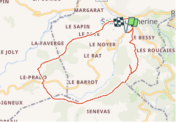

16,8 km | 24 km-effort


Utilisateur


Application GPS de randonnée GRATUITE
 SityTrail
IGN / Instituts géographiques
SityTrail World
Le monde est à vous
Randonnée Trail de 9,4 km à découvrir à Auvergne-Rhône-Alpes, Rhône, Sainte-Catherine. Cette randonnée est proposée par Clubléorando.
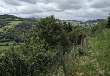
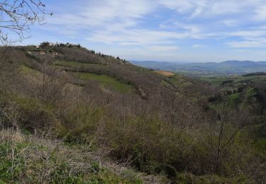
Belle ballade en boucle au départ de Ste Catherine puis montée sur les hauteurs des monts du Lyonnais en allant au point de vue de la croix du Châtelard et retour en traversant le bois des Feuilles

Marche

Marche

Marche

Marche

Marche

Marche

Marche
Marche
Marche