


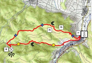
11,1 km | 16,6 km-effort


Utilisateur


Application GPS de randonnée GRATUITE
 SityTrail
IGN / Instituts géographiques
SityTrail World
Le monde est à vous
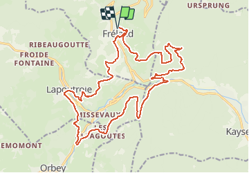
Randonnée V.T.T. de 23 km à découvrir à Grand Est, Haut-Rhin, Fréland. Cette randonnée est proposée par duchaine.nicolas.
Via Gare de Fréland, retour par les Allagouttes, le chemin du Baa, Lapoutroie et aprcours santé

Marche

Marche

Marche

Randonnée équestre

Randonnée équestre

Randonnée équestre

Marche

Marche
Marche