![](/images/other/stat-length.png)
![Randonnée Marche Créhen - St Jacut - île Ebihens - Photo](https://media.geolcdn.com/t/1900/400/3210441b-681a-44fd-a32e-b60ec43af4b1.jpg&format=pjpeg&maxdim=2)
St Jacut - île Ebihens
meunier.ph.
Utilisateur
![Longueur](/images/other/stat-length.png)
Longueur
17,9 km
![Altitude max](https://static1.geolcdn.com/siteimages/upload/files/1508320355ic_sort_altitude_max_24dp.png)
Altitude max
44 m
![Dénivelé positif](https://static1.geolcdn.com/siteimages/upload/files/1508320355ic_sort_den_pos_24dp.png)
Dénivelé positif
194 m
![Km-Effort](/images/other/stat-length.png)
Km-Effort
21 km
![Altitude min](https://static1.geolcdn.com/siteimages/upload/files/1508320355ic_sort_altitude_min_24dp.png)
Altitude min
-3 m
![Dénivelé négatif](https://static1.geolcdn.com/siteimages/upload/files/1508320355ic_sort_den_neg_24dp.png)
Dénivelé négatif
199 m
![Boucle](https://static1.geolcdn.com/siteimages/upload/files/16400158638029165_repeat_loop_refresh_sync_direction_icon.png)
Boucle
Oui
Date de création :
2021-03-15 09:36:11.167
Dernière modification :
2021-03-15 18:37:55.009
![Marche](https://static1.geolcdn.com/sitytour/trail-icons/101.png)
4h15
Difficulté : Facile
![Scannez ce code QR pour ouvrir la randonnée dans l'application SityTrail](https://capi.geolives.com/qq0zvz2zws4bq2lad0pu/sitytour/trails/2708618/qr.png?size=200)
Application GPS de randonnée GRATUITE
À propos
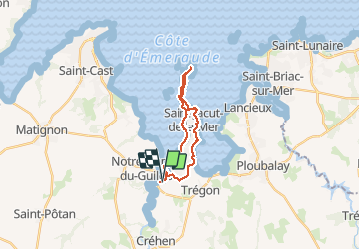
Randonnée Marche de 17,9 km à découvrir à Bretagne, Côtes-d'Armor, Créhen. Cette randonnée est proposée par meunier.ph..
Description
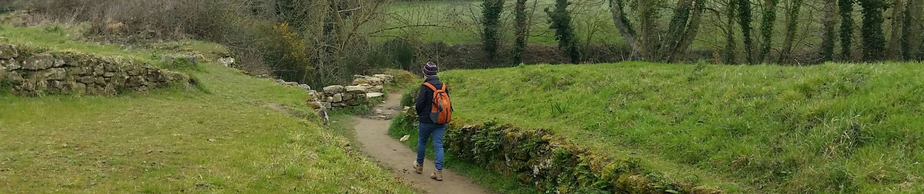
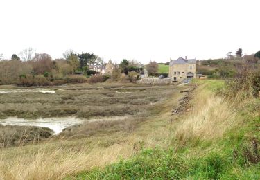
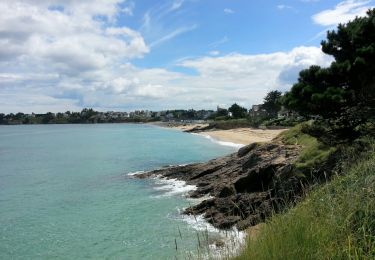
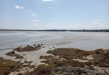
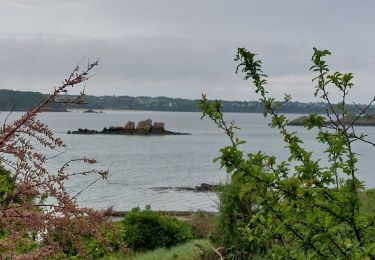
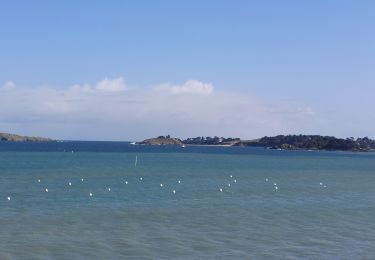
Parcours agréable où il est possible d'alterner entre le sentier côtier,serpentant parmi la végétation par endroits, et la plage. L'accès à l'île Ebihens est possible à marée basse. Prévoir l'heure de retour depuis cette île pour éviter un bivouac...
Localisation
Pays :
France
Région :
Bretagne
Département/Province :
Côtes-d'Armor
Commune :
Créhen
Localité :
Unknown
Départ:(Dec)
Départ:(UTM)
558390 ; 5380281 (30U) N.
Commentaires
Randonnées à proximité
![Randonnée V.T.T. Beaussais-sur-Mer - Circuit du Plessix - Plessix-Baluçon - Photo](https://media.geolcdn.com/t/375/260/ext.jpg?maxdim=2&url=https%3A%2F%2Fservices.sitytrail.com%2FGeolivesWS%2FDownloadMedia.ashx%3FTrailID%3D112349%26Media%3D10425_3.jpg)
![V.T.T. V.T.T.](https://static1.geolcdn.com/sitytour/trail-icons/202.png)
Circuit du Plessix - Plessix-Baluçon
V.T.T.
Facile
(1)
Beaussais-sur-Mer,
Bretagne,
Côtes-d'Armor,
France
![](/images/other/stat-length.png)
10,5 km | 12 km-effort
45min
![](https://static1.geolcdn.com/siteimages/upload/files/16400158638029165_repeat_loop_refresh_sync_direction_icon.png)
Oui
![Randonnée A pied Lancieux - Chemin des Poissoniers - Photo](https://media.geolcdn.com/t/375/260/5766fb3e-1c2e-4f5d-a7d3-e9d598898327.jpeg&format=jpg&maxdim=2)
![A pied A pied](https://static1.geolcdn.com/sitytour/trail-icons/100.png)
Chemin des Poissoniers
A pied
Facile
Lancieux,
Bretagne,
Côtes-d'Armor,
France
![](/images/other/stat-length.png)
7,3 km | 8,3 km-effort
1h 52min
![](https://static1.geolcdn.com/siteimages/upload/files/16400158638029165_repeat_loop_refresh_sync_direction_icon.png)
Oui
![Randonnée A pied Lancieux - Autour de Lancieux - Photo](https://media.geolcdn.com/t/375/260/18d11f25-421d-4ea3-b01f-45ea981b4922.jpeg&format=jpg&maxdim=2)
![A pied A pied](https://static1.geolcdn.com/sitytour/trail-icons/100.png)
Autour de Lancieux
A pied
Facile
Lancieux,
Bretagne,
Côtes-d'Armor,
France
![](/images/other/stat-length.png)
10,9 km | 12,2 km-effort
2h 45min
![](https://static1.geolcdn.com/siteimages/upload/files/16400158638029165_repeat_loop_refresh_sync_direction_icon.png)
Oui
![Randonnée Marche Lancieux - Lancieux - 9.5km 85m 2h40 - 2017 06 29 - Photo](https://media.geolcdn.com/t/375/260/b4339de9-72ed-4334-a389-424f42d7d0bb.jpg&format=jpg&maxdim=2)
![Marche Marche](https://static1.geolcdn.com/sitytour/trail-icons/101.png)
Lancieux - 9.5km 85m 2h40 - 2017 06 29
Marche
Très facile
Lancieux,
Bretagne,
Côtes-d'Armor,
France
![](/images/other/stat-length.png)
9,5 km | 10,7 km-effort
2h 40min
![](https://static1.geolcdn.com/siteimages/upload/files/16400158638029165_repeat_loop_refresh_sync_direction_icon.png)
Oui
![Randonnée Marche Lancieux - lancieux - Photo](https://media.geolcdn.com/t/375/260/ext.jpg?maxdim=2&url=https%3A%2F%2Fstatic1.geolcdn.com%2Fsiteimages%2Fupload%2Ffiles%2F1553511878bg_sport_marche.png)
![Marche Marche](https://static1.geolcdn.com/sitytour/trail-icons/101.png)
lancieux
Marche
Facile
(2)
Lancieux,
Bretagne,
Côtes-d'Armor,
France
![](/images/other/stat-length.png)
11,7 km | 13 km-effort
2h 47min
![](https://static1.geolcdn.com/siteimages/upload/files/16400158638029165_repeat_loop_refresh_sync_direction_icon.png)
Oui
![Randonnée Marche Saint-Jacut-de-la-Mer - St Jacut de la Mer 7.7.23 - Photo](https://media.geolcdn.com/t/375/260/7c37f328-93e1-4d4a-83bf-ec0b125bb7cd.jpg&format=jpg&maxdim=2)
![Marche Marche](https://static1.geolcdn.com/sitytour/trail-icons/101.png)
St Jacut de la Mer 7.7.23
Marche
Facile
Saint-Jacut-de-la-Mer,
Bretagne,
Côtes-d'Armor,
France
![](/images/other/stat-length.png)
10,2 km | 11,8 km-effort
3h 20min
![](https://static1.geolcdn.com/siteimages/upload/files/16400158638029165_repeat_loop_refresh_sync_direction_icon.png)
Oui
![Randonnée Marche Saint-Jacut-de-la-Mer - GR_34_BC_09_St-Jacut-De-La-Mer_St-Cast-Le-Guildo_20230506 - Photo](https://media.geolcdn.com/t/375/260/a6421446-397c-40f2-8ef8-6251eb55e355.jpg&format=jpg&maxdim=2)
![Marche Marche](https://static1.geolcdn.com/sitytour/trail-icons/101.png)
GR_34_BC_09_St-Jacut-De-La-Mer_St-Cast-Le-Guildo_20230506
Marche
Facile
Saint-Jacut-de-la-Mer,
Bretagne,
Côtes-d'Armor,
France
![](/images/other/stat-length.png)
18,4 km | 23 km-effort
5h 9min
![](https://static1.geolcdn.com/siteimages/upload/files/16400158638029165_repeat_loop_refresh_sync_direction_icon.png)
Non
![Randonnée Marche Lancieux - GR_34_BB_08_Lancieux_St-Jacut-De-La-Mer_20230412 - Photo](https://media.geolcdn.com/t/375/260/86a0b3e1-a1c8-42ed-96fe-98d26efbe101.jpg&format=jpg&maxdim=2)
![Marche Marche](https://static1.geolcdn.com/sitytour/trail-icons/101.png)
GR_34_BB_08_Lancieux_St-Jacut-De-La-Mer_20230412
Marche
Difficile
Lancieux,
Bretagne,
Côtes-d'Armor,
France
![](/images/other/stat-length.png)
15,9 km | 17,8 km-effort
4h 2min
![](https://static1.geolcdn.com/siteimages/upload/files/16400158638029165_repeat_loop_refresh_sync_direction_icon.png)
Non
![Randonnée Marche Saint-Cast-le-Guildo - les 4 Vaux. Pen Guen - Photo](https://media.geolcdn.com/t/375/260/9c051867-9892-4ee3-a39c-78d231c8b844.jpg&format=jpg&maxdim=2)
![Marche Marche](https://static1.geolcdn.com/sitytour/trail-icons/101.png)
les 4 Vaux. Pen Guen
Marche
Moyen
Saint-Cast-le-Guildo,
Bretagne,
Côtes-d'Armor,
France
![](/images/other/stat-length.png)
6 km | 7,9 km-effort
1h 51min
![](https://static1.geolcdn.com/siteimages/upload/files/16400158638029165_repeat_loop_refresh_sync_direction_icon.png)
Oui