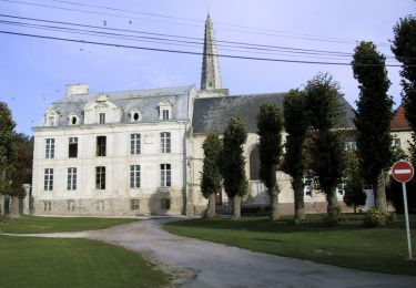
44 km | 50 km-effort
hauteville
cnockaert
Utilisateur
Longueur
61 km
Altitude max
169 m
Dénivelé positif
651 m
Km-Effort
70 km
Altitude min
78 m
Dénivelé négatif
651 m
Boucle
Oui
Date de création :
2014-12-10 00:00:00.0
Dernière modification :
2014-12-10 00:00:00.0
5h50
Difficulté : Inconnu
Application GPS de randonnée GRATUITE
À propos
Randonnée V.T.T. de 61 km à découvrir à Hauts-de-France, Pas-de-Calais, Hauteville. Cette randonnée est proposée par cnockaert.
Localisation
Pays :
France
Région :
Hauts-de-France
Département/Province :
Pas-de-Calais
Commune :
Hauteville
Localité :
Unknown
Départ:(Dec)
Départ:(UTM)
469572 ; 5569155 (31U) N.
Commentaires
Randonnées à proximité
Les 6 châteaux - Avesnes le Comte
V.T.T.
Difficile
(1)
Avesnes-le-Comte,
Hauts-de-France,
Pas-de-Calais,
France
2h 10min
Oui
Lucheux
V.T.T.
Moyen
(2)
Fosseux,
Hauts-de-France,
Pas-de-Calais,
France
44 km | 50 km-effort
3h 0min
Oui
Avesnes le Comte, Noyelle-Vion, Manin, Beaufort-Blavincourt
Marche
Moyen
Avesnes-le-Comte,
Hauts-de-France,
Pas-de-Calais,
France
10,8 km | 12,2 km-effort
2h 30min
Oui
Randonnée autour de Hauteville - Barly - Fosseux
Marche
Moyen
Hauteville,
Hauts-de-France,
Pas-de-Calais,
France
10,4 km | 11,8 km-effort
2h 0min
Oui
Montenescourt - Gouves - Wanquetin
Marche
Moyen
Montenescourt,
Hauts-de-France,
Pas-de-Calais,
France
10,6 km | 11,9 km-effort
2h 0min
Oui
Habarcq - Hermaville - Noyelette en l'eau
Marche
Moyen
Habarcq,
Hauts-de-France,
Pas-de-Calais,
France
8,9 km | 10,2 km-effort
2h 0min
Oui
Le sentier des loups - Gouy en Artois
Marche
Difficile
Gouy-en-Artois,
Hauts-de-France,
Pas-de-Calais,
France
14,2 km | 15,9 km-effort
3h 34min
Oui
Montenescourt Habarcq Hermaville Bois d'Habarcq
Marche
Moyen
Montenescourt,
Hauts-de-France,
Pas-de-Calais,
France
11 km | 12,9 km-effort
2h 0min
Oui
Montenescourt - Wanquetin - Noyellette - Habarcq - Gouves
Marche
Moyen
Montenescourt,
Hauts-de-France,
Pas-de-Calais,
France
10,1 km | 11,2 km-effort
2h 0min
Oui