![](/images/other/stat-length.png)
![Randonnée Marche Éternoz - éternoz la re-belle - Photo](https://media.geolcdn.com/t/1900/400/4a290635-7f86-44d2-ab39-79b688193c33.jpg&format=pjpeg&maxdim=2)
éternoz la re-belle
eltonnermou
Utilisateur
![Longueur](/images/other/stat-length.png)
![Altitude max](https://static1.geolcdn.com/siteimages/upload/files/1508320355ic_sort_altitude_max_24dp.png)
![Dénivelé positif](https://static1.geolcdn.com/siteimages/upload/files/1508320355ic_sort_den_pos_24dp.png)
![Km-Effort](/images/other/stat-length.png)
![Altitude min](https://static1.geolcdn.com/siteimages/upload/files/1508320355ic_sort_altitude_min_24dp.png)
![Dénivelé négatif](https://static1.geolcdn.com/siteimages/upload/files/1508320355ic_sort_den_neg_24dp.png)
![Boucle](https://static1.geolcdn.com/siteimages/upload/files/16400158638029165_repeat_loop_refresh_sync_direction_icon.png)
![Marche](https://static1.geolcdn.com/sitytour/trail-icons/101.png)
5h46
Difficulté : Difficile
![Scannez ce code QR pour ouvrir la randonnée dans l'application SityTrail](https://capi.geolives.com/qq0zvz2zws4bq2lad0pu/sitytour/trails/2686070/qr.png?size=200)
Application GPS de randonnée GRATUITE
À propos
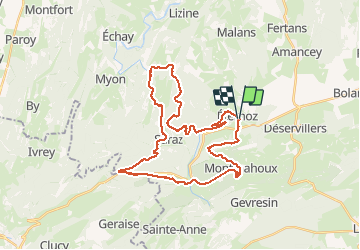
Randonnée Marche de 36 km à découvrir à Bourgogne-Franche-Comté, Doubs, Éternoz. Cette randonnée est proposée par eltonnermou.
Description
36 km réel (sans le beug dans l'enregistrement (lors de la descente sur Nans) ;
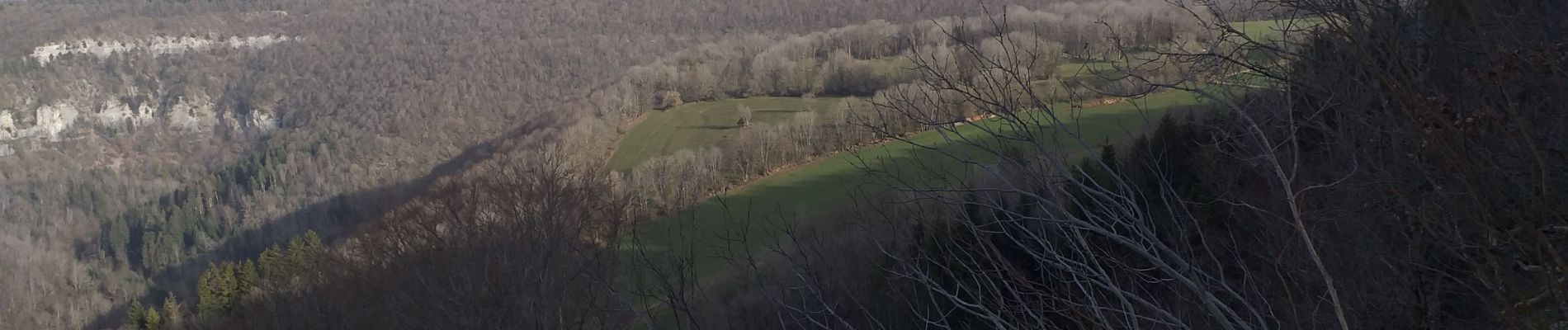
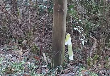
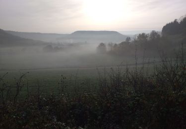
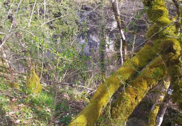
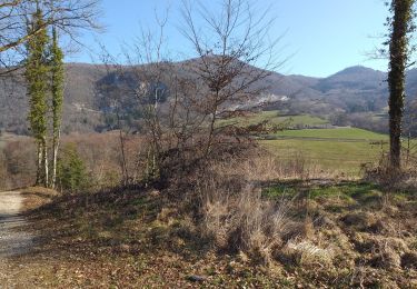
Cette très belle randonnée pédestre vous entrainera à travers différents paysages. Beaucoup de beaux points de vues sur les Alpes, le massif du Jura à la table d'orientation de Montmahoux. La descente sur Nans sous ste anne est un peu technique mais vous offre de superbes points de vue. Dans la montée en direction de Saraz (bien après avoir traversé la départementale) suivre le balisage GRP (jaune rouge) sur votre gauche, il vous mènera directement à Alaise vous évitant beaucoup de goudron .... vous ne verrez pas le belvédère de Sarraz ; la descente pour arriver à Chiprey est assez bucolique.
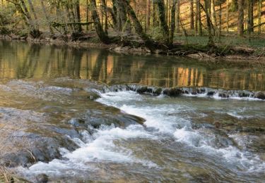
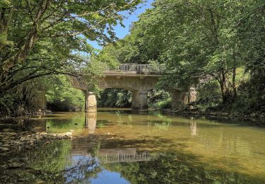
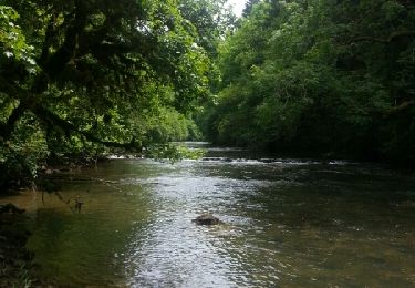
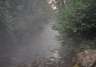
Puis vous longez les gorges le long de la magnifique rivière le Lison, sur plusieurs kilomètres (6,8) avant une remontée le long du ruisseau de Vau ; enfin possibilité de raccourcir : au km 24,3 (restera alors 3km environ) ; puis de même au km 26,1.
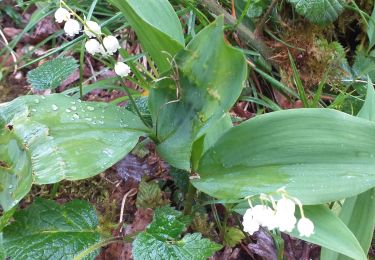
Avec un peu de chance, vous surprendrez des chamois sur les pentes escarpées du secteur. Vous pourrez apprécier la diversité de la flore et profiter d'un parcours ombragé et très agréable au bord de l'eau.
Possibilité de faire ce parcours dans l'autre sens (on commence et on fini par une descente) mais attention les montées sont plus raides.
Localisation
Commentaires
Randonnées à proximité
![Randonnée Marche Éternoz - Eternoz, lison - Photo](https://media.geolcdn.com/t/375/260/208ebe96-2cd0-48ef-ba00-81a5144b65f2.jpg&format=jpg&maxdim=2)
![Marche Marche](https://static1.geolcdn.com/sitytour/trail-icons/101.png)
Marche
![](/images/other/stat-length.png)
![](https://static1.geolcdn.com/siteimages/upload/files/16400158638029165_repeat_loop_refresh_sync_direction_icon.png)
![Randonnée Marche Éternoz - Les Gorges du Lison - Eternoz - Photo](https://media.geolcdn.com/t/375/260/ext.jpg?maxdim=2&url=https%3A%2F%2Fservices.sitytrail.com%2FGeolivesWS%2FDownloadMedia.ashx%3FTrailID%3D317678%26Media%3D16971_2.jpg)
![Marche Marche](https://static1.geolcdn.com/sitytour/trail-icons/101.png)
Marche
![](/images/other/stat-length.png)
![](https://static1.geolcdn.com/siteimages/upload/files/16400158638029165_repeat_loop_refresh_sync_direction_icon.png)
![Randonnée A pied Éternoz - Tour du Monniot - Photo](https://media.geolcdn.com/t/375/260/4f40bb2a-64fb-41b5-a821-5ab6a4ea7106.jpeg&format=jpg&maxdim=2)
![A pied A pied](https://static1.geolcdn.com/sitytour/trail-icons/100.png)
A pied
![](/images/other/stat-length.png)
![](https://static1.geolcdn.com/siteimages/upload/files/16400158638029165_repeat_loop_refresh_sync_direction_icon.png)
![Randonnée Marche Éternoz - eternoz belvédère chandelier - Photo](https://media.geolcdn.com/t/375/260/ext.jpg?maxdim=2&url=https%3A%2F%2Fservices.sitytrail.com%2FGeolivesWS%2FDownloadMedia.ashx%3FTrailID%3D310128%26Media%3Dfix__20140607143146.jpg)
![Marche Marche](https://static1.geolcdn.com/sitytour/trail-icons/101.png)
Marche
![](/images/other/stat-length.png)
![](https://static1.geolcdn.com/siteimages/upload/files/16400158638029165_repeat_loop_refresh_sync_direction_icon.png)
![Randonnée Marche Malans - bon an Malans - Photo](https://media.geolcdn.com/t/375/260/c8493cd4-41d2-4726-8c11-d8d25395d3a6.jpg&format=jpg&maxdim=2)
![Marche Marche](https://static1.geolcdn.com/sitytour/trail-icons/101.png)
Marche
![](/images/other/stat-length.png)
![](https://static1.geolcdn.com/siteimages/upload/files/16400158638029165_repeat_loop_refresh_sync_direction_icon.png)
![Randonnée Marche Lizine - lizine croix et lison - Photo](https://media.geolcdn.com/t/375/260/89ebaf4b-099d-4372-ae6f-6f2d43eb6248.jpg&format=jpg&maxdim=2)
![Marche Marche](https://static1.geolcdn.com/sitytour/trail-icons/101.png)
Marche
![](/images/other/stat-length.png)
![](https://static1.geolcdn.com/siteimages/upload/files/16400158638029165_repeat_loop_refresh_sync_direction_icon.png)
![Randonnée Marche Nans-sous-Sainte-Anne - Boucle du Lison - Photo](https://media.geolcdn.com/t/375/260/88a5dc3c-618f-436b-b7c4-4eaeac97e8a4.jpg&format=jpg&maxdim=2)
![Marche Marche](https://static1.geolcdn.com/sitytour/trail-icons/101.png)
Marche
![](/images/other/stat-length.png)
![](https://static1.geolcdn.com/siteimages/upload/files/16400158638029165_repeat_loop_refresh_sync_direction_icon.png)
![Randonnée Marche Éternoz - Coulans sur Lison - Photo](https://media.geolcdn.com/t/375/260/f76583f3-f01a-4c08-bae6-79048f4b92a9.jpg&format=jpg&maxdim=2)
![Marche Marche](https://static1.geolcdn.com/sitytour/trail-icons/101.png)
Marche
![](/images/other/stat-length.png)
![](https://static1.geolcdn.com/siteimages/upload/files/16400158638029165_repeat_loop_refresh_sync_direction_icon.png)
![Randonnée Marche Nans-sous-Sainte-Anne - Nans sous st Anne](https://media.geolcdn.com/t/375/260/b6cfc0fd-6acf-4e57-870f-4690a7cde30a.jpg&format=jpg&maxdim=2)
![Marche Marche](https://static1.geolcdn.com/sitytour/trail-icons/101.png)
Marche
![](/images/other/stat-length.png)
![](https://static1.geolcdn.com/siteimages/upload/files/16400158638029165_repeat_loop_refresh_sync_direction_icon.png)