![](/images/other/stat-length.png)
![Randonnée Marche Aix-la-Chapelle - Kornelimünster - Photo](https://media.geolcdn.com/t/1900/400/ext.pjpeg?maxdim=2&url=https%3A%2F%2Fstatic1.geolcdn.com%2Fsiteimages%2Fupload%2Ffiles%2F1553511878bg_sport_marche.png)
Kornelimünster
flip96
Utilisateur
![Longueur](/images/other/stat-length.png)
Longueur
17,1 km
![Altitude max](https://static1.geolcdn.com/siteimages/upload/files/1508320355ic_sort_altitude_max_24dp.png)
Altitude max
317 m
![Dénivelé positif](https://static1.geolcdn.com/siteimages/upload/files/1508320355ic_sort_den_pos_24dp.png)
Dénivelé positif
284 m
![Km-Effort](/images/other/stat-length.png)
Km-Effort
21 km
![Altitude min](https://static1.geolcdn.com/siteimages/upload/files/1508320355ic_sort_altitude_min_24dp.png)
Altitude min
223 m
![Dénivelé négatif](https://static1.geolcdn.com/siteimages/upload/files/1508320355ic_sort_den_neg_24dp.png)
Dénivelé négatif
285 m
![Boucle](https://static1.geolcdn.com/siteimages/upload/files/16400158638029165_repeat_loop_refresh_sync_direction_icon.png)
Boucle
Oui
Date de création :
2014-12-10 00:00:00.0
Dernière modification :
2014-12-10 00:00:00.0
![Marche](https://static1.geolcdn.com/sitytour/trail-icons/101.png)
4h27
Difficulté : Facile
![Scannez ce code QR pour ouvrir la randonnée dans l'application SityTrail](https://capi.geolives.com/qq0zvz2zws4bq2lad0pu/sitytour/trails/267759/qr.png?size=200)
Application GPS de randonnée GRATUITE
À propos
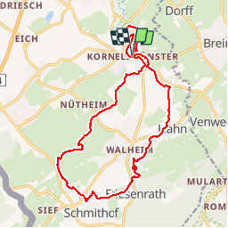
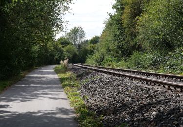
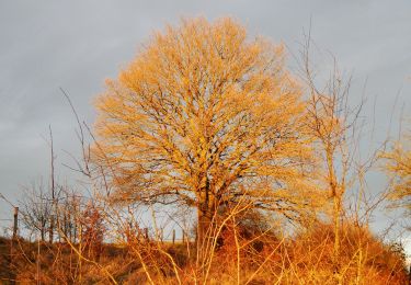
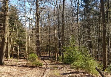
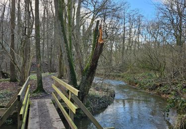
Randonnée Marche de 17,1 km à découvrir à Rhénanie-du-Nord-Westphalie, Région urbaine d'Aix-la-Chapelle, Aix-la-Chapelle. Cette randonnée est proposée par flip96.
Description
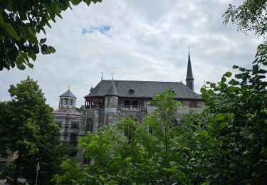
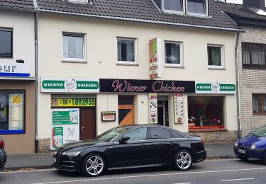
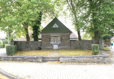
Rondwandeling vanuit Kornelimünster.
Prachtige, eenvoudige wandeling door het groen, langs Iterbach en Inde en het oude stadje Kornelismünster.
Opmerkingen? flip96@home.nl
Localisation
Pays :
Allemagne
Région :
Rhénanie-du-Nord-Westphalie
Département/Province :
Région urbaine d'Aix-la-Chapelle
Commune :
Aix-la-Chapelle
Localité :
Kornelimünster/Walheim
Départ:(Dec)
Départ:(UTM)
301139 ; 5623413 (32U) N.
Commentaires
Randonnées à proximité
![Randonnée Marche Aix-la-Chapelle - Kornelimünster - Photo](https://media.geolcdn.com/t/375/260/5caf8e34-5825-43c1-849c-6d076a59c5fa.jpg&format=jpg&maxdim=2)
![Marche Marche](https://static1.geolcdn.com/sitytour/trail-icons/101.png)
Kornelimünster
Marche
Moyen
(1)
Aix-la-Chapelle,
Rhénanie-du-Nord-Westphalie,
Région urbaine d'Aix-la-Chapelle,
Allemagne
![](/images/other/stat-length.png)
15,5 km | 19,8 km-effort
4h 30min
![](https://static1.geolcdn.com/siteimages/upload/files/16400158638029165_repeat_loop_refresh_sync_direction_icon.png)
Oui
![Randonnée Marche Raeren - Lichtenbusch - Photo](https://media.geolcdn.com/t/375/260/83311396-e126-40d9-b822-9da5f0d28323.jpg&format=jpg&maxdim=2)
![Marche Marche](https://static1.geolcdn.com/sitytour/trail-icons/101.png)
Lichtenbusch
Marche
Facile
(2)
Raeren,
Wallonie,
Liège,
Belgique
![](/images/other/stat-length.png)
14,8 km | 17 km-effort
3h 52min
![](https://static1.geolcdn.com/siteimages/upload/files/16400158638029165_repeat_loop_refresh_sync_direction_icon.png)
Oui
![Randonnée A pied Aix-la-Chapelle - Rundweg um Eilendorf - Photo](https://media.geolcdn.com/t/375/260/87580b8e-9a60-47cb-a755-acb46765e988.jpeg&format=jpg&maxdim=2)
![A pied A pied](https://static1.geolcdn.com/sitytour/trail-icons/100.png)
Rundweg um Eilendorf
A pied
Facile
Aix-la-Chapelle,
Rhénanie-du-Nord-Westphalie,
Région urbaine d'Aix-la-Chapelle,
Allemagne
![](/images/other/stat-length.png)
12,6 km | 14,4 km-effort
3h 16min
![](https://static1.geolcdn.com/siteimages/upload/files/16400158638029165_repeat_loop_refresh_sync_direction_icon.png)
Oui
![Randonnée A pied Roetgen - Rott Rundweg A3 - Photo](https://media.geolcdn.com/t/375/260/68d54c01-37fc-4225-b77f-3c3692b6e11c.jpeg&format=jpg&maxdim=2)
![A pied A pied](https://static1.geolcdn.com/sitytour/trail-icons/100.png)
Rott Rundweg A3
A pied
Facile
Roetgen,
Rhénanie-du-Nord-Westphalie,
Région urbaine d'Aix-la-Chapelle,
Allemagne
![](/images/other/stat-length.png)
4,4 km | 5,8 km-effort
1h 18min
![](https://static1.geolcdn.com/siteimages/upload/files/16400158638029165_repeat_loop_refresh_sync_direction_icon.png)
Oui
![Randonnée A pied Aix-la-Chapelle - Kalkofenweg - Photo](https://media.geolcdn.com/t/375/260/0acf23cd-5e55-42e1-90ae-3e15385deef5.jpeg&format=jpg&maxdim=2)
![A pied A pied](https://static1.geolcdn.com/sitytour/trail-icons/100.png)
Kalkofenweg
A pied
Facile
Aix-la-Chapelle,
Rhénanie-du-Nord-Westphalie,
Région urbaine d'Aix-la-Chapelle,
Allemagne
![](/images/other/stat-length.png)
6,9 km | 8,1 km-effort
1h 50min
![](https://static1.geolcdn.com/siteimages/upload/files/16400158638029165_repeat_loop_refresh_sync_direction_icon.png)
Oui
![Randonnée A pied Aix-la-Chapelle - IndeRoute - Photo](https://media.geolcdn.com/t/375/260/5b45f3d2-bacb-401d-82e5-6a813ae291fc.jpeg&format=jpg&maxdim=2)
![A pied A pied](https://static1.geolcdn.com/sitytour/trail-icons/100.png)
IndeRoute
A pied
Facile
Aix-la-Chapelle,
Rhénanie-du-Nord-Westphalie,
Région urbaine d'Aix-la-Chapelle,
Allemagne
![](/images/other/stat-length.png)
6,5 km | 8,2 km-effort
1h 52min
![](https://static1.geolcdn.com/siteimages/upload/files/16400158638029165_repeat_loop_refresh_sync_direction_icon.png)
Non
![Randonnée Marche Raeren - Lichtenbusch - Raeren - Photo](https://media.geolcdn.com/t/375/260/e5c92a16-1a79-4bf9-bcd2-21508d76292d.jpg&format=jpg&maxdim=2)
![Marche Marche](https://static1.geolcdn.com/sitytour/trail-icons/101.png)
Lichtenbusch - Raeren
Marche
Facile
Raeren,
Wallonie,
Liège,
Belgique
![](/images/other/stat-length.png)
17,5 km | 21 km-effort
4h 39min
![](https://static1.geolcdn.com/siteimages/upload/files/16400158638029165_repeat_loop_refresh_sync_direction_icon.png)
Non
![Randonnée Marche Raeren - A la découverte de Lichtenbusch 🥾 - Photo](https://media.geolcdn.com/t/375/260/d85f3b38-8057-41c0-b7d8-4d0370e979ce.jpg&format=jpg&maxdim=2)
![Marche Marche](https://static1.geolcdn.com/sitytour/trail-icons/101.png)
A la découverte de Lichtenbusch 🥾
Marche
Très facile
Raeren,
Wallonie,
Liège,
Belgique
![](/images/other/stat-length.png)
15 km | 17,2 km-effort
3h 3min
![](https://static1.geolcdn.com/siteimages/upload/files/16400158638029165_repeat_loop_refresh_sync_direction_icon.png)
Oui
![Randonnée A pied Roetgen - Mulartshütte A2 - Photo](https://media.geolcdn.com/t/375/260/88899e7d-f5cf-4aa4-8dfd-83c652889fdc.jpeg&format=jpg&maxdim=2)
![A pied A pied](https://static1.geolcdn.com/sitytour/trail-icons/100.png)
Mulartshütte A2
A pied
Facile
Roetgen,
Rhénanie-du-Nord-Westphalie,
Région urbaine d'Aix-la-Chapelle,
Allemagne
![](/images/other/stat-length.png)
5,6 km | 6,7 km-effort
1h 31min
![](https://static1.geolcdn.com/siteimages/upload/files/16400158638029165_repeat_loop_refresh_sync_direction_icon.png)
Oui