


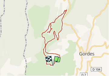

15,1 km | 25 km-effort

Utilisateur


Application GPS de randonnée GRATUITE
 SityTrail
IGN / Instituts géographiques
SityTrail World
Le monde est à vous
Randonnée Marche de 10,1 km à découvrir à Provence-Alpes-Côte d'Azur, Vaucluse, Gordes. Cette randonnée est proposée par ericf64.
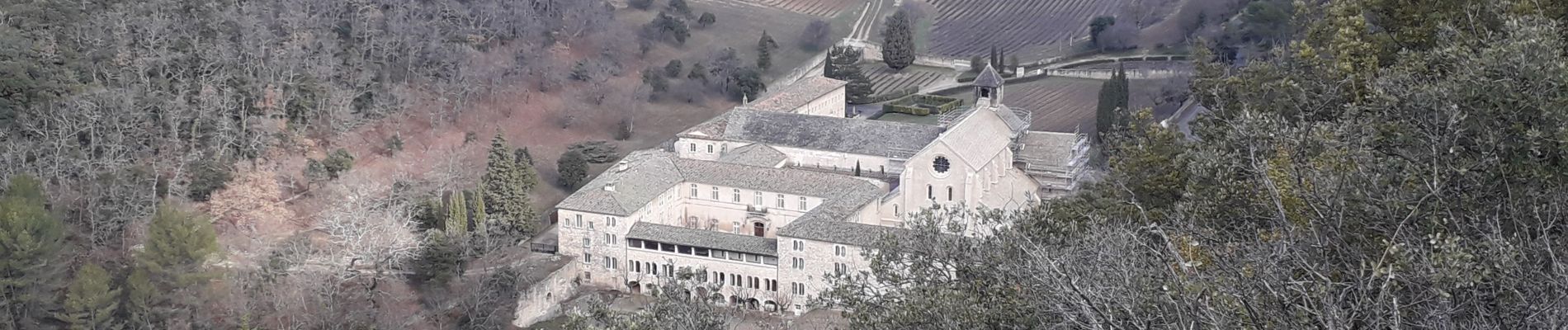
du village des bories en passant par les gorges , boucle par abbaye de Senanque. attention bien suivre le tracé plusieurs chemins se croisent en cours de route. sur le dessus du plateau ne pas aller chercher La pointe après les champs de lavande


Marche

Marche

A pied

V.T.T.

V.T.T.

Marche

A pied

Marche
Marche
Très très chouette balade, mais des chemins très escarpés par endroit et à front de falaise. Balade pour des habitués Et pas en mode "famille".