![](/images/other/stat-length.png)
![Randonnée Marche Chartres - Bois de Lèves et de Champhol - Photo](https://media.geolcdn.com/t/1900/400/ext.pjpeg?maxdim=2&url=https%3A%2F%2Fstatic1.geolcdn.com%2Fsiteimages%2Fupload%2Ffiles%2F1553511878bg_sport_marche.png)
Bois de Lèves et de Champhol
zaegelmarc
Utilisateur
![Longueur](/images/other/stat-length.png)
Longueur
16,8 km
![Altitude max](https://static1.geolcdn.com/siteimages/upload/files/1508320355ic_sort_altitude_max_24dp.png)
Altitude max
166 m
![Dénivelé positif](https://static1.geolcdn.com/siteimages/upload/files/1508320355ic_sort_den_pos_24dp.png)
Dénivelé positif
155 m
![Km-Effort](/images/other/stat-length.png)
Km-Effort
18,9 km
![Altitude min](https://static1.geolcdn.com/siteimages/upload/files/1508320355ic_sort_altitude_min_24dp.png)
Altitude min
117 m
![Dénivelé négatif](https://static1.geolcdn.com/siteimages/upload/files/1508320355ic_sort_den_neg_24dp.png)
Dénivelé négatif
157 m
![Boucle](https://static1.geolcdn.com/siteimages/upload/files/16400158638029165_repeat_loop_refresh_sync_direction_icon.png)
Boucle
Oui
Date de création :
2021-02-09 08:07:25.951
Dernière modification :
2021-02-09 11:56:10.221
![Marche](https://static1.geolcdn.com/sitytour/trail-icons/101.png)
3h48
Difficulté : Moyen
![Scannez ce code QR pour ouvrir la randonnée dans l'application SityTrail](https://capi.geolives.com/qq0zvz2zws4bq2lad0pu/sitytour/trails/2665390/qr.png?size=200)
Application GPS de randonnée GRATUITE
À propos
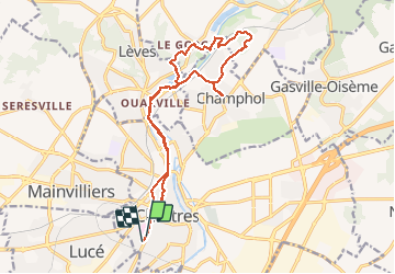
Randonnée Marche de 16,8 km à découvrir à Centre-Val de Loire, Eure-et-Loir, Chartres. Cette randonnée est proposée par zaegelmarc.
Description
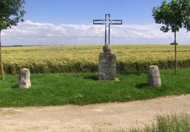
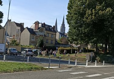
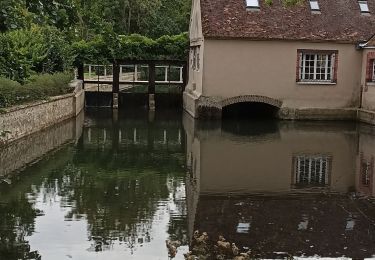
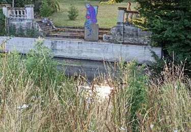
Butte des charbonniers, grands prés, Aligre, le Mousseau, bois de Lèves, moulin en travaux, dechetterie et bois de Champhol, la Barillette, le Rigeard, place Drouaise, rue Muret, boulangerie Feuillette.
Localisation
Pays :
France
Région :
Centre-Val de Loire
Département/Province :
Eure-et-Loir
Commune :
Chartres
Localité :
Unknown
Départ:(Dec)
Départ:(UTM)
387735 ; 5366286 (31U) N.
Commentaires
Randonnées à proximité
![Randonnée Marche Chartres - Parcours historique Chartres en Lumières - Photo](https://media.geolcdn.com/t/375/260/5af69804-d751-4429-87e4-2de41d93a942.jpg&format=jpg&maxdim=2)
![Marche Marche](https://static1.geolcdn.com/sitytour/trail-icons/101.png)
Parcours historique Chartres en Lumières
Marche
Facile
Chartres,
Centre-Val de Loire,
Eure-et-Loir,
France
![](/images/other/stat-length.png)
6,7 km | 7,8 km-effort
1h 42min
![](https://static1.geolcdn.com/siteimages/upload/files/16400158638029165_repeat_loop_refresh_sync_direction_icon.png)
Non
![Randonnée Marche Chartres - Parcours de la ville historique de Chartres - Photo](https://media.geolcdn.com/t/375/260/5e4a7e3c-abb5-42c8-8b44-13932b698f48.jpg&format=jpg&maxdim=2)
![Marche Marche](https://static1.geolcdn.com/sitytour/trail-icons/101.png)
Parcours de la ville historique de Chartres
Marche
Très facile
Chartres,
Centre-Val de Loire,
Eure-et-Loir,
France
![](/images/other/stat-length.png)
7,7 km | 8,9 km-effort
2h 13min
![](https://static1.geolcdn.com/siteimages/upload/files/16400158638029165_repeat_loop_refresh_sync_direction_icon.png)
Non
![Randonnée Marche Chartres - balade autour cathédrale de Chartres - Photo](https://media.geolcdn.com/t/375/260/589e1a6c-9aee-41e4-b0c1-21e1dc04e42e.jpg&format=jpg&maxdim=2)
![Marche Marche](https://static1.geolcdn.com/sitytour/trail-icons/101.png)
balade autour cathédrale de Chartres
Marche
Facile
Chartres,
Centre-Val de Loire,
Eure-et-Loir,
France
![](/images/other/stat-length.png)
5,3 km | 6,1 km-effort
2h 31min
![](https://static1.geolcdn.com/siteimages/upload/files/16400158638029165_repeat_loop_refresh_sync_direction_icon.png)
Oui
![Randonnée Marche Gasville-Oisème - proj 2020_20190716Oiseme - Photo](https://media.geolcdn.com/t/375/260/ext.jpg?maxdim=2&url=https%3A%2F%2Fstatic1.geolcdn.com%2Fsiteimages%2Fupload%2Ffiles%2F1553511878bg_sport_marche.png)
![Marche Marche](https://static1.geolcdn.com/sitytour/trail-icons/101.png)
proj 2020_20190716Oiseme
Marche
Très facile
(1)
Gasville-Oisème,
Centre-Val de Loire,
Eure-et-Loir,
France
![](/images/other/stat-length.png)
10,8 km | 12,7 km-effort
2h 35min
![](https://static1.geolcdn.com/siteimages/upload/files/16400158638029165_repeat_loop_refresh_sync_direction_icon.png)
Oui
![Randonnée V.T.T. Mainvilliers - Les planeurs de la base des planeurs d''Armenonville - Chartres - Photo](https://media.geolcdn.com/t/375/260/ext.jpg?maxdim=2&url=https%3A%2F%2Fservices.sitytrail.com%2FGeolivesWS%2FDownloadMedia.ashx%3FTrailID%3D172818%26Media%3D14251_6.jpg)
![V.T.T. V.T.T.](https://static1.geolcdn.com/sitytour/trail-icons/202.png)
Les planeurs de la base des planeurs d''Armenonville - Chartres
V.T.T.
Moyen
(1)
Mainvilliers,
Centre-Val de Loire,
Eure-et-Loir,
France
![](/images/other/stat-length.png)
53 km | 60 km-effort
4h 0min
![](https://static1.geolcdn.com/siteimages/upload/files/16400158638029165_repeat_loop_refresh_sync_direction_icon.png)
Oui
![Randonnée Marche nordique Chartres - 2024 MB Jardin d'horticulture, Lèves - Photo](https://media.geolcdn.com/t/375/260/0e4f5937-b923-45b6-86aa-21a4f2d5122d.jpg&format=jpg&maxdim=2)
![Marche nordique Marche nordique](https://static1.geolcdn.com/sitytour/trail-icons/102.png)
2024 MB Jardin d'horticulture, Lèves
Marche nordique
Facile
Chartres,
Centre-Val de Loire,
Eure-et-Loir,
France
![](/images/other/stat-length.png)
9,4 km | 10,5 km-effort
1h 55min
![](https://static1.geolcdn.com/siteimages/upload/files/16400158638029165_repeat_loop_refresh_sync_direction_icon.png)
Oui
![Randonnée Marche Chartres - 2023 Chartres tour de ville - Photo](https://media.geolcdn.com/t/375/260/dc0d9c93-9da7-45cc-94c6-fd51d08d97c6.jpg&format=jpg&maxdim=2)
![Marche Marche](https://static1.geolcdn.com/sitytour/trail-icons/101.png)
2023 Chartres tour de ville
Marche
Facile
Chartres,
Centre-Val de Loire,
Eure-et-Loir,
France
![](/images/other/stat-length.png)
11,3 km | 12,4 km-effort
1h 58min
![](https://static1.geolcdn.com/siteimages/upload/files/16400158638029165_repeat_loop_refresh_sync_direction_icon.png)
Oui
![Randonnée Marche Luisant - 2023 poney club Luisant - Photo](https://media.geolcdn.com/t/375/260/f79cf83c-4943-43a3-b8fd-6c24cb55f677.jpg&format=jpg&maxdim=2)
![Marche Marche](https://static1.geolcdn.com/sitytour/trail-icons/101.png)
2023 poney club Luisant
Marche
Difficile
Luisant,
Centre-Val de Loire,
Eure-et-Loir,
France
![](/images/other/stat-length.png)
10,8 km | 12,3 km-effort
2h 48min
![](https://static1.geolcdn.com/siteimages/upload/files/16400158638029165_repeat_loop_refresh_sync_direction_icon.png)
Oui
![Randonnée Marche nordique Chartres - Chartres Stade GP vers St prest - Photo](https://media.geolcdn.com/t/375/260/38bd2996-8114-4e41-ad68-81ce046a739f.jpg&format=jpg&maxdim=2)
![Marche nordique Marche nordique](https://static1.geolcdn.com/sitytour/trail-icons/102.png)
Chartres Stade GP vers St prest
Marche nordique
Facile
Chartres,
Centre-Val de Loire,
Eure-et-Loir,
France
![](/images/other/stat-length.png)
12,9 km | 14,4 km-effort
2h 27min
![](https://static1.geolcdn.com/siteimages/upload/files/16400158638029165_repeat_loop_refresh_sync_direction_icon.png)
Oui