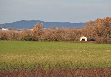
11,8 km | 14,8 km-effort
Villeneuve sur Vere via Milhavet (version 2)
tercla
Utilisateur
Longueur
14,9 km
Altitude max
308 m
Dénivelé positif
297 m
Km-Effort
18,9 km
Altitude min
234 m
Dénivelé négatif
298 m
Boucle
Oui
Date de création :
2021-02-07 09:17:46.379
Dernière modification :
2021-02-07 16:38:44.349
4h50
Difficulté : Très facile
Application GPS de randonnée GRATUITE
À propos
Randonnée Marche de 14,9 km à découvrir à Occitanie, Tarn, Villeneuve-sur-Vère. Cette randonnée est proposée par tercla.
Localisation
Pays :
France
Région :
Occitanie
Département/Province :
Tarn
Commune :
Villeneuve-sur-Vère
Localité :
Unknown
Départ:(Dec)
Départ:(UTM)
422112 ; 4872534 (31T) N.
Commentaires
Randonnées à proximité
sentier du Causse et un peu plus...
Marche nordique
Difficile
Souel,
Occitanie,
Tarn,
France
12,4 km | 16,9 km-effort
2h 49min
Oui
Boucle Villeneuve-sur-Vere/Roumanou
Marche
Très facile
Villeneuve-sur-Vère,
Occitanie,
Tarn,
France
20 km | 25 km-effort
5h 2min
Oui
cestayrols
Marche
Très facile
Cestayrols,
Occitanie,
Tarn,
France
9,9 km | 12,4 km-effort
2h 56min
Oui
cestayrols
Marche
Très facile
Cestayrols,
Occitanie,
Tarn,
France
9,9 km | 12,4 km-effort
2h 56min
Oui
De la vigne à l'olivier au départ de Capendut
Marche
Difficile
Milhavet,
Occitanie,
Tarn,
France
11,4 km | 14,2 km-effort
3h 13min
Oui
Sentier des chevaux Cestayrol
Marche nordique
Moyen
(1)
Cestayrols,
Occitanie,
Tarn,
France
9,7 km | 12,1 km-effort
2h 13min
Oui
Chemin Des Moines Castanet
Marche nordique
Moyen
Castanet,
Occitanie,
Tarn,
France
8,1 km | 10,7 km-effort
1h 53min
Oui
rando Villeneuve sur vère
Marche
Difficile
Villeneuve-sur-Vère,
Occitanie,
Tarn,
France
11,8 km | 14,2 km-effort
3h 54min
Oui