![](/images/other/stat-length.png)
![Randonnée Marche Miglos - rocher de MIGLOS - Photo](https://media.geolcdn.com/t/1900/400/50dd3b08-cf6c-423a-9a83-85e7a8a41a23.jpg&format=pjpeg&maxdim=2)
rocher de MIGLOS
chrisgps
Utilisateur
![Longueur](/images/other/stat-length.png)
Longueur
12,8 km
![Altitude max](https://static1.geolcdn.com/siteimages/upload/files/1508320355ic_sort_altitude_max_24dp.png)
Altitude max
1698 m
![Dénivelé positif](https://static1.geolcdn.com/siteimages/upload/files/1508320355ic_sort_den_pos_24dp.png)
Dénivelé positif
822 m
![Km-Effort](/images/other/stat-length.png)
Km-Effort
24 km
![Altitude min](https://static1.geolcdn.com/siteimages/upload/files/1508320355ic_sort_altitude_min_24dp.png)
Altitude min
883 m
![Dénivelé négatif](https://static1.geolcdn.com/siteimages/upload/files/1508320355ic_sort_den_neg_24dp.png)
Dénivelé négatif
823 m
![Boucle](https://static1.geolcdn.com/siteimages/upload/files/16400158638029165_repeat_loop_refresh_sync_direction_icon.png)
Boucle
Oui
Date de création :
2021-02-07 07:31:30.038
Dernière modification :
2021-02-08 10:16:50.021
![Marche](https://static1.geolcdn.com/sitytour/trail-icons/101.png)
6h50
Difficulté : Moyen
![Scannez ce code QR pour ouvrir la randonnée dans l'application SityTrail](https://capi.geolives.com/qq0zvz2zws4bq2lad0pu/sitytour/trails/2663422/qr.png?size=200)
Application GPS de randonnée GRATUITE
À propos
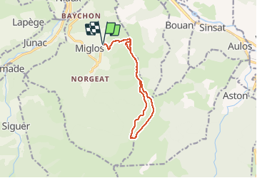
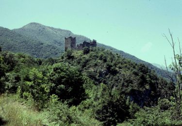
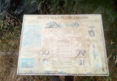
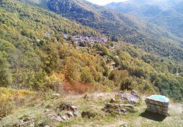
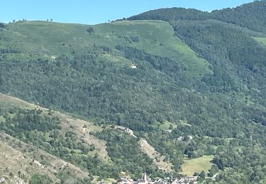
Randonnée Marche de 12,8 km à découvrir à Occitanie, Ariège, Miglos. Cette randonnée est proposée par chrisgps.
Description
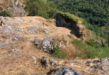
Montée par le cap et la crête de la Lesse de Bialac.
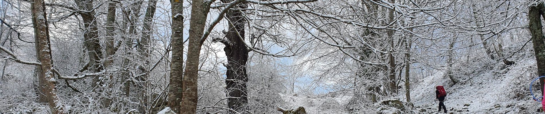
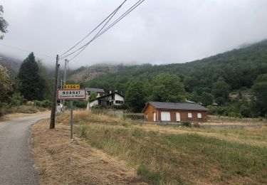
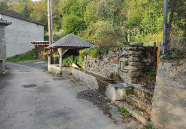
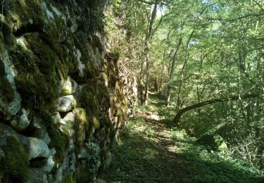
Redescente à Norrat par la piste jusqu'au col de Larnat. A partir de là, Même chemin que la montée par le ravin du Correc (très "humide" et boueux)
Localisation
Pays :
France
Région :
Occitanie
Département/Province :
Ariège
Commune :
Miglos
Localité :
Unknown
Départ:(Dec)
Départ:(UTM)
386188 ; 4738697 (31T) N.
Commentaires
Randonnées à proximité
![Randonnée Vélo électrique Niaux - Niaux - Photo](https://media.geolcdn.com/t/375/260/2925b5db-f18d-4157-bbef-94a57335fc75.jpg&format=jpg&maxdim=2)
![Vélo électrique Vélo électrique](https://static1.geolcdn.com/sitytour/trail-icons/205.png)
![Randonnée Vélo électrique Niaux - Château Miglos - Photo](https://media.geolcdn.com/t/375/260/8bba2701-86a9-409d-bc1b-998f1da97a1d.jpg&format=jpg&maxdim=2)
![Vélo électrique Vélo électrique](https://static1.geolcdn.com/sitytour/trail-icons/205.png)
Château Miglos
Vélo électrique
Très facile
Niaux,
Occitanie,
Ariège,
France
![](/images/other/stat-length.png)
8,1 km | 11 km-effort
45min
![](https://static1.geolcdn.com/siteimages/upload/files/16400158638029165_repeat_loop_refresh_sync_direction_icon.png)
Non
![Randonnée A pied Lapège - Lapège et Pladetis - Photo](https://media.geolcdn.com/t/375/260/acf32a31-72a6-4e31-a909-32a8fa5a01b2.jpeg&format=jpg&maxdim=2)
![A pied A pied](https://static1.geolcdn.com/sitytour/trail-icons/100.png)
Lapège et Pladetis
A pied
Facile
Lapège,
Occitanie,
Ariège,
France
![](/images/other/stat-length.png)
10,1 km | 18,8 km-effort
4h 16min
![](https://static1.geolcdn.com/siteimages/upload/files/16400158638029165_repeat_loop_refresh_sync_direction_icon.png)
Non
![Randonnée Marche Larnat - Cap de la Lesse - Photo](https://media.geolcdn.com/t/375/260/92ac1c0a-3485-447b-b2e9-0e186b2c8c4a.jpg&format=jpg&maxdim=2)
![Marche Marche](https://static1.geolcdn.com/sitytour/trail-icons/101.png)
![Randonnée Marche Capoulet-et-Junac - Le Vicdessos par Illié - Photo](https://media.geolcdn.com/t/375/260/ca761c83-3387-4b8c-a324-b7eee82e1103.jpg&format=jpg&maxdim=2)
![Marche Marche](https://static1.geolcdn.com/sitytour/trail-icons/101.png)
Le Vicdessos par Illié
Marche
Moyen
Capoulet-et-Junac,
Occitanie,
Ariège,
France
![](/images/other/stat-length.png)
14,3 km | 24 km-effort
5h 52min
![](https://static1.geolcdn.com/siteimages/upload/files/16400158638029165_repeat_loop_refresh_sync_direction_icon.png)
Oui
![Randonnée Marche Larnat - Cap de la lesse - Photo](https://media.geolcdn.com/t/375/260/ext.jpg?maxdim=2&url=https%3A%2F%2Fstatic1.geolcdn.com%2Fsiteimages%2Fupload%2Ffiles%2F1553511878bg_sport_marche.png)
![Marche Marche](https://static1.geolcdn.com/sitytour/trail-icons/101.png)
Cap de la lesse
Marche
Difficile
(1)
Larnat,
Occitanie,
Ariège,
France
![](/images/other/stat-length.png)
14,8 km | 23 km-effort
4h 42min
![](https://static1.geolcdn.com/siteimages/upload/files/16400158638029165_repeat_loop_refresh_sync_direction_icon.png)
Oui
![Randonnée Marche Niaux - Niaux - Photo](https://media.geolcdn.com/t/375/260/204f7a14-8f48-445f-8259-da3afe3dc7c2.jpg&format=jpg&maxdim=2)
![Marche Marche](https://static1.geolcdn.com/sitytour/trail-icons/101.png)
![Randonnée Marche Capoulet-et-Junac - Tour de la bouiche de Gesties - Photo](https://media.geolcdn.com/t/375/260/ba0a2fd5-5f69-46ff-b270-5e49916fe0c2.jpg&format=jpg&maxdim=2)
![Marche Marche](https://static1.geolcdn.com/sitytour/trail-icons/101.png)
Tour de la bouiche de Gesties
Marche
Difficile
Capoulet-et-Junac,
Occitanie,
Ariège,
France
![](/images/other/stat-length.png)
17,3 km | 0 m-effort
7h 40min
![](https://static1.geolcdn.com/siteimages/upload/files/16400158638029165_repeat_loop_refresh_sync_direction_icon.png)
Oui
![Randonnée sport Niaux - 2024_07_22_petit tour après midi - Photo](https://media.geolcdn.com/t/375/260/728d3417-7826-4ef4-9022-901cb9a28592.jpg&format=jpg&maxdim=2)
2024_07_22_petit tour après midi
sport
Très facile
Niaux,
Occitanie,
Ariège,
France
![](/images/other/stat-length.png)
12,6 km | 18,8 km-effort
Inconnu
![](https://static1.geolcdn.com/siteimages/upload/files/16400158638029165_repeat_loop_refresh_sync_direction_icon.png)
Oui