


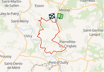

25 km | 34 km-effort


Utilisateur


Application GPS de randonnée GRATUITE
 SityTrail
IGN / Instituts géographiques
SityTrail World
Le monde est à vous
Randonnée V.T.T. de 25 km à découvrir à Normandie, Calvados, Donnay. Cette randonnée est proposée par albers.
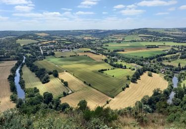
belle rando beau panorama au départ. De bien belle descentes certaine un peu technique, et surtout et évidemment des montées..... de vaches!!! c'est la Suisse Normande.

V.T.T.


A pied

A pied
A pied

A pied

A pied
Marche nordique