Randonnée V.T.T. Virton - Fourneau Marchand I  -  Balade_VTT_26kms - Photo

Fourneau Marchand I - Balade_VTT_26kms

 Pascal L
Pascal L

Utilisateur

© OpenStreetMap contributors
Longueur
Longueur
26 km
Altitude max
Altitude max
360 m
Dénivelé positif
Dénivelé positif
445 m
Km-Effort
Km-Effort  
32 km
Altitude min
Altitude min
209 m
Dénivelé négatif
Dénivelé négatif
444 m
Boucle
Boucle
Oui
Date de création :
2021-01-24 14:46:36.506
Dernière modification :
2022-11-05 12:04:05.149

(0 Avis)

V.T.T.
V.T.T.
2h32
Difficulté : Moyen

Scannez ce code QR pour ouvrir la randonnée dans l'application SityTrail

Application GPS de randonnée GRATUITE

Logo SityTrail SityTrail

IGN / Instituts géographiques

Télécharger SityTrail sur l'App Store Télécharger SityTrail sur Google Play

Logo SityTrail SityTrail World

Le monde est à vous

Télécharger SityTrail sur l'App Store Télécharger SityTrail sur Google Play Télécharger SityTrail sur Huawei AppGallery

À propos

Randonnée V.T.T. de 26 km à découvrir à Wallonie, Luxembourg, Virton. Cette randonnée est proposée par Pascal L.

Description

Départ/Retour: Virton (Delhaize)
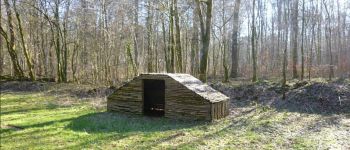
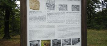
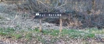
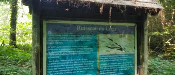
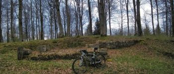
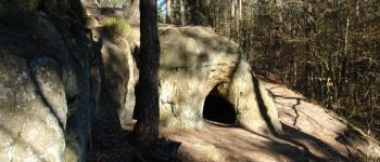
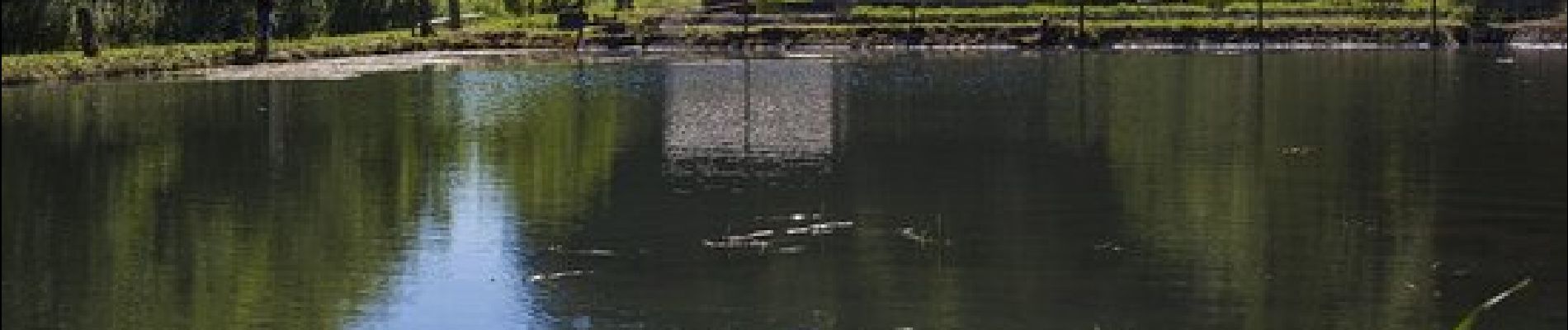
Endroits de passage : Pierrard (Institut des Arts et Métiers), Ravel (ligne 155), Ethe, Ravel (Laclaireau), Ourdon (Ferme de Bar), Bois de l’Acquêt, le Fourneau Marchand et sa pisciculture, Huombois (attention : chiens en liberté !), Haut de la Casquette (Bois de Sainte-Marie), Ruisseau de Hambressart, Bois de Robelmont, Robelmont,

Ref.
- https://www.facebook.com/pecheriefourneaumarchand/
- https://www.facebook.com/PiscicultureduFourneauMarchand/
- https://www.sh-opeditions.com/blog/a-la-pecherie-du-fourneau-marchand
- https://ravel.wallonie.be/home/itineraires/local/ligne-155.html
- https://www.fermedebar.be/

Vidéo:  https://vimeo.com/514669397

(2021.01.24)        

Profil altimétrique

Photos

31 photos au total. Cliquez sur une photo pour les afficher toutes dans la galerie.

Points d'intérêt

Point d'intérêt Virton - Pas Bayard à Virton - Photo
Pascal L
Point d'intérêt Virton - Ruisseau du Cron - Photo
Pascal L
Point d'intérêt Virton - Trou des fées - Photo
Pascal L

Localisation

Pays :
Belgique
Région :
Wallonie
Département/Province :
Luxembourg
Commune :
Virton
Localité :
Virton
Départ:(UTM)
683793 ; 5494040 (31U) N.

Randonnées à proximité

Randonnée Marche Virton - RB-Lu-17_Ethe_via-var-1-et-2-et-3 - Photo
Marche
PRO

Marche

Très facile
(3)
Virton, Wallonie, Luxembourg, Belgique
29 km | 35 km-effort
7h 33min
Oui
Randonnée V.T.T. Virton - Autour de Ethe  -  Balade_VTT_20kms - Photo
V.T.T.
Pascal L

V.T.T.

Facile
(1)
Virton, Wallonie, Luxembourg, Belgique
21 km | 26 km-effort
1h 40min
Oui
Randonnée Marche Virton - GAUME Balade  naturelle et historique - Photo
Marche
julucasi

Marche

Très facile
(1)
Virton, Wallonie, Luxembourg, Belgique
5,2 km | 6,8 km-effort
1h 16min
Oui
Randonnée A pied Virton - La Bajocienne - Photo
A pied
GUIDE+

A pied

Facile
(1)
Virton, Wallonie, Luxembourg, Belgique
11 km | 14,5 km-effort
3h 17min
Oui
Randonnée A pied Virton - Chenois-Latour Boucle agricole et touristique - Entre villages, pommes et petits fruits - Photo
A pied
GUIDE
DUPONT Rita

A pied

Facile
Virton, Wallonie, Luxembourg, Belgique
6,4 km | 7,7 km-effort
1h 45min
Oui
Randonnée Marche Virton - RB-Lu-17_Ethe_via-racc - Photo
Marche
PRO

Marche

Très facile
Virton, Wallonie, Luxembourg, Belgique
15,6 km | 19,3 km-effort
4h 8min
Oui
Randonnée Marche Virton - RB-Lu-17_Ethe - Photo
Marche
PRO

Marche

Très facile
Virton, Wallonie, Luxembourg, Belgique
22 km | 28 km-effort
5h 55min
Oui
Randonnée Cheval Rouvroy - rallye 2014 - Photo
Cheval
christianegabriel

Cheval

Moyen
(1)
Rouvroy, Wallonie, Luxembourg, Belgique
26 km | 32 km-effort
4h 1min
Oui
Randonnée V.T.T. Virton - Autour de Tintigny  -  Balade_VTT_54Kms - Photo
V.T.T.
Pascal L

V.T.T.

Très difficile
Virton, Wallonie, Luxembourg, Belgique
54 km | 64 km-effort
4h 25min
Oui


Fermer
Mes abonnements