


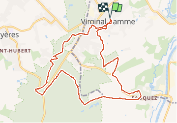


17,1 km | 22 km-effort

Utilisateur


Application GPS de randonnée GRATUITE
 SityTrail
IGN / Instituts géographiques
SityTrail World
Le monde est à vous
Randonnée Marche de 11,1 km à découvrir à Wallonie, Brabant wallon, Ittre. Cette randonnée est proposée par Michele Vercauteren.
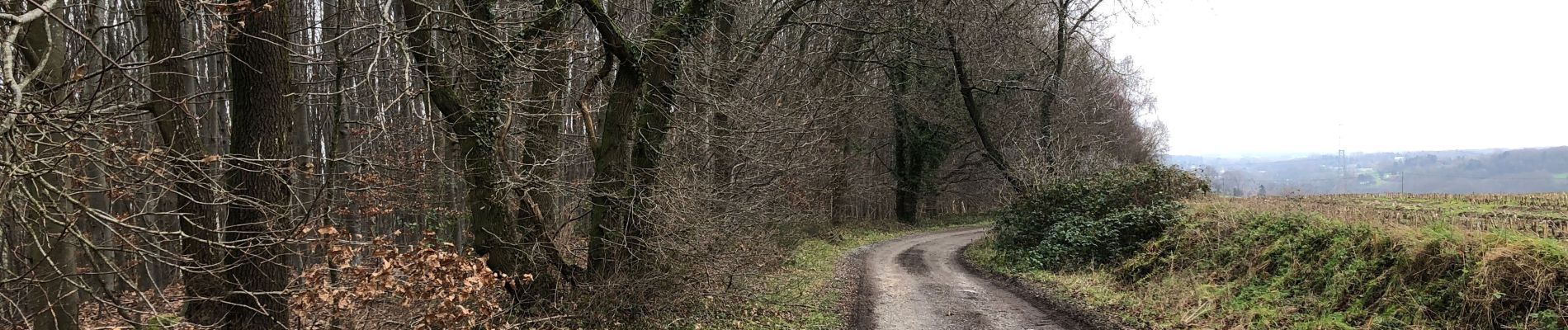
Très belle randonnée à travers les bois.


26 photos au total. Cliquez sur une photo pour les afficher toutes dans la galerie.

Marche

Marche

Marche
Marche
Marche

Marche

Marche

Marche

Marche