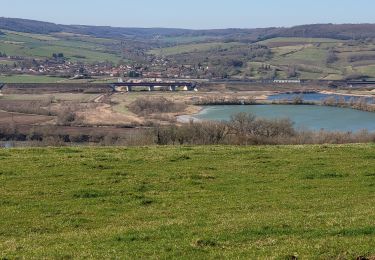
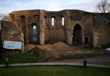
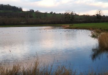
Randonnée V.T.T. Norroy-lès-Pont-à-Mousson - Ecole cyclo 27km - Photo
 PhilippeC54
PhilippeC54

Utilisateur

© OpenStreetMap contributors
Longueur
Longueur
27 km
Altitude max
Altitude max
387 m
Dénivelé positif
Dénivelé positif
540 m
Km-Effort
Km-Effort  
34 km
Altitude min
Altitude min
214 m
Dénivelé négatif
Dénivelé négatif
540 m
Boucle
Boucle
Oui
Date de création :
2014-12-10 00:00:00.0
Dernière modification :
2014-12-10 00:00:00.0

(1 Avis)

V.T.T.
V.T.T.
2h12
Difficulté : Moyen

Scannez ce code QR pour ouvrir la randonnée dans l'application SityTrail

Application GPS de randonnée GRATUITE

Logo SityTrail SityTrail

IGN / Instituts géographiques

Télécharger SityTrail sur l'App Store Télécharger SityTrail sur Google Play

Logo SityTrail SityTrail World

Le monde est à vous

Télécharger SityTrail sur l'App Store Télécharger SityTrail sur Google Play Télécharger SityTrail sur Huawei AppGallery

À propos

Randonnée V.T.T. de 27 km à découvrir à Grand Est, Meurthe-et-Moselle, Norroy-lès-Pont-à-Mousson. Cette randonnée est proposée par PhilippeC54.

Description

Rencontre école cyclo à PAM

Profil altimétrique

Localisation

Pays :
France
Région :
Grand Est
Département/Province :
Meurthe-et-Moselle
Commune :
Norroy-lès-Pont-à-Mousson
Localité :
Unknown
Départ:(Dec)
Départ:(UTM)
281476 ; 5423982 (32U) N.

Commentaires

Veuillez vous connecter pour laisser un commentaire ou une note


très bon


Randonnées à proximité

Randonnée V.T.T. Pont-à-Mousson - Pose balises V3 - Photo
V.T.T.
PhilippeC54

V.T.T.

Moyen
(1)
Pont-à-Mousson, Grand Est, Meurthe-et-Moselle, France
19,9 km | 26 km-effort
2h 1min
Non
Randonnée Marche Champey-sur-Moselle - CHAMPEY - LA FRONTIERE - Photo
Marche
jean-marie.parachini

Marche

Facile
Champey-sur-Moselle, Grand Est, Meurthe-et-Moselle, France
10,7 km | 14,5 km-effort
3h 31min
Oui
Randonnée Marche Montauville - AUDAX PONT A MOUSSON SI SEC - Photo
Marche
Toyot 8

Marche

Difficile
(1)
Montauville, Grand Est, Meurthe-et-Moselle, France
50 km | 60 km-effort
13h 35min
Oui
Randonnée V.T.T. Pont-à-Mousson - essai 4 LEVO SL - Photo
V.T.T.
PhilippeC54

V.T.T.

Difficile
Pont-à-Mousson, Grand Est, Meurthe-et-Moselle, France
58 km | 77 km-effort
3h 29min
Oui
Randonnée Marche Pont-à-Mousson - Mousson par les remparts - Photo
Marche
jean-marie.parachini

Marche

Très facile
Pont-à-Mousson, Grand Est, Meurthe-et-Moselle, France
4,6 km | 6,8 km-effort
23min
Non
Randonnée Marche Pont-à-Mousson - les etangs Muller - Photo
Marche
jean-marie.parachini

Marche

Très facile
Pont-à-Mousson, Grand Est, Meurthe-et-Moselle, France
4,4 km | 4,8 km-effort
55min
Oui
Randonnée Marche Prény - Forêt de Preny dévastée quelle dommage - Photo
Marche
bitiba

Marche

Moyen
Prény, Grand Est, Meurthe-et-Moselle, France
7,4 km | 9,7 km-effort
1h 14min
Non
Randonnée V.T.T. Vilcey-sur-Trey - Les villages du Saillant de St-Mihiel, aux portes de Pontà-Mousson. - Circuit n° 12 - Photo
V.T.T.
tracegps

V.T.T.

Difficile
Vilcey-sur-Trey, Grand Est, Meurthe-et-Moselle, France
47 km | 56 km-effort
2h 30min
Oui
Randonnée Marche Maidières - Maidieres - Boucle des vergers - variante - Photo
Marche
jean-marie.parachini

Marche

Moyen
Maidières, Grand Est, Meurthe-et-Moselle, France
6,4 km | 8,7 km-effort
2h 1min
Oui


Fermer
Mes abonnements