
Tour de Mauvezin

lorenzot54
Utilisateur

Longueur
4,3 km

Altitude max
180 m

Dénivelé positif
66 m

Km-Effort
5,2 km

Altitude min
125 m

Dénivelé négatif
66 m
Boucle
Oui
Date de création :
2021-01-10 14:02:40.0
Dernière modification :
2021-01-10 15:43:34.835
1h20
Difficulté : Inconnu

Application GPS de randonnée GRATUITE
À propos
Randonnée Marche de 4,3 km à découvrir à Occitanie, Gers, Mauvezin. Cette randonnée est proposée par lorenzot54.
Description
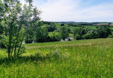
Passer long du temple, petit sentier long piscine arrivée au parc de jeu. Traverser l'arrats par vieux moulin puis faire le tour du lac. On remonte par le parc du château fort en terrasse.
Localisation
Pays :
France
Région :
Occitanie
Département/Province :
Gers
Commune :
Mauvezin
Localité :
Unknown
Départ:(Dec)
Départ:(UTM)
329762 ; 4844911 (31T) N.
Commentaires
Randonnées à proximité

Mauvezin :Le Gouffre de La Hobio


A pied
Facile
(1)
Mauvezin,
Occitanie,
Gers,
France

15,1 km | 18,8 km-effort
Inconnu
Oui

Ronde des foies gras - Mauvezin


Course à pied
Difficile
Mauvezin,
Occitanie,
Gers,
France

25 km | 29 km-effort
3h 0min
Non

Ronde des foies gras - Mauvezin


V.T.T.
Moyen
Mauvezin,
Occitanie,
Gers,
France

25 km | 29 km-effort
2h 0min
Non

Circuit des Jonquilles


A pied
Facile
Mauvezin,
Occitanie,
Gers,
France

13,4 km | 15,3 km-effort
3h 15min
Oui

La Gimone - Sarrant


V.T.T.
Facile
Mauvezin,
Occitanie,
Gers,
France

25 km | 29 km-effort
2h 24min
Oui


Marie vers Saint sauvy


Marche
Très facile
Saint-Antonin,
Occitanie,
Gers,
France

5,8 km | 6,7 km-effort
1h 28min
Non

Randonnée VTT - Mauvezin


V.T.T.
Moyen
Mauvezin,
Occitanie,
Gers,
France

15,5 km | 18,3 km-effort
1h 10min
Oui

mauvezin rando degust


Marche
Difficile
Mauvezin,
Occitanie,
Gers,
France

14,5 km | 16,5 km-effort
4h 4min
Oui


 SityTrail


