![](/images/other/stat-length.png)
![Randonnée Marche Saint-Georges-sur-Cher - Saint-Georges-sur-Cher - les Magasins Montfourgon le Moulin du Porteau - 10km 110m 2h25 - 2021 01 02 - Photo](https://media.geolcdn.com/t/1900/400/f115f6ef-46e3-4de7-a2db-116f89709983.jpg&format=pjpeg&maxdim=2)
Saint-Georges-sur-Cher - les Magasins Montfourgon le Moulin du Porteau - 10km 110m 2h25 - 2021 01 02
Orcal37
Utilisateur GUIDE
![Longueur](/images/other/stat-length.png)
Longueur
10,1 km
![Altitude max](https://static1.geolcdn.com/siteimages/upload/files/1508320355ic_sort_altitude_max_24dp.png)
Altitude max
121 m
![Dénivelé positif](https://static1.geolcdn.com/siteimages/upload/files/1508320355ic_sort_den_pos_24dp.png)
Dénivelé positif
110 m
![Km-Effort](/images/other/stat-length.png)
Km-Effort
11,6 km
![Altitude min](https://static1.geolcdn.com/siteimages/upload/files/1508320355ic_sort_altitude_min_24dp.png)
Altitude min
64 m
![Dénivelé négatif](https://static1.geolcdn.com/siteimages/upload/files/1508320355ic_sort_den_neg_24dp.png)
Dénivelé négatif
110 m
![Boucle](https://static1.geolcdn.com/siteimages/upload/files/16400158638029165_repeat_loop_refresh_sync_direction_icon.png)
Boucle
Oui
Date de création :
2021-01-02 13:54:54.664
Dernière modification :
2024-09-11 16:07:59.943
![Marche](https://static1.geolcdn.com/sitytour/trail-icons/101.png)
2h25
Difficulté : Facile
![Scannez ce code QR pour ouvrir la randonnée dans l'application SityTrail](https://capi.geolives.com/qq0zvz2zws4bq2lad0pu/sitytour/trails/2630752/qr.png?size=200)
Application GPS de randonnée GRATUITE
À propos
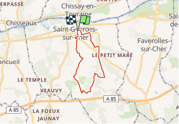
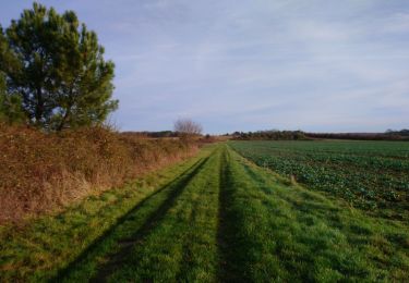
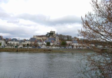
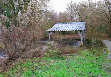
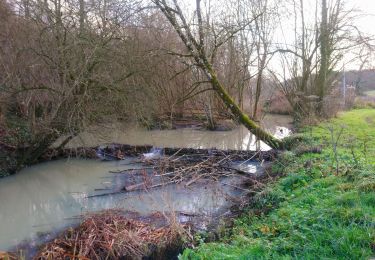
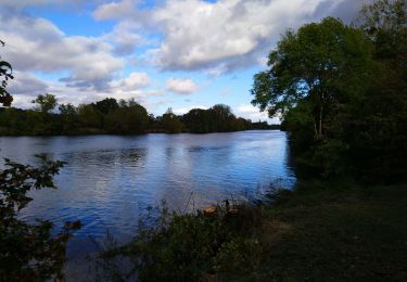
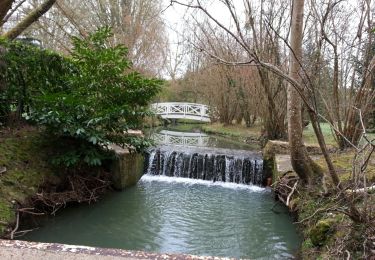
Randonnée Marche de 10,1 km à découvrir à Centre-Val de Loire, Loir-et-Cher, Saint-Georges-sur-Cher. Cette randonnée est proposée par Orcal37.
Description
Saint-Georges-sur-Cher - les Magasins - Montfourgon - le Moulin du Porteau - 10km 110m 2h25 - 2021 01 02
Localisation
Pays :
France
Région :
Centre-Val de Loire
Département/Province :
Loir-et-Cher
Commune :
Saint-Georges-sur-Cher
Localité :
Unknown
Départ:(Dec)
Départ:(UTM)
358683 ; 5242807 (31T) N.
Commentaires
Randonnées à proximité
![Randonnée Marche Épeigné-les-Bois - Epeigné-les-Bois - Sentier de Montpoupon - 11.5km 165m 2h15 - 2016 12 29 - Photo](https://media.geolcdn.com/t/375/260/22b359e3-6d6b-40c2-85c5-21ba9f35e3e3.jpg&format=jpg&maxdim=2)
![Marche Marche](https://static1.geolcdn.com/sitytour/trail-icons/101.png)
Epeigné-les-Bois - Sentier de Montpoupon - 11.5km 165m 2h15 - 2016 12 29
Marche
Facile
(1)
Épeigné-les-Bois,
Centre-Val de Loire,
Indre-et-Loire,
France
![](/images/other/stat-length.png)
11,4 km | 13,7 km-effort
2h 15min
![](https://static1.geolcdn.com/siteimages/upload/files/16400158638029165_repeat_loop_refresh_sync_direction_icon.png)
Oui
![Randonnée Marche Chissay-en-Touraine - Chissay-en-Touraine - Zig zag Beaune les Durdents - 18.2km 330m 3h50 - 2024 08 14 - Photo](https://media.geolcdn.com/t/375/260/30944a30-b41f-4f9d-8ec2-2b86a26d941c.jpg&format=jpg&maxdim=2)
![Marche Marche](https://static1.geolcdn.com/sitytour/trail-icons/101.png)
Chissay-en-Touraine - Zig zag Beaune les Durdents - 18.2km 330m 3h50 - 2024 0...
Marche
Moyen
Chissay-en-Touraine,
Centre-Val de Loire,
Loir-et-Cher,
France
![](/images/other/stat-length.png)
17,8 km | 22 km-effort
3h 50min
![](https://static1.geolcdn.com/siteimages/upload/files/16400158638029165_repeat_loop_refresh_sync_direction_icon.png)
Oui
![Randonnée Marche Saint-Georges-sur-Cher - Saint-Georges-sur-Cher - GRP Forêt Montrichard - 17.6km 165m 3h40 - 2023 12 27 - Photo](https://media.geolcdn.com/t/375/260/880c30e7-b6b6-4502-9fce-27a680430128.jpg&format=jpg&maxdim=2)
![Marche Marche](https://static1.geolcdn.com/sitytour/trail-icons/101.png)
Saint-Georges-sur-Cher - GRP Forêt Montrichard - 17.6km 165m 3h40 - 2023 12 27
Marche
Facile
Saint-Georges-sur-Cher,
Centre-Val de Loire,
Loir-et-Cher,
France
![](/images/other/stat-length.png)
17,7 km | 19,8 km-effort
3h 40min
![](https://static1.geolcdn.com/siteimages/upload/files/16400158638029165_repeat_loop_refresh_sync_direction_icon.png)
Oui
![Randonnée Marche Faverolles-sur-Cher - Montrichard - GR41 Forêt GRP - 13.9km 220m 3h30 - 2022 03 03 - Photo](https://media.geolcdn.com/t/375/260/e0906f58-3286-4bdf-8af8-a43f3b5ae1bb.jpg&format=jpg&maxdim=2)
![Marche Marche](https://static1.geolcdn.com/sitytour/trail-icons/101.png)
Montrichard - GR41 Forêt GRP - 13.9km 220m 3h30 - 2022 03 03
Marche
Facile
Faverolles-sur-Cher,
Centre-Val de Loire,
Loir-et-Cher,
France
![](/images/other/stat-length.png)
13,9 km | 16,9 km-effort
3h 30min
![](https://static1.geolcdn.com/siteimages/upload/files/16400158638029165_repeat_loop_refresh_sync_direction_icon.png)
Oui
![Randonnée Marche Saint-Georges-sur-Cher - Saint-Georges-sur-Cher - Vrigny la Rabotière - 5.8km 50m 1h25 - 2021 12 26 - Photo](https://media.geolcdn.com/t/375/260/bf0f4dfb-3021-439f-aae4-efd12cf3a4f1.jpg&format=jpg&maxdim=2)
![Marche Marche](https://static1.geolcdn.com/sitytour/trail-icons/101.png)
Saint-Georges-sur-Cher - Vrigny la Rabotière - 5.8km 50m 1h25 - 2021 12 26
Marche
Facile
Saint-Georges-sur-Cher,
Centre-Val de Loire,
Loir-et-Cher,
France
![](/images/other/stat-length.png)
5,8 km | 6,5 km-effort
1h 25min
![](https://static1.geolcdn.com/siteimages/upload/files/16400158638029165_repeat_loop_refresh_sync_direction_icon.png)
Oui
![Randonnée Marche Saint-Georges-sur-Cher - Saint-Georges-sur-Cher - barrage de castors de Chézelles - 9.9km 130m 2h10 - 2020 12 26 - Photo](https://media.geolcdn.com/t/375/260/9d6a7779-3dab-4c71-aee3-1f28b204988e.jpg&format=jpg&maxdim=2)
![Marche Marche](https://static1.geolcdn.com/sitytour/trail-icons/101.png)
Saint-Georges-sur-Cher - barrage de castors de Chézelles - 9.9km 130m 2h10 - ...
Marche
Très facile
Saint-Georges-sur-Cher,
Centre-Val de Loire,
Loir-et-Cher,
France
![](/images/other/stat-length.png)
9,9 km | 11,7 km-effort
2h 10min
![](https://static1.geolcdn.com/siteimages/upload/files/16400158638029165_repeat_loop_refresh_sync_direction_icon.png)
Oui
![Randonnée Marche Faverolles-sur-Cher - Faverolles-sur-Cher l'Audronnière - les Raimbaudières le Port le Cher - 6.4km 50m 1h35 - 2020 10 04 - Photo](https://media.geolcdn.com/t/375/260/f011b49a-c98e-461a-9255-6b51cf3fa752.jpg&format=jpg&maxdim=2)
![Marche Marche](https://static1.geolcdn.com/sitytour/trail-icons/101.png)
Faverolles-sur-Cher l'Audronnière - les Raimbaudières le Port le Cher - 6.4km...
Marche
Facile
Faverolles-sur-Cher,
Centre-Val de Loire,
Loir-et-Cher,
France
![](/images/other/stat-length.png)
6,4 km | 7,1 km-effort
1h 35min
![](https://static1.geolcdn.com/siteimages/upload/files/16400158638029165_repeat_loop_refresh_sync_direction_icon.png)
Oui
![Randonnée Marche Saint-Georges-sur-Cher - Saint-Georges-sur-Cher - Salle des Fêtes la Vallée Pitrou la Larderie la Poterie - 12.3km 130m 2h30 - 2014 03 16 - Photo](https://media.geolcdn.com/t/375/260/ext.jpg?maxdim=2&url=https%3A%2F%2Fservices.sitytrail.com%2FGeolivesWS%2FDownloadMedia.ashx%3FTrailID%3D258187%26Media%3Dfix__20140316093314.jpg)
![Marche Marche](https://static1.geolcdn.com/sitytour/trail-icons/101.png)
Saint-Georges-sur-Cher - Salle des Fêtes la Vallée Pitrou la Larderie la Pote...
Marche
Facile
Saint-Georges-sur-Cher,
Centre-Val de Loire,
Loir-et-Cher,
France
![](/images/other/stat-length.png)
12,4 km | 14,1 km-effort
2h 30min
![](https://static1.geolcdn.com/siteimages/upload/files/16400158638029165_repeat_loop_refresh_sync_direction_icon.png)
Oui
![Randonnée Marche Chenonceaux - Chenonceaux - Photo](https://media.geolcdn.com/t/375/260/ext.jpg?maxdim=2&url=https%3A%2F%2Fstatic1.geolcdn.com%2Fsiteimages%2Fupload%2Ffiles%2F1553511878bg_sport_marche.png)
![Marche Marche](https://static1.geolcdn.com/sitytour/trail-icons/101.png)
Chenonceaux
Marche
Facile
(1)
Chenonceaux,
Centre-Val de Loire,
Indre-et-Loire,
France
![](/images/other/stat-length.png)
10,9 km | 13,1 km-effort
2h 50min
![](https://static1.geolcdn.com/siteimages/upload/files/16400158638029165_repeat_loop_refresh_sync_direction_icon.png)
Oui