![](/images/other/stat-length.png)
![Randonnée Marche Estagel - 20201216 Estagel - Calce - Photo](https://media.geolcdn.com/t/1900/400/37828b1c-a727-4fa4-95e5-15b013f51adc.jpg&format=pjpeg&maxdim=2)
20201216 Estagel - Calce
ThonyM
Utilisateur
![Longueur](/images/other/stat-length.png)
Longueur
15,8 km
![Altitude max](https://static1.geolcdn.com/siteimages/upload/files/1508320355ic_sort_altitude_max_24dp.png)
Altitude max
313 m
![Dénivelé positif](https://static1.geolcdn.com/siteimages/upload/files/1508320355ic_sort_den_pos_24dp.png)
Dénivelé positif
462 m
![Km-Effort](/images/other/stat-length.png)
Km-Effort
22 km
![Altitude min](https://static1.geolcdn.com/siteimages/upload/files/1508320355ic_sort_altitude_min_24dp.png)
Altitude min
77 m
![Dénivelé négatif](https://static1.geolcdn.com/siteimages/upload/files/1508320355ic_sort_den_neg_24dp.png)
Dénivelé négatif
461 m
![Boucle](https://static1.geolcdn.com/siteimages/upload/files/16400158638029165_repeat_loop_refresh_sync_direction_icon.png)
Boucle
Oui
Date de création :
2020-12-16 07:49:20.0
Dernière modification :
2020-12-16 12:21:16.887
![Marche](https://static1.geolcdn.com/sitytour/trail-icons/101.png)
3h36
Difficulté : Moyen
![Scannez ce code QR pour ouvrir la randonnée dans l'application SityTrail](https://capi.geolives.com/qq0zvz2zws4bq2lad0pu/sitytour/trails/2620227/qr.png?size=200)
Application GPS de randonnée GRATUITE
À propos
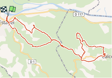
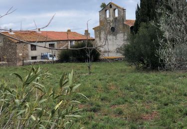
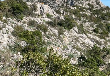
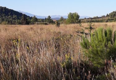
Randonnée Marche de 15,8 km à découvrir à Occitanie, Pyrénées-Orientales, Estagel. Cette randonnée est proposée par ThonyM.
Description
Un peu sportif par endroits mais relativement aisé. Le village de Calce vaut le détour : château..
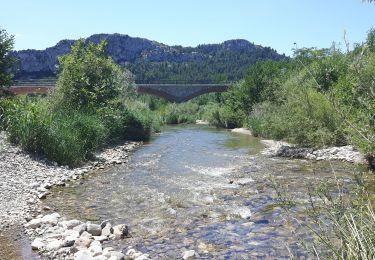
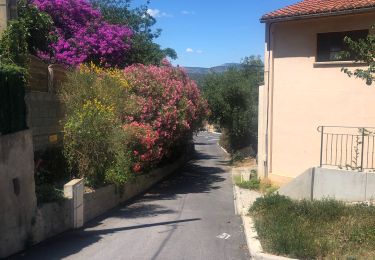
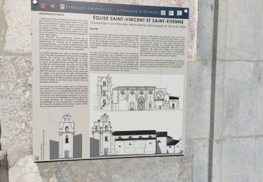
Localisation
Pays :
France
Région :
Occitanie
Département/Province :
Pyrénées-Orientales
Commune :
Estagel
Localité :
Unknown
Départ:(Dec)
Départ:(UTM)
475495 ; 4735803 (31T) N.
Commentaires
Randonnées à proximité
![Randonnée Marche Tautavel - Tautavel chemin des bacs - Photo](https://media.geolcdn.com/t/375/260/4347d338-087b-4ab9-a23d-b90780ad37c2.jpg&format=jpg&maxdim=2)
![Marche Marche](https://static1.geolcdn.com/sitytour/trail-icons/101.png)
Tautavel chemin des bacs
Marche
Facile
(3)
Tautavel,
Occitanie,
Pyrénées-Orientales,
France
![](/images/other/stat-length.png)
9,5 km | 12,4 km-effort
2h 30min
![](https://static1.geolcdn.com/siteimages/upload/files/16400158638029165_repeat_loop_refresh_sync_direction_icon.png)
Oui
![Randonnée Marche Montner - Montner Força Réal et château de Caladroy - Photo](https://media.geolcdn.com/t/375/260/00644a8b-4507-46ff-9b0c-bf2cb54055bf.jpg&format=jpg&maxdim=2)
![Marche Marche](https://static1.geolcdn.com/sitytour/trail-icons/101.png)
Montner Força Réal et château de Caladroy
Marche
Difficile
Montner,
Occitanie,
Pyrénées-Orientales,
France
![](/images/other/stat-length.png)
18,4 km | 26 km-effort
5h 43min
![](https://static1.geolcdn.com/siteimages/upload/files/16400158638029165_repeat_loop_refresh_sync_direction_icon.png)
Oui
![Randonnée Marche Estagel - ESTAGEL Chapelle St Laurent MARDI FAIT - Photo](https://media.geolcdn.com/t/375/260/14957312-1764-401b-980d-e06b9de6af18.jpg&format=jpg&maxdim=2)
![Marche Marche](https://static1.geolcdn.com/sitytour/trail-icons/101.png)
ESTAGEL Chapelle St Laurent MARDI FAIT
Marche
Moyen
(1)
Estagel,
Occitanie,
Pyrénées-Orientales,
France
![](/images/other/stat-length.png)
12,2 km | 16,9 km-effort
3h 26min
![](https://static1.geolcdn.com/siteimages/upload/files/16400158638029165_repeat_loop_refresh_sync_direction_icon.png)
Oui
![Randonnée Marche Latour-de-France - Latour de France 08/12/2021 - Photo](https://media.geolcdn.com/t/375/260/645a3cd7-e5af-42b0-b7e0-83164582f13a.jpg&format=jpg&maxdim=2)
![Marche Marche](https://static1.geolcdn.com/sitytour/trail-icons/101.png)
Latour de France 08/12/2021
Marche
Moyen
Latour-de-France,
Occitanie,
Pyrénées-Orientales,
France
![](/images/other/stat-length.png)
12,4 km | 16,2 km-effort
3h 12min
![](https://static1.geolcdn.com/siteimages/upload/files/16400158638029165_repeat_loop_refresh_sync_direction_icon.png)
Oui
![Randonnée Marche Tautavel - TAUTAVEL la Tour del Far A/R - Photo](https://media.geolcdn.com/t/375/260/7315cb9e-35b2-46c7-8732-adf6f85e9975.jpg&format=jpg&maxdim=2)
![Marche Marche](https://static1.geolcdn.com/sitytour/trail-icons/101.png)
TAUTAVEL la Tour del Far A/R
Marche
Moyen
Tautavel,
Occitanie,
Pyrénées-Orientales,
France
![](/images/other/stat-length.png)
6,3 km | 11,4 km-effort
3h 55min
![](https://static1.geolcdn.com/siteimages/upload/files/16400158638029165_repeat_loop_refresh_sync_direction_icon.png)
Oui
![Randonnée Marche Tautavel - Tautavel -Torre del Far - Photo](https://media.geolcdn.com/t/375/260/f1e44f1c-1dc1-496a-9f67-a9c732e79842.jpg&format=jpg&maxdim=2)
![Marche Marche](https://static1.geolcdn.com/sitytour/trail-icons/101.png)
Tautavel -Torre del Far
Marche
Moyen
(2)
Tautavel,
Occitanie,
Pyrénées-Orientales,
France
![](/images/other/stat-length.png)
9,5 km | 15,4 km-effort
3h 1min
![](https://static1.geolcdn.com/siteimages/upload/files/16400158638029165_repeat_loop_refresh_sync_direction_icon.png)
Oui
![Randonnée Marche Tautavel - La torre del far Tautavel - Photo](https://media.geolcdn.com/t/375/260/cad1b594-a886-41a2-af0e-3786c0c41b8c.jpg&format=jpg&maxdim=2)
![Marche Marche](https://static1.geolcdn.com/sitytour/trail-icons/101.png)
La torre del far Tautavel
Marche
Tautavel,
Occitanie,
Pyrénées-Orientales,
France
![](/images/other/stat-length.png)
9,6 km | 15,6 km-effort
3h 11min
![](https://static1.geolcdn.com/siteimages/upload/files/16400158638029165_repeat_loop_refresh_sync_direction_icon.png)
Oui
![Randonnée Marche Tautavel - tautavel - Photo](https://media.geolcdn.com/t/375/260/f34f6986-d4b4-4e63-abd4-eb0d36e51368.jpg&format=jpg&maxdim=2)
![Marche Marche](https://static1.geolcdn.com/sitytour/trail-icons/101.png)
tautavel
Marche
Très facile
Tautavel,
Occitanie,
Pyrénées-Orientales,
France
![](/images/other/stat-length.png)
14,6 km | 19,4 km-effort
8h 5min
![](https://static1.geolcdn.com/siteimages/upload/files/16400158638029165_repeat_loop_refresh_sync_direction_icon.png)
Oui
![Randonnée Marche Latour-de-France - 66 LATOUR-DE-FRANCE, visite du village, massif de Tourèze et vallée de l'Agly - Photo](https://media.geolcdn.com/t/375/260/ext.jpg?maxdim=2&url=https%3A%2F%2Fservices.sitytrail.com%2FGeolivesWS%2FDownloadMedia.ashx%3FTrailID%3D485378%26Media%3D20151023161024.jpg)
![Marche Marche](https://static1.geolcdn.com/sitytour/trail-icons/101.png)
66 LATOUR-DE-FRANCE, visite du village, massif de Tourèze et vallée de l'Agly
Marche
Moyen
Latour-de-France,
Occitanie,
Pyrénées-Orientales,
France
![](/images/other/stat-length.png)
8,3 km | 11 km-effort
1h 47min
![](https://static1.geolcdn.com/siteimages/upload/files/16400158638029165_repeat_loop_refresh_sync_direction_icon.png)
Oui