![](/images/other/stat-length.png)
![Randonnée A pied Leeuw-Saint-Pierre - 12 km Vlezembeek Vagervuur - Zobbroek- et Laarbeekvallei - brasserie Lindemans - Photo](https://media.geolcdn.com/t/1900/400/ext.pjpeg?maxdim=2&url=https%3A%2F%2Fstatic1.geolcdn.com%2Fsiteimages%2Fupload%2Ffiles%2F1545311037marcheuse_200dpi.jpg)
12 km Vlezembeek Vagervuur - Zobbroek- et Laarbeekvallei - brasserie Lindemans
Matamimi
Utilisateur
![Longueur](/images/other/stat-length.png)
Longueur
11,3 km
![Altitude max](https://static1.geolcdn.com/siteimages/upload/files/1508320355ic_sort_altitude_max_24dp.png)
Altitude max
63 m
![Dénivelé positif](https://static1.geolcdn.com/siteimages/upload/files/1508320355ic_sort_den_pos_24dp.png)
Dénivelé positif
86 m
![Km-Effort](/images/other/stat-length.png)
Km-Effort
12,4 km
![Altitude min](https://static1.geolcdn.com/siteimages/upload/files/1508320355ic_sort_altitude_min_24dp.png)
Altitude min
30 m
![Dénivelé négatif](https://static1.geolcdn.com/siteimages/upload/files/1508320355ic_sort_den_neg_24dp.png)
Dénivelé négatif
89 m
![Boucle](https://static1.geolcdn.com/siteimages/upload/files/16400158638029165_repeat_loop_refresh_sync_direction_icon.png)
Boucle
Non
Date de création :
2020-11-14 12:13:51.991
Dernière modification :
2020-11-14 19:35:01.03
![A pied](https://static1.geolcdn.com/sitytour/trail-icons/100.png)
--
Difficulté : Facile
![Scannez ce code QR pour ouvrir la randonnée dans l'application SityTrail](https://capi.geolives.com/qq0zvz2zws4bq2lad0pu/sitytour/trails/2600012/qr.png?size=200)
Application GPS de randonnée GRATUITE
À propos
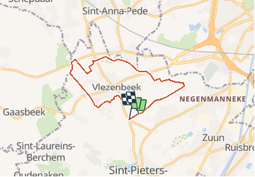
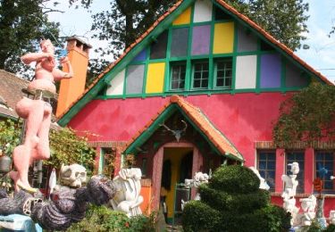
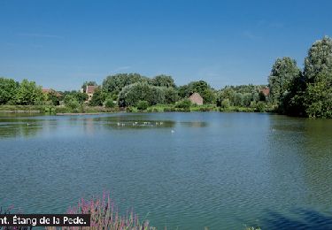
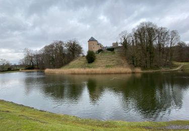
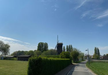
Randonnée A pied de 11,3 km à découvrir à Flandre, Brabant flamand, Leeuw-Saint-Pierre. Cette randonnée est proposée par Matamimi.
Description
Sentiers, chemins agricoles et petites routes.
En passant par Vlezembeek, le long de la réserve de la Zobbroekvallei, puis devant la brasserie Lindemans et le long de la réserve du Laarbeek.
En période de pluie, plusieurs passages très boueux.
Localisation
Pays :
Belgique
Région :
Flandre
Département/Province :
Brabant flamand
Commune :
Leeuw-Saint-Pierre
Localité :
Vlezenbeek
Départ:(Dec)
Départ:(UTM)
587387 ; 5628026 (31U) N.
Commentaires
Randonnées à proximité
![Randonnée Marche Beersel - RL-GG-24_Beersel_Hennuyères - Photo](https://media.geolcdn.com/t/375/260/102ff410-776a-4c59-ae38-58c43777bc8a.jpg&format=jpg&maxdim=2)
![Marche Marche](https://static1.geolcdn.com/sitytour/trail-icons/101.png)
RL-GG-24_Beersel_Hennuyères
Marche
Moyen
(2)
Beersel,
Flandre,
Brabant flamand,
Belgique
![](/images/other/stat-length.png)
37 km | 47 km-effort
10h 44min
![](https://static1.geolcdn.com/siteimages/upload/files/16400158638029165_repeat_loop_refresh_sync_direction_icon.png)
Non
![Randonnée Marche Anderlecht - RB-Br-05-Rac02 - Photo](https://media.geolcdn.com/t/375/260/ext.jpg?maxdim=2&url=https%3A%2F%2Fservices.sitytrail.com%2FGeolivesWS%2FDownloadMedia.ashx%3FTrailID%3D247888%26Media%3Defa9a3b4-e0b1-4a00-9376-0ef985b02cd6.jpg)
![Marche Marche](https://static1.geolcdn.com/sitytour/trail-icons/101.png)
RB-Br-05-Rac02
Marche
Facile
(5)
Anderlecht,
Bruxelles-Capitale,
Inconnu,
Belgique
![](/images/other/stat-length.png)
14,3 km | 16,6 km-effort
3h 46min
![](https://static1.geolcdn.com/siteimages/upload/files/16400158638029165_repeat_loop_refresh_sync_direction_icon.png)
Oui
![Randonnée Marche Anderlecht - RB-Br-05 - Photo](https://media.geolcdn.com/t/375/260/ext.jpg?maxdim=2&url=https%3A%2F%2Fservices.sitytrail.com%2FGeolivesWS%2FDownloadMedia.ashx%3FTrailID%3D247884%26Media%3Defa9a3b4-e0b1-4a00-9376-0ef985b02cd6.jpg)
![Marche Marche](https://static1.geolcdn.com/sitytour/trail-icons/101.png)
RB-Br-05
Marche
Difficile
(3)
Anderlecht,
Bruxelles-Capitale,
Inconnu,
Belgique
![](/images/other/stat-length.png)
23 km | 27 km-effort
6h 8min
![](https://static1.geolcdn.com/siteimages/upload/files/16400158638029165_repeat_loop_refresh_sync_direction_icon.png)
Oui
![Randonnée Marche Lennik - gaasbeek (départ du parking du château) - Photo](https://media.geolcdn.com/t/375/260/b65667a1-6a17-4664-a23a-2140eac1eacf.jpg&format=jpg&maxdim=2)
![Marche Marche](https://static1.geolcdn.com/sitytour/trail-icons/101.png)
gaasbeek (départ du parking du château)
Marche
Moyen
(1)
Lennik,
Flandre,
Brabant flamand,
Belgique
![](/images/other/stat-length.png)
7,2 km | 8,6 km-effort
1h 57min
![](https://static1.geolcdn.com/siteimages/upload/files/16400158638029165_repeat_loop_refresh_sync_direction_icon.png)
Non
![Randonnée Marche Beersel - Beersel 10km - Photo](https://media.geolcdn.com/t/375/260/4be021b0-0611-495b-8c11-6bedba66a35d.jpg&format=jpg&maxdim=2)
![Marche Marche](https://static1.geolcdn.com/sitytour/trail-icons/101.png)
Beersel 10km
Marche
Moyen
(2)
Beersel,
Flandre,
Brabant flamand,
Belgique
![](/images/other/stat-length.png)
10,5 km | 13,1 km-effort
2h 34min
![](https://static1.geolcdn.com/siteimages/upload/files/16400158638029165_repeat_loop_refresh_sync_direction_icon.png)
Oui
![Randonnée Marche Beersel - Entre Beersel et Dworp - Photo](https://media.geolcdn.com/t/375/260/ext.jpg?maxdim=2&url=https%3A%2F%2Fservices.sitytrail.com%2FGeolivesWS%2FDownloadMedia.ashx%3FTrailID%3D310076%26Media%3D3efa6535-4846-4e23-9c11-65c16b69488b.jpg)
![Marche Marche](https://static1.geolcdn.com/sitytour/trail-icons/101.png)
Entre Beersel et Dworp
Marche
Moyen
(1)
Beersel,
Flandre,
Brabant flamand,
Belgique
![](/images/other/stat-length.png)
10,1 km | 13 km-effort
2h 45min
![](https://static1.geolcdn.com/siteimages/upload/files/16400158638029165_repeat_loop_refresh_sync_direction_icon.png)
Oui
![Randonnée Marche Anderlecht - RB-Br-06-Rac02 - Photo](https://media.geolcdn.com/t/375/260/ext.jpg?maxdim=2&url=https%3A%2F%2Fservices.sitytrail.com%2FGeolivesWS%2FDownloadMedia.ashx%3FTrailID%3D247893%26Media%3D30c83acb-9f39-44f9-b0f1-68c580ded77c.jpg)
![Marche Marche](https://static1.geolcdn.com/sitytour/trail-icons/101.png)
RB-Br-06-Rac02
Marche
Très facile
(2)
Anderlecht,
Bruxelles-Capitale,
Inconnu,
Belgique
![](/images/other/stat-length.png)
8,4 km | 9,2 km-effort
2h 5min
![](https://static1.geolcdn.com/siteimages/upload/files/16400158638029165_repeat_loop_refresh_sync_direction_icon.png)
Non
![Randonnée Marche Lennik - Autour de Gaasbeek - Photo](https://media.geolcdn.com/t/375/260/5c335b1b-d34f-4c3a-9430-6e6f640c8bc4.jpg&format=jpg&maxdim=2)
![Marche Marche](https://static1.geolcdn.com/sitytour/trail-icons/101.png)
Autour de Gaasbeek
Marche
Facile
(1)
Lennik,
Flandre,
Brabant flamand,
Belgique
![](/images/other/stat-length.png)
9,1 km | 10,9 km-effort
2h 10min
![](https://static1.geolcdn.com/siteimages/upload/files/16400158638029165_repeat_loop_refresh_sync_direction_icon.png)
Oui
![Randonnée Marche Anderlecht - Campagne Anderlechtoise - Photo](https://media.geolcdn.com/t/375/260/96b3018c-57d6-4f02-bbdf-bc8fb98a0e3c.jpg&format=jpg&maxdim=2)
![Marche Marche](https://static1.geolcdn.com/sitytour/trail-icons/101.png)
Campagne Anderlechtoise
Marche
Moyen
(1)
Anderlecht,
Bruxelles-Capitale,
Inconnu,
Belgique
![](/images/other/stat-length.png)
6,3 km | 7,3 km-effort
1h 23min
![](https://static1.geolcdn.com/siteimages/upload/files/16400158638029165_repeat_loop_refresh_sync_direction_icon.png)
Oui