![](/images/other/stat-length.png)
![Randonnée A pied Choisy-au-Bac - en forêt de Laigue_12_sur le Mont Renard et le Mont l'Ecange - Photo](https://media.geolcdn.com/t/1900/400/ext.pjpeg?maxdim=2&url=https%3A%2F%2Fstatic1.geolcdn.com%2Fsiteimages%2Fupload%2Ffiles%2F1545311037marcheuse_200dpi.jpg)
en forêt de Laigue_12_sur le Mont Renard et le Mont l'Ecange
en forêt de Laigue
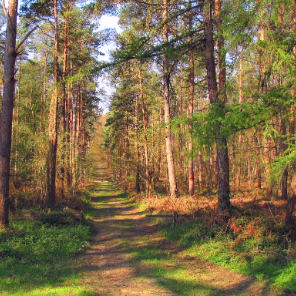
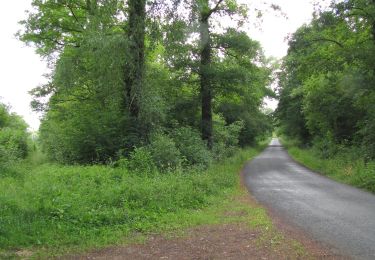
vive la rando en forêt
![Longueur](/images/other/stat-length.png)
![Altitude max](https://static1.geolcdn.com/siteimages/upload/files/1508320355ic_sort_altitude_max_24dp.png)
![Dénivelé positif](https://static1.geolcdn.com/siteimages/upload/files/1508320355ic_sort_den_pos_24dp.png)
![Km-Effort](/images/other/stat-length.png)
![Altitude min](https://static1.geolcdn.com/siteimages/upload/files/1508320355ic_sort_altitude_min_24dp.png)
![Dénivelé négatif](https://static1.geolcdn.com/siteimages/upload/files/1508320355ic_sort_den_neg_24dp.png)
![Boucle](https://static1.geolcdn.com/siteimages/upload/files/16400158638029165_repeat_loop_refresh_sync_direction_icon.png)
![A pied](https://static1.geolcdn.com/sitytour/trail-icons/100.png)
--
Difficulté : Difficile
![Scannez ce code QR pour ouvrir la randonnée dans l'application SityTrail](https://capi.geolives.com/qq0zvz2zws4bq2lad0pu/sitytour/trails/2598564/qr.png?size=200)
Application GPS de randonnée GRATUITE
À propos
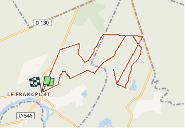
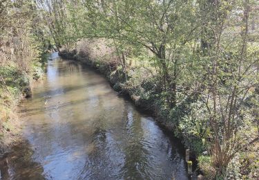
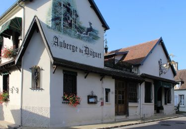
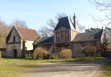
Randonnée A pied de 10,7 km à découvrir à Hauts-de-France, Oise, Choisy-au-Bac. Cette randonnée est proposée par en forêt de Laigue.
Description
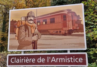
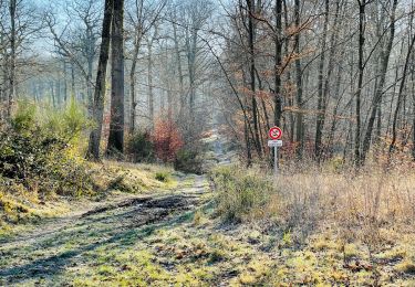
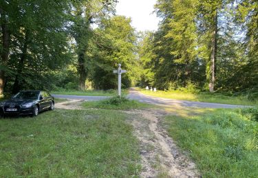
objectifs de cette rando: balayer le Mont Renard et le Mont l'Ecange pour plus d'informations en suivant des chemins très très peu fréquentés.
Au départ du carrefour du Pont du Francport, suivre la Route du Francport et monter sur une partie du Mont Renard. Rejoindre le carrefour des Bonshommes et tourner autour du Mont l'Ecange en passant au carrefour du Mont l'Ecange et près de l'étang du Vivier du Grès. Rejoindre le carrefour de la Trouée des Bonhommes (Route du Grand Octogone) puis tourner autour du Mont Renard entre la Route des Bonhommes, la Route de Royaumont et la Route du Grand Octogone. Rejoindre le carrefour du Mont Renard et suivre la Route du Mont Renard, plus belle que celle du Chemin de la Voie d'Eau, pour retourner au point de départ.
Localisation
Commentaires
Randonnées à proximité
![Marche Marche](https://static1.geolcdn.com/sitytour/trail-icons/101.png)
Marche
![](/images/other/stat-length.png)
![](https://static1.geolcdn.com/siteimages/upload/files/16400158638029165_repeat_loop_refresh_sync_direction_icon.png)
![Marche Marche](https://static1.geolcdn.com/sitytour/trail-icons/101.png)
Marche
![](/images/other/stat-length.png)
![](https://static1.geolcdn.com/siteimages/upload/files/16400158638029165_repeat_loop_refresh_sync_direction_icon.png)
![Randonnée Marche Clairoix - Randonnée au fort Ganelon ( Clairoix) - Photo](https://media.geolcdn.com/t/375/260/7a95814e-c3a8-4395-93ea-d54e84192771.jpg&format=jpg&maxdim=2)
![Marche Marche](https://static1.geolcdn.com/sitytour/trail-icons/101.png)
Marche
![](/images/other/stat-length.png)
![](https://static1.geolcdn.com/siteimages/upload/files/16400158638029165_repeat_loop_refresh_sync_direction_icon.png)
![Randonnée Marche Choisy-au-Bac - Choisy au Bac - Photo](https://media.geolcdn.com/t/375/260/5babfbf2-74be-4aa2-8a85-5aa5f3b07088.jpg&format=jpg&maxdim=2)
![Marche Marche](https://static1.geolcdn.com/sitytour/trail-icons/101.png)
Marche
![](/images/other/stat-length.png)
![](https://static1.geolcdn.com/siteimages/upload/files/16400158638029165_repeat_loop_refresh_sync_direction_icon.png)
![Randonnée Marche Compiègne - Compiegne rond point de l’Armistice 13,4 km - Photo](https://media.geolcdn.com/t/375/260/329c33a1-5259-47b3-b855-7d5e0d5065b3.jpg&format=jpg&maxdim=2)
![Marche Marche](https://static1.geolcdn.com/sitytour/trail-icons/101.png)
Marche
![](/images/other/stat-length.png)
![](https://static1.geolcdn.com/siteimages/upload/files/16400158638029165_repeat_loop_refresh_sync_direction_icon.png)
![Marche Marche](https://static1.geolcdn.com/sitytour/trail-icons/101.png)
Marche
![](/images/other/stat-length.png)
![](https://static1.geolcdn.com/siteimages/upload/files/16400158638029165_repeat_loop_refresh_sync_direction_icon.png)
![Randonnée A pied Vieux-Moulin - Promenade de Vieux moulin - Photo](https://media.geolcdn.com/t/375/260/a17a3f18-dfc3-477d-9052-cabfbc8976c4.jpeg&format=jpg&maxdim=2)
![A pied A pied](https://static1.geolcdn.com/sitytour/trail-icons/100.png)
A pied
![](/images/other/stat-length.png)
![](https://static1.geolcdn.com/siteimages/upload/files/16400158638029165_repeat_loop_refresh_sync_direction_icon.png)
![Randonnée A pied Compiègne - Promenade du Point de Vue des beaux Monts - Photo](https://media.geolcdn.com/t/375/260/f4e4a11c-27de-4764-8d9c-d7eb5d9a8cef.jpeg&format=jpg&maxdim=2)
![A pied A pied](https://static1.geolcdn.com/sitytour/trail-icons/100.png)
A pied
![](/images/other/stat-length.png)
![](https://static1.geolcdn.com/siteimages/upload/files/16400158638029165_repeat_loop_refresh_sync_direction_icon.png)
![Randonnée Marche Rethondes - en forêt de Laigue_15_07_2021_autour du Mont du Fouilleux et du Mont des Singes - Photo](https://media.geolcdn.com/t/375/260/ae49f85a-387f-48a8-bf93-e96ca1fcfc19.jpg&format=jpg&maxdim=2)
![Marche Marche](https://static1.geolcdn.com/sitytour/trail-icons/101.png)
Marche
![](/images/other/stat-length.png)
![](https://static1.geolcdn.com/siteimages/upload/files/16400158638029165_repeat_loop_refresh_sync_direction_icon.png)